Coyote Gulch Permit: Route
Coyote Gulch permits are walk-up only in Grand Staircase-Escalante National Monument. The route covers 26 miles.
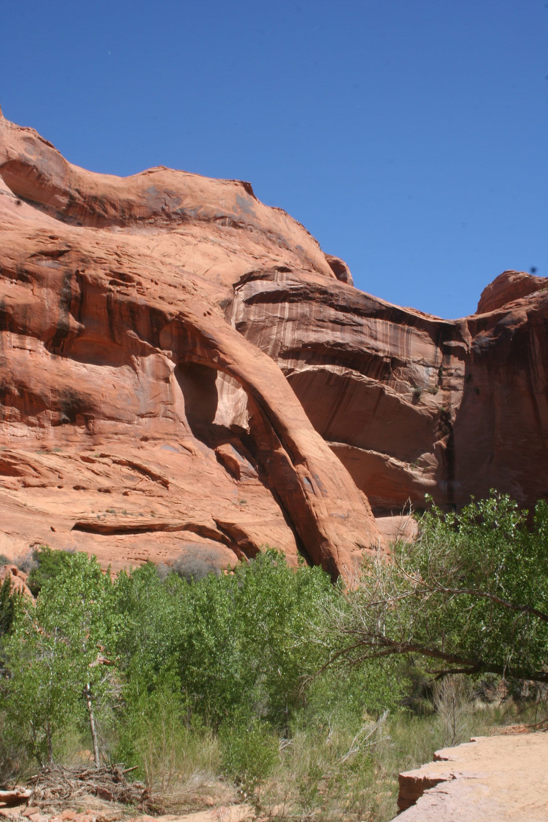
Walk through an impossible desert canyon where natural bridges span 130 feet overhead and waterfalls pour into swimming holes under a ribbon of sky.
This guide covers the Coyote Gulch Overnight permit.
2-4 nights
Duration
26 miles
Distance
1,000'
Elevation Gain
moderate
Difficulty
About Coyote Gulch
Coyote Gulch is the premier canyon backpacking route in Grand Staircase-Escalante National Monument. The canyon contains Jacob Hamblin Arch, Coyote Natural Bridge, Cliff Arch, and Stevens Arch along with waterfalls, swimming holes, and sculpted sandstone. A free permit is required for overnight camping and is obtained by self-registration at trailheads or the Escalante Interagency Visitor Center. No quotas, no fees, no reservations.
Coyote Gulch contains more natural arches, bridges, and dramatic features per mile than almost any other canyon in the Southwest. Jacob Hamblin Arch, Coyote Natural Bridge, and Cliff Arch create a highlight reel that would be the centerpiece of any other hike. Here, they're just part of the journey.
The Coyote Gulch route
- Distance
- 26 miles
- Route type
- point-to-point
- Elevation gain
- 1,000 ft
- High point
- 5,000 ft
- Low point
- 4,050 ft
- Trip length
- 2-4 nights
- Difficulty
- moderate
Points along the route
- Hurricane Wash TrailheadMile 0, 4,566 ft
- Red Well TrailheadMile 0, 4,505 ft
- Fortymile Ridge (Crack-in-the-Wall)Mile 0, 4,800 ft
- Jacob Hamblin ArchMile 10, 4,300 ft
- Coyote Natural BridgeMile 11, 4,093 ft
- Cliff ArchMile 12, 4,022 ft
- Waterfall AlcoveMile 13, 4,150 ft
- Stevens ArchMile 15, 4,100 ft
- Escalante River ConfluenceMile 16, 3,746 ft
Coyote Gulch permit detailsandAll Grand Staircase-Escalante National Monument permits
The Experience
The canyon walls curve overhead like frozen waves. A waterfall appears around the bend, pouring into a pool that glows turquoise in the reflected light. You duck under a natural bridge 130 feet above your head, then another. Each bend reveals something new. After 15 miles, you'll still be surprised.
Most hikers enter via Hurricane Wash or Red Well Trailhead, dropping into the canyon system before reaching Coyote Gulch proper. The route follows the streambed downstream, passing major features in sequence.
Jacob Hamblin Arch appears first, a massive span high on the canyon wall. Coyote Natural Bridge follows, stretching 130 feet across the wash. Cliff Arch clings to the canyon rim. Stevens Arch waits near the confluence with the Escalante River.
Camping is permitted anywhere below the rim, but the sandy benches near the bridges and the alcoves below Cliff Arch are favorites. The free permit (self-registration) allows multi-day exploration.
What to Expect
13-20 miles depending on route and access
Multiple natural bridges and arches
Perennial stream with waterfalls and pools
At-large camping (no designated sites)
Free permit via self-registration
Get Coyote Gulch Alerts
Be first to know when cancellations happen.
Permit Requirements
Free permit required (self-registration at trailheads)
Camp at least 200 feet from water sources
No fires except in designated fire pans (bring your own)
Pack out all waste including human waste (WAG bags recommended)
Respect cryptobiotic soil
No camping on vegetation
Gear & Preparation
Required Gear
- •Water filter (perennial stream available)
- •WAG bags for human waste
- •Sun protection (limited shade)
- •Camp shoes for wet crossings
- •Detailed topo map or GPS
Recommended Gear
- •Swimsuit for pools
- •Camera with wide-angle lens
- •Trekking poles for stream crossings
- •Fire pan if planning campfire
- •Extra water capacity for side trips
Hazards & Safety
Flash floods. Canyon has minimal escape. Check weather for entire watershed.
Access roads are rough. High-clearance vehicle recommended.
Quicksand-like mud in some areas
Heat exhaustion in summer
Limited cell service in entire area
Best Time to Visit
March-May and September-November. Spring brings waterfalls at peak flow. Summer is hot but swimmable pools provide relief. Winter is cold but beautiful.
100+ wilderness permits, extensive backcountry experience
This guide is based on personal experience obtaining wilderness permits and is regularly updated to reflect current policies and strategies.
Frequently Asked Questions
Do I need a permit for Coyote Gulch?
+
Yes, a permit is required. Walk-up permits are available at the trailhead or visitor center, but arrive early as they may be limited.
When is the best time to visit Coyote Gulch?
+
March-May and September-November. Spring brings waterfalls at peak flow. Summer is hot but swimmable pools provide relief. Winter is cold but beautiful.
How long is the Coyote Gulch route?
+
The route is 26 miles, as a point-to-point. Plan on 2-4 nights.
How difficult is the Coyote Gulch route?
+
Backpackers seeking world-class canyon scenery with moderate physical challenge.
What gear do I need for the Coyote Gulch route?
+
Essential gear includes: Water filter (perennial stream available), WAG bags for human waste, Sun protection (limited shade), Camp shoes for wet crossings, Detailed topo map or GPS.
Don't Miss Your Coyote Gulch Permit
Cancellations happen every day. PermitSnag monitors Coyote Gulch availability 24/7 and alerts you the moment a spot opens up.
Get Permit Alerts