Whitney Mountaineer's Permit: Route and Dates
Whitney Mountaineer's permits are booked by advance reservation in Inyo National Forest. The route covers 12 miles.
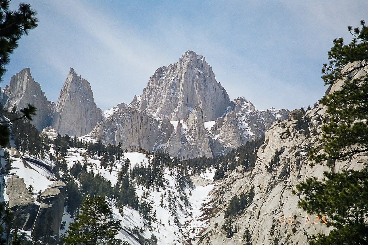
Take the highest summit in the contiguous United States by the line USFS says has no hiking trail at all — up the North Fork, over the Ebersbacher Ledges, and into a couloir the trail hikers never see.
This guide covers the Mount Whitney Mountaineer's Route permit.
$6 reservation fee + $15 per person Whitney Zone recreation fee
Permit Cost
1-2 days
Duration
12 miles
Distance
6,205'
Elevation Gain
strenuous
Difficulty
About Whitney Mountaineer's
The Mountaineer's Route is the technical way up the highest peak in the contiguous United States, and the important thing to understand first is that it uses a completely different permit from the famous one. Recreation.gov spells it out on the Mt. Whitney page: climbers planning a multi-day trip approaching the East Face, East Buttress, Mountaineers Route or routes on Mt Russell need the overnight permit for the North Fork of Lone Pine Creek trail, found under the general Inyo National Forest wilderness permits — not the Mt. Whitney lottery. A single-day attempt is the exception and does require the Mt. Whitney Zone Day Use permit. USFS describes the approach in its own words: the North Fork of Lone Pine Creek trail includes the approach to the Mountaineers Route, the trail is steep and hard to follow as you climb up and scramble over the Ebersbacher Ledges to reach Boy Scout Lakes, parts of the route cross granite slabs requiring route-finding skills, and the trail ends at Iceberg Lake at about 12,600 feet. Above that, there is no hiking trail to the summit and the climbing routes vary in technical difficulty. The permit itself is a rolling reservation rather than a lottery. Quota season runs May 1 to November 1; outside it, from November 2 to April 30, the number of people per day is unlimited and you book up to two weeks ahead. During quota season, 60% of each trailhead's quota is released six months in advance at 7 a.m. Pacific — an entry date of July 4 opens on January 4 — and the remaining 40% is released two weeks in advance on the same day of the week. Recreation.gov displays "NR" when the 60% is gone and the 40% has not yet dropped. Fees are $6 non-refundable per reservation plus $15 per person for trips entering the Whitney Zone, which includes the North Fork. Everything is reserved online. Print the permit from your Recreation.gov account before 10 a.m. on your entry date or the reservation is cancelled and your space goes to someone else.
The Mountaineer's Route is the answer to Whitney's crowding problem, and it is a structural answer rather than a lucky one. The famous Mt. Whitney Trail runs its own lottery against a quota of 100 day-use and 60 overnight people per entry day. The Mountaineer's Route does not touch that system at all: it enters on the North Fork of Lone Pine Creek, one entry trailhead among many on the Inyo National Forest wilderness permit, released 60% six months ahead and 40% two weeks ahead. Same summit, different door — and a genuinely harder climb once you are through it.
The Whitney Mountaineer's route
- Distance
- 12 miles
- Route type
- out-and-back
- Elevation gain
- 6,205 ft
- High point
- 14,505 ft
- Low point
- 8,300 ft
- Trip length
- 1-2 days
- Difficulty
- strenuous
Starts at Whitney Portal
Sierra Nevada. Nearest town: Lone Pine
Points along the route
- Whitney PortalMile 0, 8,400 ft
- Ebersbacher LedgesMile 1.44, 9,655 ft
- Lower Boy Scout LakeMile 1.8, 10,320 ft
- Upper Boy Scout LakeMile 2.6, 11,300 ft
- Iceberg LakeMile 4, 12,600 ft
- The NotchMile 4.25, 14,116 ft
- SummitMile 4.73, 14,505 ft
Whitney Mountaineer's permit detailsandAll Inyo National Forest permits
What to Expect
About 12 miles round trip and roughly 6,200 feet of gain from Whitney Portal at 8,300 feet to the summit
An approach USFS calls steep and hard to follow, with granite slabs that require route-finding
The trail ending at Iceberg Lake, 12,600 feet, with everything above it being actual climbing
A snow couloir in spring and loose rock once it melts out — Recreation.gov notes the area is usually snow-free July to late September
A high camp at Upper Boy Scout Lake or Iceberg Lake, or a single very long day
Group size capped at 15, with every person counting toward the quota and the fees regardless of age
Get Whitney Mountaineer's Alerts
Be first to know when cancellations happen.
Permit Requirements
A wilderness permit is required year-round for overnight trips; the Mountaineer's Route enters on North Fork of Lone Pine Creek, not the Mt. Whitney Trail
A single-day trip requires the Mt. Whitney Zone Day Use permit instead, which is a separate lottery
Quota season is May 1 to November 1; November 2 to April 30 is non-quota with unlimited daily numbers and a two-week booking window
60% of quota releases 6 months in advance at 7 a.m. Pacific; the remaining 40% releases 2 weeks in advance on the same weekday
$6 non-refundable reservation fee plus $15 per person for the Whitney Zone; no discounts for annual passes, military, seniors or children
Maximum group size 15, and groups on separate permits cannot combine to exceed it
Only the group leader or the listed alternate can pick up or use the permit, and alternates cannot be added after the reservation is made
Print the permit before the 10 a.m. no-show deadline on your entry date or the reservation is cancelled
A California Campfire Permit is required to have a campfire or operate a stove
Bear-resistant food storage is required in areas with a history of bear conflict; canisters can be rented at the Lone Pine visitor center
Cancel more than 12 days before your entry date and the per-person fee is refunded automatically; the $6 never is
Gear & Preparation
Required Gear
- •Mountaineering boots that take crampons
- •Crampons and ice axe when there is snow in the couloir
- •Helmet — the couloir is loose once it melts out
- •Bear-resistant food storage container
- •Printed permit and a printed California Campfire Permit
- •Water treatment; the North Fork and Iceberg Lake are the sources
Recommended Gear
- •Downloaded maps — Inyo NF warns most of the forest has no cell service and tells visitors not to rely on phones for navigation or communication
- •A satellite messenger, for the same reason
- •A 0°F or colder bag if you are camping at Iceberg Lake
- •Avalanche assessment gear if you are climbing the couloir in winter or spring conditions
Hazards & Safety
Route-finding failure on the Ebersbacher Ledges and the granite slabs, which USFS singles out as requiring route-finding skills
Rockfall in the couloir once the snow melts out
Avalanche and steep snow in the couloir in winter and spring
Altitude — the camp itself is at 12,600 feet and the summit is over 14,000
Afternoon thunderstorms in summer, on terrain with no shelter
No cell service, and Inyo NF advises leaving trip details with someone and a time to report you overdue
Best Time to Visit
Late spring, when the couloir still holds consolidated snow, is the classic window and falls inside the quota season that opens May 1. Recreation.gov notes the Whitney area is usually snow-free from July to late September, which turns the couloir into loose rock. The non-quota season from November 2 has no quota at all, but Recreation.gov warns that trailhead access may be affected by seasonal road closures.
Pro Tips
This is not the Mt. Whitney Trail lottery — the Mountaineer's Route enters on North Fork of Lone Pine Creek, a normal Inyo wilderness permit
A single-day push is the exception and does need the Mt. Whitney Zone Day Use permit, which is the lottery
Watch the two-week release, not just the six-month one: 40% of quota drops two weeks out on the same weekday as your entry date, at 7 a.m. Pacific
"NR" on Recreation.gov means the 60% is gone and the 40% has not dropped yet — it is not sold out
Camp at Upper Boy Scout Lake or Iceberg Lake to acclimatize; the lake sits at 12,600 feet
Print your permit before 10 a.m. on your entry date or the reservation is cancelled
Cancel more than 12 days out and the per-person fee comes back automatically
100+ wilderness permits, extensive backcountry experience
This guide is based on personal experience obtaining wilderness permits and is regularly updated to reflect current policies and strategies.
Frequently Asked Questions
How do I get a Whitney Mountaineer's permit?
+
Whitney Mountaineer's permits require advance reservations. Book online as soon as reservations open for your desired dates.
When is the best time to visit Whitney Mountaineer's?
+
Late spring, when the couloir still holds consolidated snow, is the classic window and falls inside the quota season that opens May 1. Recreation.gov notes the Whitney area is usually snow-free from July to late September, which turns the couloir into loose rock. The non-quota season from November 2 has no quota at all, but Recreation.gov warns that trailhead access may be affected by seasonal road closures.
How long is the Whitney Mountaineer's route?
+
The route is 12 miles, as an out-and-back. Plan on 1-2 days.
How difficult is the Whitney Mountaineer's route?
+
Climbers comfortable scrambling over the Ebersbacher Ledges and route-finding across granite slabs, who can handle a steep couloir in whatever condition they find it and camp at 12,600 feet.
Where does the Whitney Mountaineer's route start?
+
Whitney Portal.
What gear do I need for the Whitney Mountaineer's route?
+
Essential gear includes: Mountaineering boots that take crampons, Crampons and ice axe when there is snow in the couloir, Helmet — the couloir is loose once it melts out, Bear-resistant food storage container, Printed permit and a printed California Campfire Permit. Additional specialized gear may be required based on conditions.
Don't Miss Your Whitney Mountaineer's Permit
Cancellations happen every day. PermitSnag monitors Whitney Mountaineer's availability 24/7 and alerts you the moment a spot opens up.
Get Permit Alerts