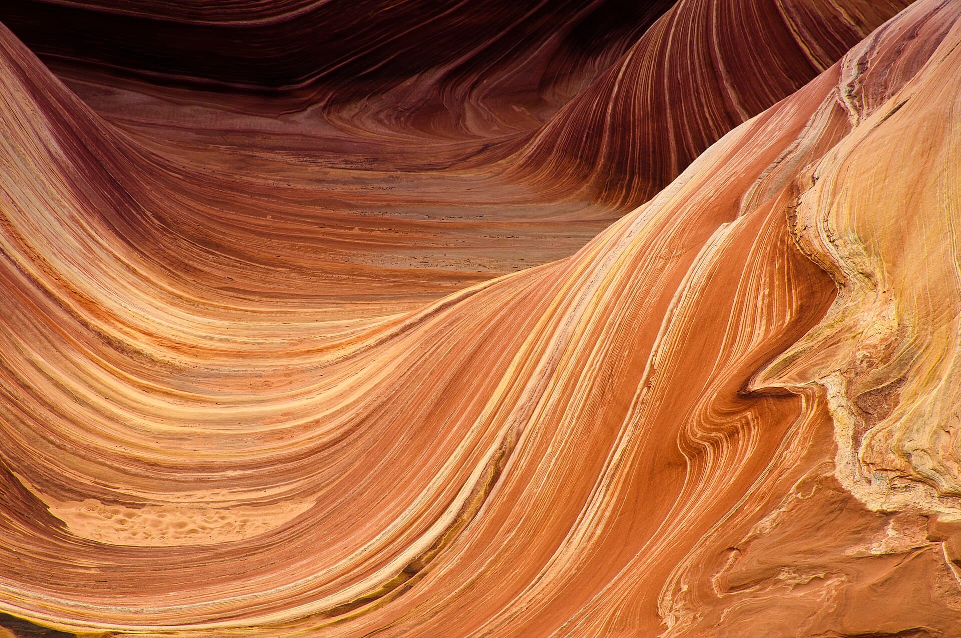
The Wave in Peak Summer: Advanced Lottery Deadline and Heat Strategy
Jul 27-30, 20263 min read
P
PermitSnag Team
96 reports
4.0
Difficulty
3
Scenery
5
The Wave sits inside Coyote Buttes North, part of Vermilion Cliffs National Monument, and access is capped hard at 64 people a day. That number covers both the advanced lottery (applied for months out) and the daily lottery (run the day before). Right now the advanced lottery window for this cycle closes July 31, with results posted August 1, so if you want a shot at a fall or winter date, get your application in before that cutoff.
The hike itself starts at Wire Pass Trailhead, elevation 4,850 feet, and runs about 3.2 miles one-way to The Wave at 5,200 feet. Total gain is only 350 feet, spread out gently over open slickrock and sandy wash bottoms — Twin Buttes around mile 1.3, then Pool Cove near White Castle at mile 1.9 before the final push up to the formation. It's an easy grade on paper, but there's no marked trail. You're navigating by landmarks and a permit-issued photo map, and in July that means doing it in serious heat with zero shade for almost the entire route.
Summer here is brutal. Surface temps on the sandstone regularly run well above air temperature, and there's no reliable water source anywhere on this route — carry every drop you'll need, plus extra. Most people hiking in this window start at first light to be off the exposed sections before midday, or plan a late-afternoon start timed to sunset light and cooler temps for the walk out. Either way, this is not a permit to treat casually just because the mileage is short.
If you land a permit for late July or August, expect a small group size (daily lottery typically issues far fewer permits than the 64 cap once you factor in walk-up limits), but also expect full summer sun with almost no cloud cover most days. Afternoon monsoon storms are common this time of year in the Colorado Plateau region, so keep an eye on forecasts — flash flood risk in the wash sections is real even when it's not raining directly overhead.
A few things people consistently get wrong: they underestimate how disorienting the terrain is without a trail, they don't bring enough water because the mileage looks short, and they show up at Wire Pass without printing or saving the permit photo map offline (cell service is nonexistent out there). Also worth knowing — the permit is for a specific date, not a time window, so plan your whole day around your entry, including the drive out on rough dirt access roads that get worse after rain.
Gear-wise this is minimalist backpacking, not a multi-day carry, but treat the water and sun protection like it's the only gear that matters. Bring a GPS track or downloaded map layer as backup navigation, and don't count on shade breaks — there basically aren't any until you're near the formation itself.
If your advanced lottery application isn't in yet, the July 31 deadline is coming up fast. Missing it means you're relying on the daily lottery, which is far more competitive and only confirms your spot the day before you'd hike.
— Compiled by the PermitSnag team from agency info, ranger updates, and public trip logs.
Conditions at Time of Trip
Jul 2026Weather
Hot, sun-exposed days with a chance of afternoon monsoon storms typical of late July
Trail
Unmarked route over open slickrock and sandy wash, navigation by landmark and permit map only
Water
No reliable water sources on route; carry all water needed for the full day
Crowds
Light
💡Tips from the Trip
💡
General
- •Apply for the advanced lottery before the July 31 deadline if you want a shot at a fall or winter date instead of relying on the daily lottery
- •Start at first light or plan a late-afternoon entry timed to sunset to avoid peak midday heat on exposed slickrock
- •Download the permit photo map and any GPS track offline before you leave cell coverage — there's no signal at Wire Pass or on route
- •Watch afternoon skies closely in wash sections; flash flood risk exists even from storms that look far away
- •Budget extra time for the dirt access road to Wire Pass, which can get rough or impassable after rain
- •Don't judge water needs by the short 3.2-mile distance — the lack of shade and heat make it a bigger day than the mileage suggests
Was this helpful?