High Sierra Trail Permit: Quota and Route
High Sierra Trail permits are booked by advance reservation in Sequoia & Kings Canyon National Parks. The route covers 72.2 miles.
Seventy-two miles from a giant sequoia grove to the highest point in the lower 48, on a trail blasted across the Great Western Divide with air compressors in 1930.
This guide covers the High Sierra Trail permit.
30
People Per Day
$15 per permit + $5 per person
Permit Cost
6-10 days
Duration
72.2 miles
Distance
strenuous
Difficulty
About High Sierra Trail
The High Sierra Trail entry point covers trips starting from Crescent Meadow or Wolverton and travelling east on the High Sierra Trail. NPS is specific about the boundary: an Alta Trail permit is not valid for the segment between Seven Mile Hill and Kaweah Gap, so this is the permit you need for the route proper. The daily quota is 30 people with 20 reservable, and there is no lottery. SEKI runs a rolling window — reservations open six months before the entry date and close one week before it, and unused reservable quota is released to the walk-up pool at the permit station. The 2026 quota season runs May 22 through September 26. Outside that window permits are self-issue at visitor centers with no daily limit and no fee. Permits for this entry point are issued in person at the Lodgepole Visitor Center, from 1 pm the day before entry.
The High Sierra Trail is the west-side answer to Mount Whitney, and NPS treats it as a distinct thing rather than a variant: "a dramatic trans-Sierra route that crosses the Great Western Divide, drops to the Kern Canyon, and ultimately leads to Mount Whitney." It reaches the John Muir Trail 49 miles from Crescent Meadow, and the summit 13 miles after that. The quota is 30 people a day with 20 reservable, and there is no lottery — which makes it the most gettable permit to Whitney of any on this list.
The High Sierra Trail
- Distance
- 72.2 miles
- Route type
- point-to-point
- High point
- 14,505 ft
- Trip length
- 6-10 days
- Difficulty
- strenuous
Entry points: Crescent Meadow, Wolverton
Great Western Divide, Sierra Nevada. Nearest town: Three Rivers
Points along the route
- Crescent MeadowMile 0
- Bearpaw MeadowMile 11.4
- Big Hamilton LakeMile 16.6
- Precipice Lake
- Kaweah GapMile 20, 10,700 ft
- Kern Hot SpringsMile 36.8
- John Muir Trail junctionMile 48.9
- Guitar LakeMile 56.6
- Mount Whitney summit14,505 ft
- Whitney PortalMile 72.2
High Sierra Trail permit detailsandAll Sequoia & Kings Canyon National Parks permits
The Experience
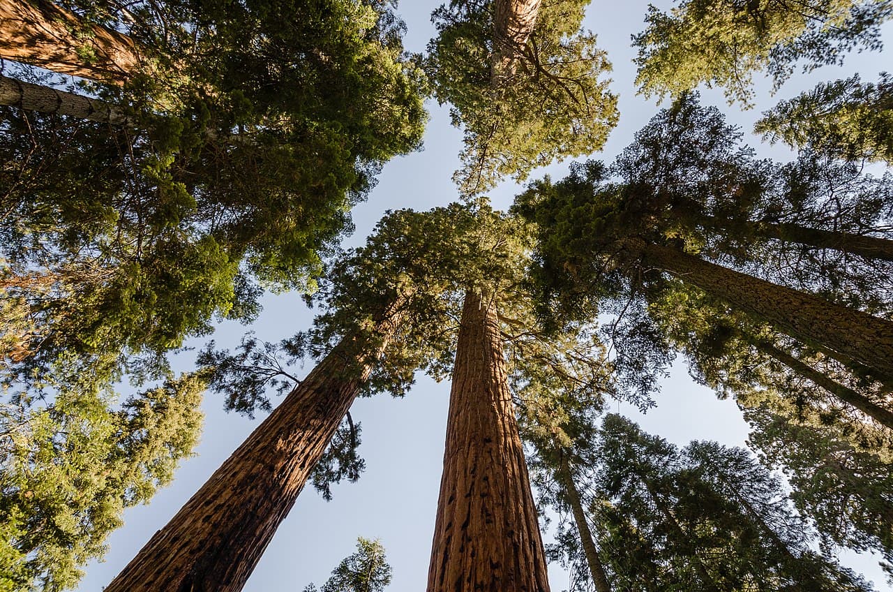
Half a mile of fir and sugar pine and the occasional sequoia, then the trail comes out on a south-facing slope at Eagle View and stays out. You spend the next two days walking a ledge across the head of a canyon with the Great Western Divide filling the horizon, and then you climb straight into it: switchbacks under the Angel Wings, a tunnel the CCC blasted in 1938, and Precipice Lake sitting frozen under Eagle Scout Peak in July.
NPS's own day-by-day breaks the trail into recognizable pieces. Day one runs 11.4 miles from Crescent Meadow to Bearpaw Meadow, mostly level, past Eagle View and across the burn from the 1980 Buckeye Fire. Day two climbs into the Divide — Lone Pine Creek at 13.1 miles, Big Hamilton Lake at 16.6, then the switchbacks past the wreckage site of a suspension bridge an avalanche tore out in 1937, through Hamilton Gorge on a ledge and tunnel the CCC cut the following summer, past Precipice Lake, and over Kaweah Gap at 10,700 feet at mile 20.
The middle of the trail is the Kern. From Big Arroyo Junction at 22.5 miles the route climbs to the Chagoopa Plateau and then drops down steep rocky switchbacks into the Kern Trench. Kern Hot Springs at 36.8 miles has a cement bathtub fed by a 115°F spring a few feet from the cold river. From there the trail runs north up a canyon that follows the Kern Canyon fault for about 25 miles, hot and dry in the middle of the day, to Junction Meadow at 42 miles.
The last stretch climbs out of the canyon to the John Muir Trail junction at 48.9 miles, Crabtree Meadow at 53.1, and Guitar Lake at 56.6 — the last campsite with water before the summit. Over Trail Crest, down 100 switchbacks to Trail Camp, and out at Whitney Portal, 72.2 miles from Crescent Meadow.
What to Expect
72.2 miles from Crescent Meadow to Whitney Portal, or 49 miles to the John Muir Trail junction
Kaweah Gap at 10,700 feet at mile 20, the crossing of the Great Western Divide
A minimum of 6 days one way, or 10 days round trip, per NPS
Heavy use — the park says "due its popularity, expect to see many people"
Designated-site camping at Bearpaw Meadow and a one-night limit at Hamilton Lakes
A permit pickup in person at the Lodgepole Visitor Center, from 1 pm the day before
Get High Sierra Trail Alerts
Be first to know when cancellations happen.
Permit Requirements
A High Sierra Trail permit is required between Seven Mile Hill and Kaweah Gap; an Alta Trail permit is not valid there
Maximum party size is 15 on trail and 12 off trail, dropping to 8 off trail on Mt. Whitney and in the Whitney and Crabtree Creeks area
Camp only in designated sites at Bearpaw Meadow — not at the Bearpaw High Sierra Camp or the ranger station
One night camping limit at Hamilton Lakes; two nights in the Crabtree and Whitney Creek area and at Guitar Lake; no camping at Timberline Lake or in the Mt. Whitney shelter
Camp further than 100 ft from water where possible and never within 25 ft; camping within 100 ft is allowed only in well-established sites
Store food in an allowed animal-resistant container, an animal-resistant box, or by counter-balance hanging; where there are no boxes or trees you must use a portable container
Fires are prohibited above 9,000 ft in the Kaweah and Tule River drainages and at Hamilton Lakes, and above 10,000 ft in the Kern River drainage
Pets are prohibited; wheeled vehicles and motorized equipment are prohibited; caching food or equipment is prohibited
Bury human waste at least 6 inches deep and 100 ft from trails, camps and water, and pack out used toilet paper
Permits are issued in person only, from 1 pm the day before entry; arrange a hold if you cannot arrive by 10 am on the entry date or the reservation is released to walk-ups
An entrance fee is required at all trailheads
Gear & Preparation
Required Gear
- •An allowed animal-resistant food container — required wherever there are no food boxes or suitable trees
- •A stove, given the campfire bans across most of the route's elevation bands
- •Water treatment; SEKI's instruction is to boil, treat or filter
- •A resupply-free food carry for 6 or more days, or a plan to exit at Whitney Portal
- •Layers for a route that runs from the Giant Forest to 14,505 feet
Recommended Gear
- •Trekking poles for the steep rocky switchbacks into and out of the Kern Trench
- •Bags for packing out toilet paper
- •A satellite device you actually know how to operate — SEKI warns not to rely on one to summon help
- •A shuttle or car plan for Whitney Portal, 72 miles and a mountain range from your car
- •Something to swim in for Kern Hot Springs
Hazards & Safety
Hazardous creek crossings early in the summer; SEKI tells hikers to check conditions when picking up the permit
Heat and no shade along the bottom of the Kern Canyon in the middle of the day
Lightning above treeline at Kaweah Gap and on the Whitney summit plateau; the 1909 summit hut conducts strikes and is not a shelter
Altitude, which SEKI notes can begin above 8,000 feet and is treated by descending
No reliable water between Guitar Lake and Trail Camp on the east side
Discretionary search and rescue — SEKI states rescuer safety comes first and expects self-reliance
Marmots at the pack-cache point below the summit spur
Best Time to Visit
The 2026 quota season runs May 22 through September 26, and the trail is best in the second half of it. Early season means dangerous creek crossings and snow at Kaweah Gap; late July through mid-September gives passable crossings, an open Whitney summit and stable weather. Outside quota season permits are self-issue with no limit and no fee, but the high country is in winter condition.
Pro Tips
There is no lottery here — set a calendar reminder for six months before your entry date and book on the rolling window
Reserve the High Sierra Trail entry point specifically; an Alta Trail permit is void between Seven Mile Hill and Kaweah Gap and the entry point cannot be changed later
Camp at Nine Mile Creek on night one instead of Bearpaw Meadow to get out of phase with the standard itinerary
Fill up at Guitar Lake; there is no reliable water between there and Trail Camp on the east side
Arrange a hold with the wilderness office if you cannot reach Lodgepole by 10 am on your entry date
Sort the shuttle before the permit — the two ends are 72 miles apart across a mountain range
Request an alternate parking area through the reservation comment box at least 7 days ahead if Crescent Meadow does not suit
100+ wilderness permits, extensive backcountry experience
This guide is based on personal experience obtaining wilderness permits and is regularly updated to reflect current policies and strategies.
Frequently Asked Questions
How do I get a High Sierra Trail permit?
+
High Sierra Trail permits require advance reservations. Book online as soon as reservations open for your desired dates.
When is the best time to visit High Sierra Trail?
+
The 2026 quota season runs May 22 through September 26, and the trail is best in the second half of it. Early season means dangerous creek crossings and snow at Kaweah Gap; late July through mid-September gives passable crossings, an open Whitney summit and stable weather. Outside quota season permits are self-issue with no limit and no fee, but the high country is in winter condition.
How long is the High Sierra Trail route?
+
The route is 72.2 miles, as a point-to-point. Plan on 6-10 days.
How difficult is the High Sierra Trail route?
+
Experienced backpackers who want a full trans-Sierra traverse and a Whitney summit without entering a lottery, and who can carry six or more days of food.
Where does the High Sierra Trail route start?
+
The permit covers 2 entry points: Crescent Meadow, Wolverton.
What gear do I need for the High Sierra Trail route?
+
Essential gear includes: An allowed animal-resistant food container — required wherever there are no food boxes or suitable trees, A stove, given the campfire bans across most of the route's elevation bands, Water treatment; SEKI's instruction is to boil, treat or filter, A resupply-free food carry for 6 or more days, or a plan to exit at Whitney Portal, Layers for a route that runs from the Giant Forest to 14,505 feet.
Don't Miss Your High Sierra Trail Permit
Cancellations happen every day. PermitSnag monitors High Sierra Trail availability 24/7 and alerts you the moment a spot opens up.
Get Permit Alerts