Reservation8/10
Grand Teton Backcountry cancellations
The park-wide overnight permit for camping anywhere in Grand Teton's backcountry...
Grand Teton National Park · Wyoming
Premier multi-day traverse of the Teton Range with world-class alpine scenery.
70% of the openings our scanner caught on Teton Crest were gone within 5 minutes.
Build your full itinerary start to finish
Add your dates and get a day-by-day plan: what needs a permit, what gear to bring, and one link to share with your whole group to coordinate every step.
No permit needed to start
Mid-July through mid-September. Snow clears from high passes by late July most years. August offers the most reliable weather and trail conditions. September brings fall colors and fewer crowds but colder nights.
Trailhead (6,800 ft)
Backcountry Tips
Today
71°
42°
Mon
56°
38°
54%
Tue
67°
37°
Wed
73°
44°
Thu
69°
50°
55%
Fri
68°
48°
48%
Sat
63°
43°
26%
Sign up at Recreation.gov if you don't have an account. Have your payment info ready.
Permits typically release on a rolling basis. Check the specific release time for your desired dates.
Log in a few minutes early. Have your dates, group size, and payment ready to go.
If your dates are sold out, people cancel all the time. Set up PermitSnag alerts to catch openings instantly.
Fitness and endurance required
Climbing, scrambling, or specialized skills
Steep dropoffs and fall potential
Route finding and trail clarity
Difficulty of bailing out mid-route
Experienced backpackers comfortable with high altitude and variable mountain weather. Those who can handle 10+ mile days with significant elevation change.
Should have completed multi-day backpacking trips with significant elevation gain. Altitude experience above 8,000 feet recommended.
Those who haven't backpacked at altitude before, anyone uncomfortable with exposure or heights, hikers who need flat terrain.
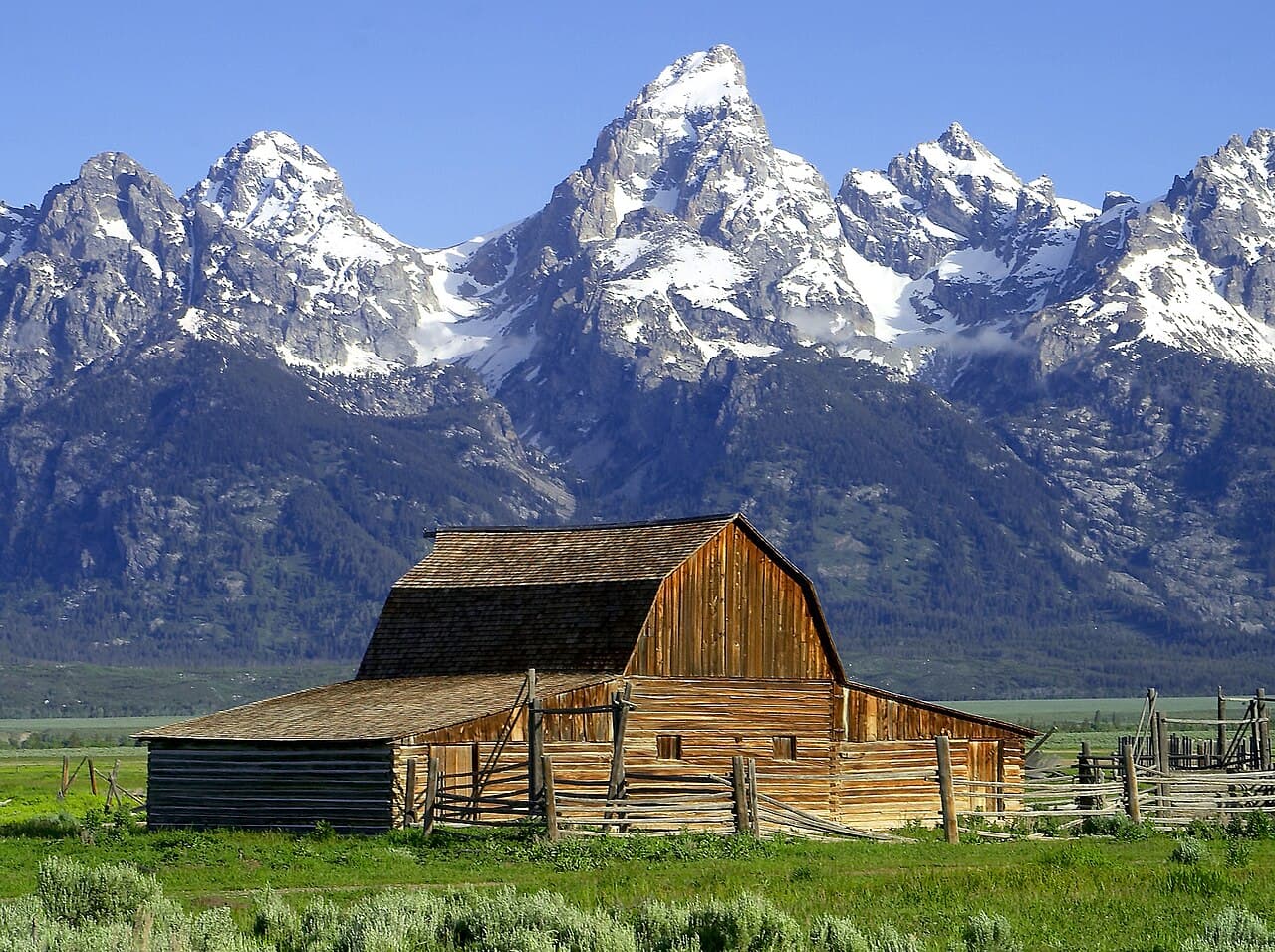
The Teton Crest Trail is widely regarded as one of America's premier high-altitude backpacking routes, traversing the dramatic backbone of the Teton Range through Grand Teton National Park and the adjacent Jedediah Smith Wilderness.
This 40-mile journey stays above 8,000 feet for nearly its entire length, crossing alpine passes, skirting pristine lakes, and offering constantly changing perspectives of the iconic peaks. The Grand Teton—at 13,775 feet the highest summit in the range—serves as a constant companion.
Unlike many backcountry destinations, the TCT requires advance planning due to highly competitive permit reservations. However, the trail's passage through permit-free wilderness (Alaska Basin) offers options for those who couldn't secure park permits.
The Teton Crest Trail offers the most concentrated mountain grandeur in the lower 48 states. These peaks have inspired mountaineers and artists for generations, and the trail provides intimate access to their vertical splendor.
Starting from the Aerial Tram at Teton Village (or hiking up from Phillips Pass), you quickly enter high alpine terrain. Marion Lake offers the first taste of Teton grandeur before Death Canyon Shelf provides arguably the most dramatic trail miles in America. Alaska Basin—technically in the Jedediah Smith Wilderness and permit-free—serves as base camp for many. From here, Hurricane Pass leads to South Fork Cascade Canyon, then Paintbrush Divide (the trail's highest point at 10,700 feet), before the final descent to String Lake.
Each step brings the Grand Teton closer, its summit growing impossibly large against the Wyoming sky. At Death Canyon Shelf, you walk a narrow bench between vertical walls and a thousand-foot drop, fully immersed in the mountains. By sunset at Alaska Basin, you understand why people return year after year.
Starting from the tram saves approximately 4 miles and 2,400 feet of gain versus the Granite Canyon trailhead, per NPS
Large paid lot at Teton Village. Free parking available further back.
Reached via Highway 390 from Jackson. NPS charges no tram fee — the aerial tram is a resort ticket, priced by the resort
Teton Village - restaurants, gear shops. Jackson (12 miles) for full services
Common exit point for SOBO hikers, can also start NOBO here
Very popular lot, fills by 7am in summer. Arrive early or use shuttle.
From Jenny Lake Junction, follow signs to String Lake
Moose Junction (15 miles) - general store, gas
Required and recommended gear for Teton Crest
Trailhead transportation options
Browse all shuttlesExperienced wilderness guides
Browse all guidesSome links may be affiliate links. Purchases support PermitSnag at no extra cost to you.
Teton Crest permits use a reservation system. PermitSnag sends lottery open, deadline, and results reminders; you can also enable cancellation alerts if spots open later.
Check with the managing agency for current season dates. Weekdays generally have better availability than weekends.
This permit has a demand score of 8/10, making it highly competitive. We recommend having backup dates and using PermitSnag's cancellation alerts.
Cancellations happen daily. Set up alerts with PermitSnag to get notified the moment a spot opens up. Pro and $19 single-permit alerts are checked about every minute, 24/7; free accounts are checked hourly.
No active conditions reported
Sign in to report trail conditions.
Sunrise from Alaska Basin illuminates the Grand Teton's west face in dramatic red light. Sunset from Death Canyon Shelf creates incredible alpenglow on the peaks.
Morning light from the east illuminates the Grand Teton beautifully from most points on the trail. Late afternoon creates dramatic shadows in the deep canyons.
Midweek trips see significantly fewer hikers. The South Fork Cascade and Paintbrush sections are busiest—plan to photograph these at dawn. Alaska Basin, being outside the park, is generally less crowded.
Consider these alternatives if your preferred dates aren't available.
3-day loop from Teton Canyon into Alaska Basin and return via the South Fork—no GTNP permit needed.
Misses Death Canyon Shelf and Paintbrush sections but still offers spectacular Teton scenery. Less competitive permits.
Day hike from Jenny Lake to Lake Solitude—9.6 miles round trip with boat shuttle or 15 miles via trail.
No permit needed. Sees some of the best scenery without multi-day commitment.
Shorter 2-day trip featuring Death Canyon Shelf—the trail's most dramatic section.
Easier permit to secure. Captures the most iconic views with less distance.
Nearby campgrounds to complete your Teton Crest trip
A small favor
Google lets you pick the sites it highlights for you. Add PermitSnag and our permit pages get marked as one of yours in AI Overviews and AI Mode.
Takes less than a minute.