Coyote Buttes South Permit: Quota and Route
Coyote Buttes South permits are booked by advance reservation in Vermilion Cliffs National Monument. The route covers 8 miles.
Explore 190-million-year-old sandstone formations as spectacular as The Wave with lottery odds that make your permit actually attainable.
This guide covers the Coyote Buttes South permit.
20
People Per Day
$6 reservation + $5/person
Permit Cost
4-8 hours
Duration
8 miles
Distance
400'
Elevation Gain
About Coyote Buttes South
Coyote Buttes South offers sandstone formations comparable to The Wave with significantly better lottery odds. The zone contains multiple named features (Cotton Candy, Paw Hole, The Teepees) plus extensive unnamed terrain. Like Coyote Buttes North (The Wave), access is by lottery permit. However, demand is lower, making permits more attainable. Maximum 20 people per day.
Coyote Buttes South holds formations every bit as remarkable as its famous northern neighbor, and it is far easier to get into. BLM issues permits for both areas by lottery and publishes no success rate for either, but the capacity tells the story: Coyote Buttes North is capped at 64 people a day across the advance and daily lotteries, and South permits are often still available in peak season. Getting there is the trade — the access roads need high clearance and four-wheel drive.
The Coyote Buttes South route
- Distance
- 8 miles
- Route type
- out-and-back
- Elevation gain
- 400 ft
- High point
- 4,800 ft
- Low point
- 4,600 ft
- Trip length
- 4-8 hours
- Difficulty
- moderate
Entry points: Cottonwood Cove Trailhead, Paw Hole Trailhead, Lone Tree Trailhead
Colorado Plateau. Nearest town: Kanab
Points along the route
- Paw Hole TrailheadMile 0, 4,600 ft
- The TeepeesMile 1.5, 4,700 ft
- Paw HoleMile 2, 4,650 ft
- The Cotton CandyMile 2.5, 4,750 ft
- South Coyote ButtesMile 3, 4,800 ft
Coyote Buttes South permit detailsandAll Vermilion Cliffs National Monument permits
The Experience
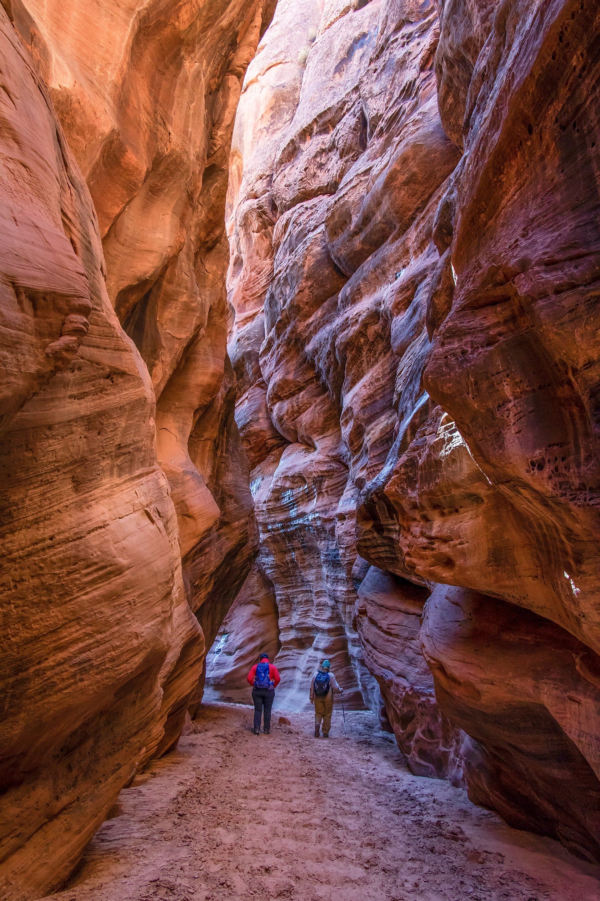
You walk through a landscape that makes no sense. Sandstone folded and twisted by forces that operated 190 million years ago. Colors swirl in patterns that seem painted rather than geological. The Cotton Candy formation lives up to its name. Paw Hole's perfect circles defy explanation. And you might be the only person here.
From the Paw Hole Trailhead (reached via Wire Pass Road or Paria Outpost), routes fan out to various formations. Unlike The Wave, there's no single iconic feature here. Instead, the entire zone is extraordinary.
The Cotton Candy, Paw Hole, and The Teepees are the named attractions, but countless unnamed formations reward exploration. Navigation is by GPS waypoints and visual landmarks. There is no trail.
What to Expect
No single iconic feature. Multiple formations to explore
6-10 miles of wandering depending on route
No marked trails. GPS navigation required
Better lottery odds than The Wave
Maximum 20 people per day, not 20 permits — a party of six uses six of the twenty (BLM: "A daily maximum of 20 people")
Get Coyote Buttes South Alerts
Be first to know when cancellations happen.
Permit Requirements
Lottery permit required
Maximum 20 people per day
Day use only (no camping)
GPS navigation essential
Stay on slickrock (protect cryptobiotic soil)
Gear & Preparation
Required Gear
- •GPS with downloaded waypoints
- •1 gallon water minimum per person
- •Sun protection
- •Sturdy footwear for slickrock
- •BLM permit and photo guide
Recommended Gear
- •Camera with polarizing filter
- •Tripod for detail shots
- •Extra water beyond minimum
- •Snacks for full-day exploration
- •Layers for temperature changes
Hazards & Safety
Navigation challenges. No trails, GPS required.
Dehydration. No water on route.
Rough access road. High clearance recommended.
Flash floods in washes
Extreme heat in summer
Best Time to Visit
March-May and September-November. Summer is dangerously hot. Winter is possible but cold.
Pro Tips
Set an alarm for 12:00 noon Mountain on the 1st — the whole month three months out goes on sale at once
Cancellations here do come back: BLM says a cancelled permit "is allocated back to the calendar so that others may reserve it"
You must carry a printed permit; BLM does not accept a phone screen
Lone Tree is the only trailhead a two-wheel-drive high-clearance vehicle may reach, and it costs you an extra 5 miles round trip through deep sand
Skip a summer date if you can — BLM records fatalities from heat-related illness in this wilderness
100+ wilderness permits, extensive backcountry experience
This guide is based on personal experience obtaining wilderness permits and is regularly updated to reflect current policies and strategies.
Frequently Asked Questions
How do I get a Coyote Buttes South permit?
+
Coyote Buttes South permits require advance reservations. Book online as soon as reservations open for your desired dates.
When is the best time to visit Coyote Buttes South?
+
March-May and September-November. Summer is dangerously hot. Winter is possible but cold.
How long is the Coyote Buttes South route?
+
The route is 8 miles, as an out-and-back. Plan on 4-8 hours.
How difficult is the Coyote Buttes South route?
+
Explorers comfortable with GPS navigation seeking Wave-quality formations without Wave-level competition.
Where does the Coyote Buttes South route start?
+
The permit covers 3 entry points: Cottonwood Cove Trailhead, Paw Hole Trailhead, Lone Tree Trailhead.
What gear do I need for the Coyote Buttes South route?
+
Essential gear includes: GPS with downloaded waypoints, 1 gallon water minimum per person, Sun protection, Sturdy footwear for slickrock, BLM permit and photo guide.
Don't Miss Your Coyote Buttes South Permit
Cancellations happen every day. PermitSnag monitors Coyote Buttes South availability 24/7 and alerts you the moment a spot opens up.
Get Permit Alerts