Walk-Up6/10
Cuyamaca Granite Springs Environmental Camp permit
Backpack-in or horseback-ride-in environmental camp, open first come, first serv...
Cuyamaca Rancho State Park · California
Environmental campsite for backpackers.
70% of the openings our scanner caught on Arroyo Seco were gone within 10 minutes.
Build your full itinerary start to finish
Add your dates and get a day-by-day plan: what needs a permit, what gear to bring, and one link to share with your whole group to coordinate every step.
No permit needed to start
Spring and autumn. Spring brings green regrowth after winter rain; autumn gives cool nights and stable weather. Summer carries the highest fire danger. Because there is no reservation, midweek arrival is the way to be confident of a site.
Trailhead (5,000 ft)
Today
78°
47°
Sun
70°
44°
Mon
81°
43°
Tue
87°
47°
Wed
89°
50°
Thu
91°
52°
Fri
90°
54°
Find this permit on the managing agency's booking system and set up an account with your payment info ready.
Permits typically release on a rolling basis. Check the specific release time for your desired dates.
Log in a few minutes early. Have your dates, group size, and payment ready to go.
If your dates are sold out, people cancel all the time. Set up PermitSnag alerts to catch openings instantly.
Fitness and endurance required
Climbing, scrambling, or specialized skills
Steep dropoffs and fall potential
Route finding and trail clarity
Difficulty of bailing out mid-route
First-time backpackers in San Diego County, families testing a short hike-in, and equestrians who want corrals a mile and a half from the trailhead.
None beyond water treatment. Register first, and arrive well before dark.
Anyone needing a guaranteed site, anyone hiking with a dog, and anyone wanting a campfire.
Arroyo Seco is the nearer of Cuyamaca Rancho's two environmental camps — 1.5 miles from Green Valley by the park's own trail table, against 4.5 miles for Granite Springs. Both are open on first come, first serve, and both have chemical toilets, non-potable water, corrals and tent sites. Family campsites take up to eight people and one group site holds up to 16.
Registration happens before you walk: register at park headquarters, the Paso Picacho contact station, or the Green Valley campground. Primitive sites are in an unlighted, remote area, so the park asks you to check in early and set up camp well before dark.
Fire is not allowed anywhere except in the developed picnic areas and campgrounds, which rules it out here. Wood gathering is not allowed anywhere in the park. For current fire restrictions the park directs visitors to call ahead.
The developed campgrounds in this park run on ReserveCalifornia from April 1 to November 30 and go first come from December 1 to March 31 — but the environmental camps are first come year round.
Arroyo Seco is only 1.5 miles from Green Valley by the park's own trail table, and it needs no reservation at all — first come, first serve, registered on the way in.
Granite Springs and Arroyo Seco environmental camps are open on first come, first serve, and both have chemical toilets, non-potable water, corrals and tent sites. The park describes primitive horse trail camps at both, with family campsites for up to eight people and one group site holding up to 16.
The park's trail table puts Arroyo Seco 1.5 miles from Green Valley and 8 miles from Paso Picacho; by equestrian trail it is 8.5 miles from Los Vaqueros. The agency notes that portions of trails may occasionally be closed or restricted.
Register at park headquarters, the Paso Picacho contact station, or the Green Valley campground before you go. The park warns that primitive sites are in an unlighted, remote area, so check in early to set up camp well before dark, and that equestrians should pack in feed because grazing is not allowed.
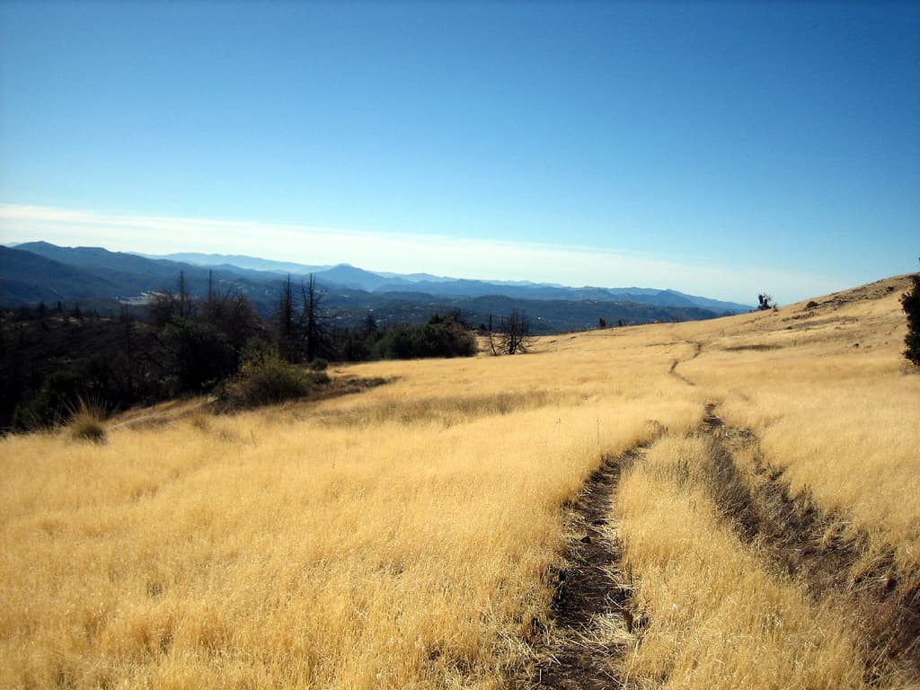
Oak woodland and mountain meadow, close enough to Green Valley that you hear nothing from it. The Cedar Fire's mark is still visible on the ridges above.
The trailhead 1.5 miles from Arroyo Seco, and one of three registration points for the trail camp.
Day use fee $10 per vehicle. Register at park headquarters, the Paso Picacho contact station, or the Green Valley campground.
East of San Diego on Highway 79, five miles north of I-8. About 50 miles east of San Diego and 15 miles south of Julian. Day-use hours 8 AM to sunset.
Julian, 15 miles north.
Required and recommended gear for Arroyo Seco
Trailhead transportation options
Browse all shuttlesExperienced wilderness guides
Browse all guidesSome links may be affiliate links. Purchases support PermitSnag at no extra cost to you.
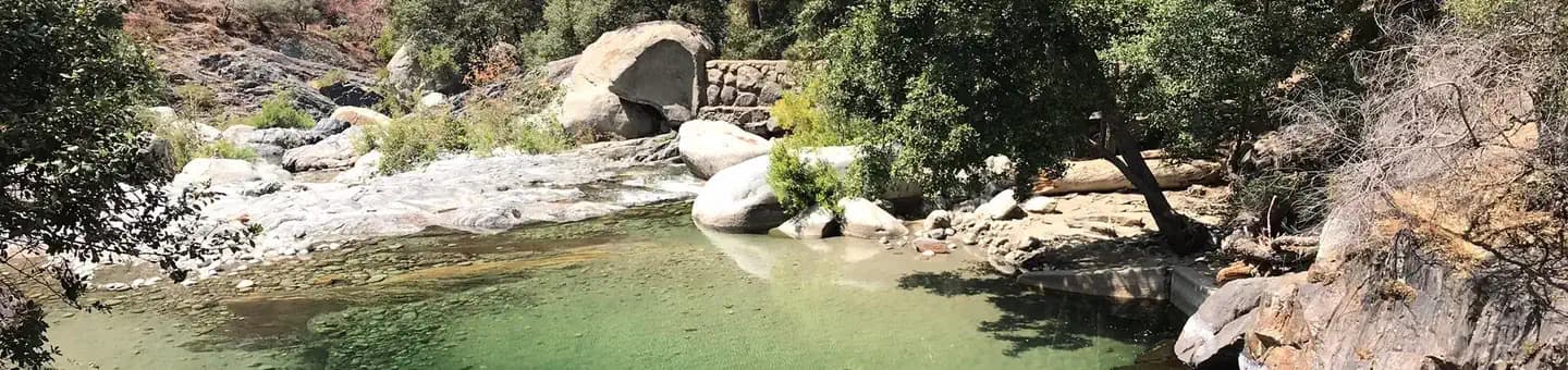
The trailhead at 4,000 feet with a creek running through the middle of it, 1.5 miles from Arroyo Seco.
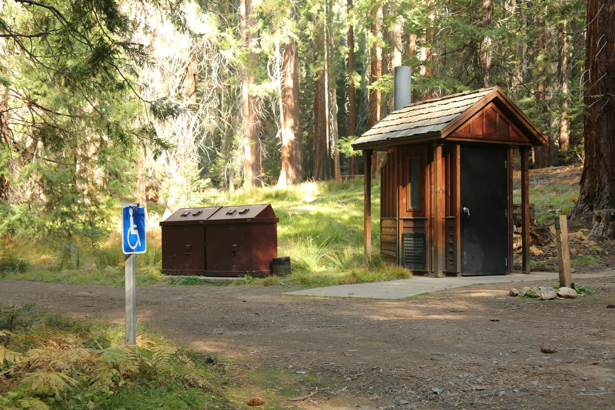
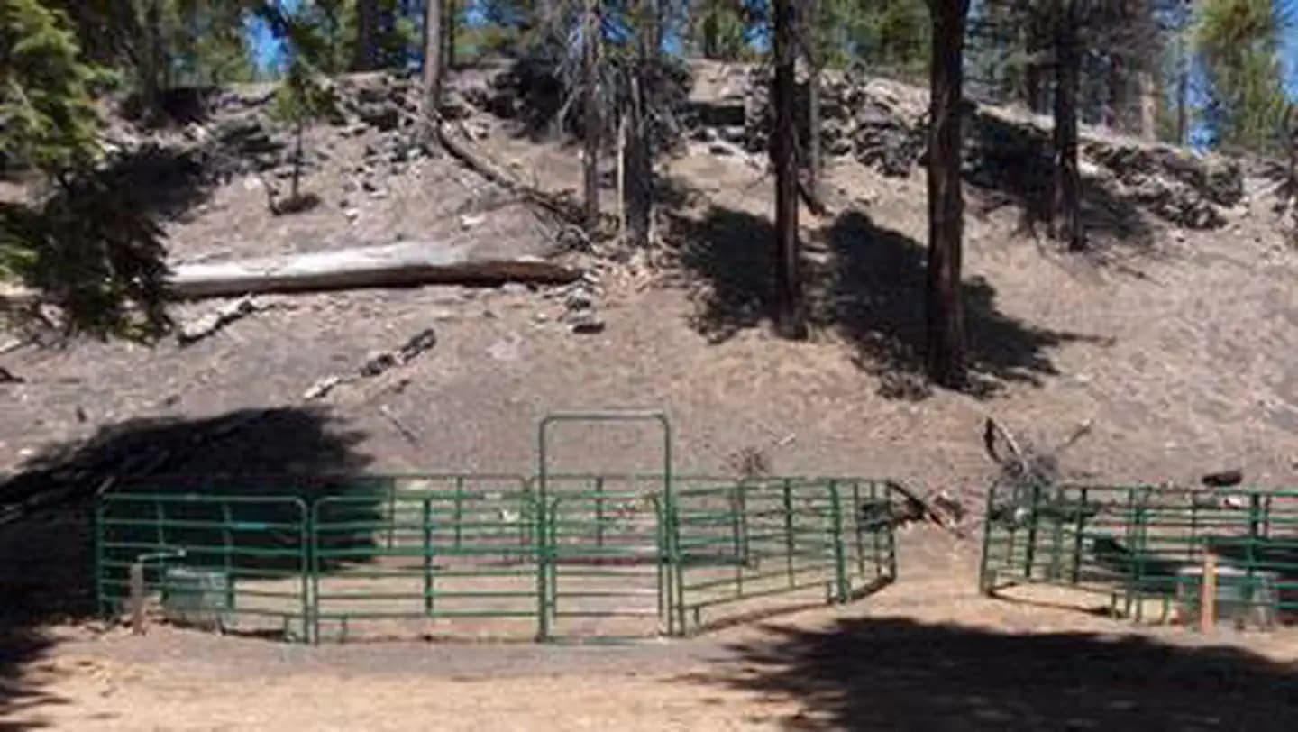
Chemical toilets, non-potable water, corrals and tent sites.
The second highest point in San Diego County; a 3.5-mile hike up Lookout Fire Road for 360-degree views.
A two-mile trail climbing from 4,800 to 5,700 feet, moderately difficult thanks to many switchbacks.
Arroyo Seco permits use a reservation system. PermitSnag sends lottery open, deadline, and results reminders; you can also enable cancellation alerts if spots open later.
Check with the managing agency for current season dates. Weekdays generally have better availability than weekends.
This permit has a demand score of 6/10, making it moderately competitive.
Cancellations happen daily. Set up alerts with PermitSnag to get notified the moment a spot opens up. Pro and $19 single-permit alerts are checked about every minute, 24/7; free accounts are checked hourly.
No active conditions reported
Sign in to report trail conditions.
No questions yet
Be the first to ask about Arroyo Seco.
Evening light across the meadows below the burn line, with fire-killed timber silhouetted on the ridges.
Spring mornings, when the regrowth is green and the light is soft.
Even at 1.5 miles, a first-come backcountry camp sees a fraction of Green Valley's traffic.
Consider these alternatives if your preferred dates aren't available.
The park's other environmental camp, 4.5 miles from Green Valley with the same amenities and the same first-come basis.
Three times the walk for a more remote feel. Identical facilities and identical registration.
A per-person quota permit for four wilderness campgrounds above 8,000 feet in the San Jacinto Mountains.
Genuinely alpine and much cooler, but subject to a real quota that fills weeks ahead in summer, and no dogs.
A Crystal Cove backcountry camp only 0.4 miles from the Ridge Park entrance by the park's trail table.
An even shorter walk and a coastal setting, and it can be reserved. But there is no water there at all, not even non-potable.
Nearby campgrounds to complete your Arroyo Seco trip
A small favor
Google lets you pick the sites it highlights for you. Add PermitSnag and our permit pages get marked as one of yours in AI Overviews and AI Mode.
Takes less than a minute.