Lottery10/10
Steep Ravine lottery
Nine rustic cabins above the surf at Rocky Point, and the hardest booking in the...
Mount Tamalpais State Park · California
Walk-in environmental campsites near the famous cabins.
70% of the openings our scanner caught on Steep Ravine Camp were gone within 10 minutes.
Build your full itinerary start to finish
Add your dates and get a day-by-day plan: what needs a permit, what gear to bring, and one link to share with your whole group to coordinate every step.
No permit needed to start
September and October are the payoff months on the Marin coast, when the summer fog thins and the terrace opens up. Park guidance is highs in the 80s and 90s in spring and summer, 50s in fall and winter, with fog common in any season. Because ReserveCalifornia opens six months ahead, an October trip means booking in April.
Trailhead (5,000 ft)
Today
78°
47°
Sun
70°
44°
Mon
81°
43°
Tue
87°
47°
Wed
89°
50°
Thu
91°
52°
Fri
90°
54°
Sign up at ReserveCalifornia if you don't have an account. Have your payment info ready.
Permits typically release on a rolling basis. Check the specific release time for your desired dates.
Log in a few minutes early. Have your dates, group size, and payment ready to go.
If your dates are sold out, people cancel all the time. Set up PermitSnag alerts to catch openings instantly.
Green hills, wildflowers on Mount Tamalpais, and fog beginning to build on the coast.
Fitness and endurance required
Climbing, scrambling, or specialized skills
Steep dropoffs and fall potential
Route finding and trail clarity
Difficulty of bailing out mid-route
Anyone who wants the Steep Ravine terrace and does not want to gamble on the cabin drawing. Tent campers who like wind and surf noise.
None, beyond being able to pitch a tent that will hold in coastal wind.
RVs and trailers, anyone bringing a dog on the trails, and anyone who needs a fully sheltered site on an exposed coast.
Steep Ravine Environmental Camp is the tent inventory on the Rocky Point terrace at Mount Tamalpais State Park, one mile south of Stinson Beach and directly above the Pacific. ReserveCalifornia carries six units here, EN01 through EN06, with a maximum stay of seven nights.
The important difference from the neighbouring cabins is how you get one. The cabins run through California State Parks' Reservation Drawing program - you apply months out and win or you do not. The environmental campsites do not. They go on ReserveCalifornia's standard schedule, which the department describes as six months in advance beginning at 8:00 a.m. Pacific, by website, by mail, or by calling 1-800-444-7275.
These are environmental campsites, which in California State Parks means walk-in and minimal: no hookups, no RVs. Restrooms and water faucets serve the terrace. Mount Tamalpais State Park is open daily 7:00 a.m. to sunset year-round, and dogs are allowed only in developed areas - not on trails, dirt roads or in backcountry areas.
Book through ReserveCalifornia. This is a California State Park, so nothing about it touches Recreation.gov.
The cabins next door are the most contested reservation in the California State Parks system - the department made them the pilot for its Reservation Drawing program in 2023. The environmental campsites sit on the same terrace, above the same surf, and they are not in that drawing. They release six months ahead at 8 a.m. Pacific like any other ReserveCalifornia site, which makes them the single most obtainable way to sleep at Rocky Point.
These are walk-in sites, not a backcountry hike: you park on the terrace and carry your gear in. ReserveCalifornia lists six units in the Steep Ravine camp area, coded EN01 through EN06, with a maximum stay of seven nights. The Steep Ravine Trail up Webb Creek starts from the same corner of the park and finishes on a steep ladder - it is the park's most-loved short hike and the obvious morning after. Pantoll, further up the mountain, has 15 first-come sites with drinking water, firewood and flush toilets, and is the backup when the terrace is full.
A marine terrace one mile south of Stinson Beach with the Pacific breaking directly below, and no walls between you and it. The surf does not stop, the fog comes and goes on its own schedule, and on the clear evenings the sun goes down over open ocean in front of you rather than behind a ridge. Behind you Mount Tamalpais rises straight off the coast.
Access road off Highway 1 about a mile south of Stinson Beach; the campsites are walk-in from the parking area on the Rocky Point marine terrace.
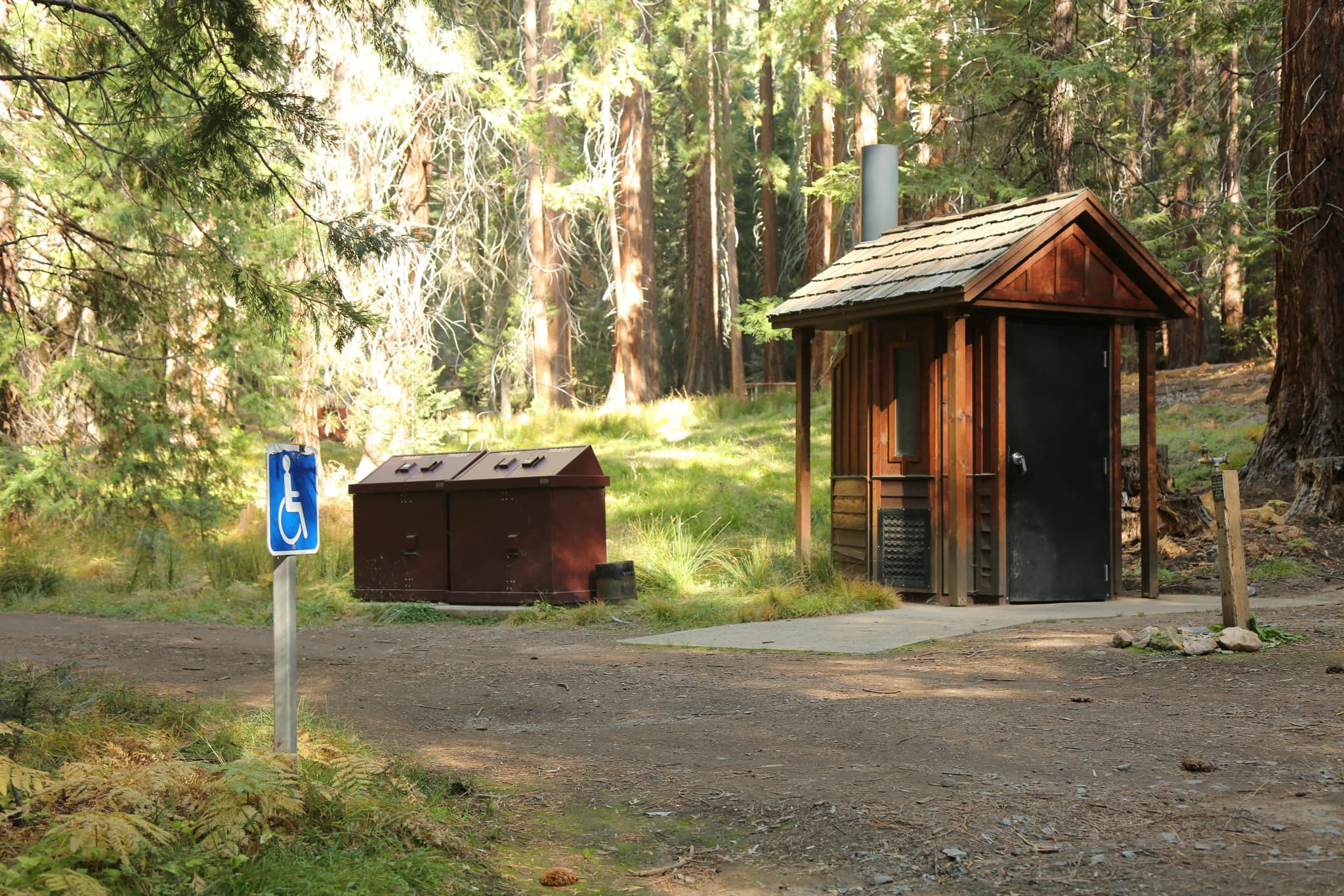
Campsite #7 is accessible and conveniently located within a short distance of accessible parking and restrooms.
From Highway 101 take Highway 1 to the Stinson Beach exit and follow signs. The park is open 7 a.m. to sunset and cars parked after hours may be fined.
Stinson Beach, about a mile north.
Upper-mountain ranger station and trailhead, and the only place in the park that takes credit cards, during business hours.
Parking fee applies. Credit cards are taken during business hours at Pantoll only; cash or check self-registration at East Peak and Bootjack.
On Panoramic Highway.
Mill Valley or Stinson Beach.
Required and recommended gear for Steep Ravine Camp
Trailhead transportation options
Browse all shuttlesExperienced wilderness guides
Browse all guidesSome links may be affiliate links. Purchases support PermitSnag at no extra cost to you.
The marine terrace one mile south of Stinson Beach holding the environmental campsites and the nine cabins
Follows Webb Creek through tall redwoods and finishes on a steep ladder
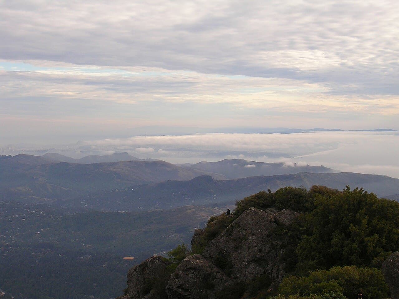
The Mount Tamalpais summit; on a clear day the view takes in the Farallon Islands 25 miles out, San Francisco Bay and Mount Diablo
15 first-come sites about 100 yards from the parking area, with drinking water, firewood and flush toilets
No. The Reservation Drawing covers the Steep Ravine cabins. The environmental campsites book on ReserveCalifornia's ordinary schedule, which California State Parks describes as six months in advance beginning at 8:00 a.m. Pacific.
ReserveCalifornia lists six units in the Steep Ravine camp area, coded EN01 through EN06.
Through ReserveCalifornia, not Recreation.gov. Reservations open six months ahead at 8:00 a.m. Pacific and can be made online, by mail, or by calling 1-800-444-7275.
ReserveCalifornia sets a maximum stay of seven nights on this camp area.
Dogs are allowed only in developed areas of Mount Tamalpais State Park. They are not allowed on trails, dirt roads or in backcountry areas, so the Steep Ravine Trail is off limits to them.
Park guidance puts highs in the 80s and 90s in spring and summer and in the 50s in fall and winter, with fog common. Pack for wind and damp in any month.
No active conditions reported
Sign in to report trail conditions.
No questions yet
Be the first to ask about Steep Ravine Camp.
No trip reports yet
Be the first to share your experience at Steep Ravine Camp.
Write the First ReportSunset straight off the terrace. The sites face open Pacific, so the sun goes down in front of you rather than behind a ridge.
The hour after a fog bank clears, when the light comes in low under the ceiling and the water lights up.
Six sites means the terrace is never crowded. Midweek in the shoulder months gets you the whole thing, and staying overnight is the only way to have it after the day-use traffic leaves.
Consider these alternatives if your preferred dates aren't available.
The nine rustic cabins on the same terrace, allocated by California State Parks' Reservation Drawing rather than the normal booking window.
A wood stove and four walls instead of a tent, but you have to win a drawing eight months ahead instead of booking six months ahead.
Walk-in environmental sites in the coastal hills of Sonoma Coast State Park, above the mouth of the Russian River.
Two hours further north and set back in redwoods rather than on an ocean terrace, but 20 sites instead of six.
Nearby campgrounds to complete your Steep Ravine Camp trip
A small favor
Google lets you pick the sites it highlights for you. Add PermitSnag and our permit pages get marked as one of yours in AI Overviews and AI Mode.
Takes less than a minute.