Reservation7/10
Inyo NF Big Pine Creek South Fork permit
Wilderness permit for entry via Big Pine Creek South Fork in Inyo National Fores...
Inyo National Forest · California
Wilderness permit for entry via Big Pine Creek North Fork in Inyo National Forest. Access to John Muir Wilderness and Ansel Adams Wilderness.
70% of the openings our scanner caught on Big Pine Creek North Fork were gone within 5 minutes.
Build your full itinerary start to finish
Add your dates and get a day-by-day plan: what needs a permit, what gear to bring, and one link to share with your whole group to coordinate every step.
No permit needed to start
The quota season runs May 1 to November 1. July through September is when the upper lakes are clear. Start early in any month, because the lower trail bakes.
Trailhead (5,000 ft)
Backcountry Tips
Today
95°
51°
Sun
94°
62°
Mon
85°
51°
Tue
87°
61°
Wed
88°
61°
Thu
90°
64°
Fri
93°
67°
Find this permit on the managing agency's booking system and set up an account with your payment info ready.
Permits typically release on a rolling basis. Check the specific release time for your desired dates.
Log in a few minutes early. Have your dates, group size, and payment ready to go.
If your dates are sold out, people cancel all the time. Set up PermitSnag alerts to catch openings instantly.
Hot below, cold at the lakes, thunderstorms most afternoons.
Fitness and endurance required
Climbing, scrambling, or specialized skills
Steep dropoffs and fall potential
Route finding and trail clarity
Difficulty of bailing out mid-route
Backpackers who want glacial lakes and Palisade views on maintained trail.
One prior climb of 2,000-plus feet carrying a pack.
Parties hoping to camp low, since the first legal ground is past the wilderness boundary.
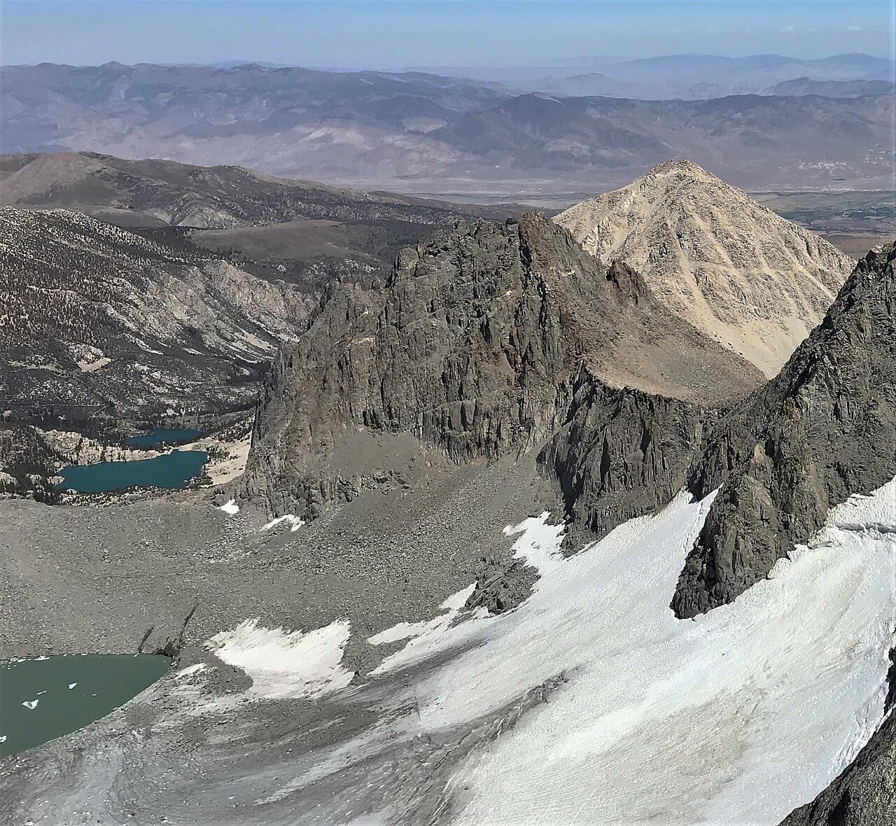
Big Pine Creek North Fork is an Inyo National Forest wilderness entry point above Big Pine, climbing into the John Muir Wilderness toward the Big Pine Lakes and the Palisade Glacier.
Inyo's quota season runs May 1 to November 1 in 2026, with reservations opening six months in advance at 7 am Pacific and additional permits released two weeks ahead. From November 2 to April 30 the trailhead is non-quota with a two-week booking window.
Inyo separates this permit from the South Fork, so check the area map before booking. Camping is barred from the trailhead to a quarter mile past the wilderness boundary near Second Falls, and campfires are prohibited outright.
Inyo National Forest describes the Big Pine North Fork trail going to the popular First through Seventh Lakes north of Temple Crag and Mount Sill, past a chain of lakes where you can see the effects of past glacial activity: glacier polish, and erratics, those oddly balanced boulders left standing on the polished granite as the glacier melted.
The hike starts across sunny sage and manzanita covered slopes above First Falls and enters the wilderness boundary near Second Falls. Camping is prohibited from the trailhead to a quarter mile past that boundary, so the climb has to be done in one go.
Above that the lakes come in sequence. Inyo notes a side trail to Black Lake offering views of the Palisade Glacier and the Sierra Crest before looping back to the main trail near Fourth Lake, which is the standard way to make a loop out of the basin.
Regulations are strict: no campfires anywhere, and food and refuse must be stored in a bear-resistant container or counter-balanced at least 15 feet above the ground and 10 feet horizontally from a tree trunk.
The first miles are hot, open sage and manzanita above First Falls with no shade at all. Then the canyon closes in and the lakes start, one after another, each one a shade of milky turquoise from the glacial flour coming off the Palisade Glacier.
Required and recommended gear for Big Pine Creek North Fork
Trailhead transportation options
Browse all shuttlesExperienced wilderness guides
Browse all guidesSome links may be affiliate links. Purchases support PermitSnag at no extra cost to you.
The trail climbs across sage and manzanita slopes above the falls.
Near the wilderness boundary. No camping until a quarter mile past it.
Side trail with views of the Palisade Glacier, rejoining near Fourth Lake.
The far end of the lake chain, north of Temple Crag and Mount Sill.
No. Inyo National Forest issues them as separate reservations, and the South Fork permit states plainly that it does not include the North Fork.
Not until a quarter mile past the wilderness boundary near Second Falls. Inyo prohibits camping from the trailhead to that point.
No. Inyo prohibits campfires on this entry point, so bring a stove.
Inyo lists First through Seventh Lakes north of Temple Crag and Mount Sill, with a Black Lake side trail that rejoins the main trail near Fourth Lake.
No active conditions reported
Sign in to report trail conditions.
No questions yet
Be the first to ask about Big Pine Creek North Fork.
No trip reports yet
Be the first to share your experience at Big Pine Creek North Fork.
Write the First ReportFirst light on Temple Crag from Second Lake, when the peak lights up over the turquoise water.
Mid-morning at Third or Fifth Lake, when the sun is high enough to bring out the glacial colour.
Second and Third Lakes take almost all the traffic. Fifth through Seventh are usually empty.
Consider these alternatives if your preferred dates aren't available.
The other fork, toward Brainard and Finger Lakes under the Middle Palisades.
Rougher trail and a creek ford, but far fewer people.
The next canyon north, over Bishop Pass into Dusy Basin.
Crosses the crest and reaches the John Muir Trail, on a busier permit.
A short trip into a quiet granite basin below Mount Thompson.
Much less mileage and easier permits, without the glacier.
Nearby campgrounds to complete your Big Pine Creek North Fork trip
Articles that plan a trip around this permit.
A small favor
Google lets you pick the sites it highlights for you. Add PermitSnag and our permit pages get marked as one of yours in AI Overviews and AI Mode.
Takes less than a minute.