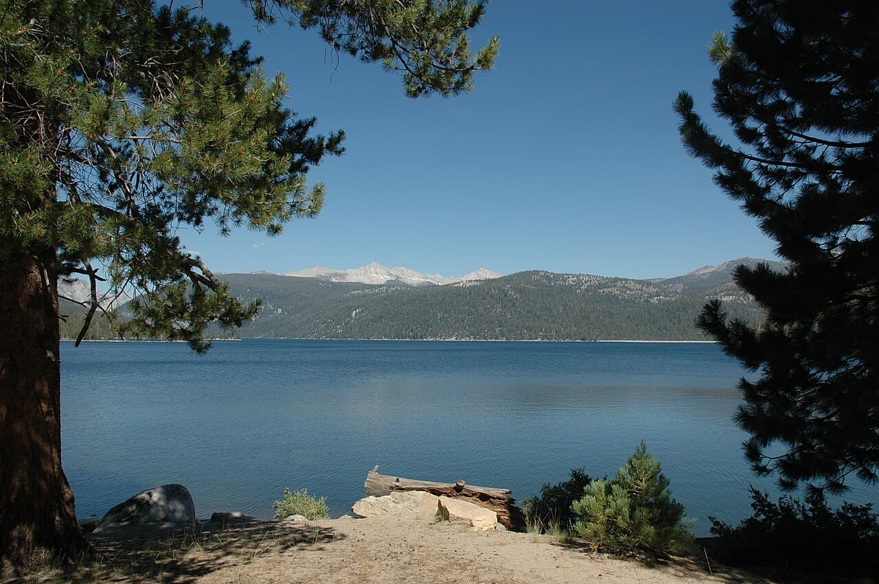
Sierra National Forest Wilderness Permit
Sierra National Forest · California
One overnight permit covering 55 entry trails into the John Muir, Ansel Adams, Dinkey Lakes and Kaiser Wildernesses. You reserve a trailhead and a start date, then walk where you like.
70% of the openings our scanner caught on Sierra NF Wilderness were gone within 5 minutes.
Plan the full trip, not just the permit
Build your full itinerary start to finish
Add your dates and get a day-by-day plan: what needs a permit, what gear to bring, and one link to share with your whole group to coordinate every step.
No permit needed to start
Sierra NF Wilderness Quick Facts
Sierra NF Wilderness Permit Facts
- As of September 2026, Sierra NF Wilderness in Sierra National Forest, California requires a permit issued via reservation.
- Sierra NF Wilderness is a high-demand permit, rating 7/10 on PermitSnag's demand index.
- Cancelled Sierra NF Wilderness permits are re-released on the booking system; PermitSnag monitors availability and alerts watchers when dates open.
Key Information
Key Dates
Permit Details
Pro Tips
- •Quota is only on your entry date and entry trail — once you are in, you can move between the four wildernesses and on into Yosemite, SEKI or Inyo on the same permit
- •Walk-up spaces are released online 14 days out and only online; USFS says "We do not create walk-up permits at the Stations"
- •If your trip exits over Mt. Whitney you must pick that option when you book, and the per-person fee triples
- •Call the issuing office three days before your start date to confirm and get the permit printed, or the reservation is voided as a no-show
- •Changing entry trail or entry date means a brand-new reservation and a second set of fees, so get the trailhead right the first time
What to Expect
Route Details
Highlights
- •A trailhead-and-date reservation, not a site or an itinerary
- •Quota only on your entry date; no exit quota anywhere on the Sierra
- •Granite lake basins between roughly 7,000 and 12,000 feet
- •Long, slow mountain driving to most trailheads
- •In-person permit pickup at Prather or North Fork, after a phone call three days out
Best Time to Visit
Mid-July through September, once the passes clear and creek crossings drop. Permits are required and available year-round, but the high country is under snow well into summer in a big year, and the forest roads to several trailheads close in winter.
Hazards & Considerations
- !Altitude — USFS tells permit holders outright to "learn symptoms of altitude sickness"
- !No cell service across most of the forest; do not plan to navigate or call for help by phone
- !Bears, and vehicle break-ins at trailheads where food is left in cars
- !Early-season snow on passes and high creek crossings from snowmelt
- !Afternoon thunderstorms on exposed granite in summer
- !Fire restrictions that change through the season and can close areas outright
Weather Forecast
Trailhead (5,000 ft)
Backcountry Tips
- Today: Expect 28°F colder at summit. Layer up.
- Today: Freezing temps at elevation. Bring insulation even if warm below.
- Tomorrow: Expect 28°F colder at summit. Layer up.
Today
59°
42°
Thu
58°
43°
Fri
60°
40°
Sat
60°
38°
Sun
57°
35°
Mon
59°
34°
Tue
68°
36°
How to Get This Permit
Create a Recreation.gov account
Sign up at Recreation.gov if you don't have an account. Have your payment info ready.
Know the release schedule
Permits typically release on a rolling basis. Check the specific release time for your desired dates.
Be ready when permits drop
Log in a few minutes early. Have your dates, group size, and payment ready to go.
Monitor for cancellations
If your dates are sold out, people cancel all the time. Set up PermitSnag alerts to catch openings instantly.
When to Go
Conditions
Snow still on the passes and creeks running high with melt. Many access roads not yet open.
Crowd Level
LowAdvantages
- +Empty quotas
- +Waterfalls and full creeks
- +Wildflowers at lower elevations
Challenges
- !Snow-covered passes
- !Dangerous creek crossings
- !Road closures to high trailheads
- !Mosquitoes as the snow goes
Difficulty Assessment
Fitness and endurance required
Climbing, scrambling, or specialized skills
Route finding and trail clarity
Difficulty of bailing out mid-route
Best For
Backpackers ready for multi-day trips at altitude who would rather drive further than compete for an east-side trailhead.
Recommended Experience
Prior multi-day backpacking. Snow travel skills for anything before mid-July.
Not Recommended For
Anyone relying on a phone for navigation or rescue, and first-time backpackers going straight to the high passes.
About This Permit
One Recreation.gov permit covers overnight travel into four wildernesses on the west side of the Sierra crest: the John Muir, the Ansel Adams, Dinkey Lakes and Kaiser. USFS sells it as 55 separate entry trails, each with its own daily quota, spread across the High Sierra and Bass Lake ranger districts.
What you reserve is a start date and an entry trail, nothing more. Once you are through, the permit is good for continuous travel — including across the boundary into Yosemite, Sequoia, Kings Canyon or Inyo — for up to 14 days in one area. Reservations open six months ahead on a rolling basis, with a January release for the start of the season and a walk-up quota that goes online 14 days before each arrival date.
The Experience
Why It Matters
Almost everyone who plans a High Sierra trip plans it from the east side, out of Inyo National Forest, and competes for the same handful of famous trailheads. Sierra National Forest holds the western half of the same country: the John Muir and Ansel Adams Wildernesses, plus Dinkey Lakes and Kaiser, reached from Florence Lake, Courtright, Huntington and the Bass Lake district. USFS calls it "the longest roadless section of the Sierra Nevada Mountain Range," and several of these 55 entry trails put you on the JMT or the PCT within a day.
The Route
The permit is a single product covering four wildernesses, and which one you get depends entirely on the trailhead you reserve.
The Ansel Adams entries — Isberg, Fernandez, Walton, Chiquito, Mammoth — climb out of the Bass Lake district in the north toward the Ritter Range and the Yosemite boundary. Several of them cross into Yosemite Wilderness on the same permit.
The John Muir entries run out of the High Sierra district in the middle: Florence, Bear Ridge, Mono Creek, Devils/Graveyard and Maxson from Courtright. This is the JMT and PCT corridor, and Florence Lake is the classic western resupply approach for hikers coming over Selden Pass.
Dinkey Lakes and Kaiser are the smaller, closer-in wildernesses, with short entries like Cliff Lake, Nelson, Potter Pass and Sample Meadow that make a weekend rather than an expedition.
The Feeling
The drive up is long and the ranger station is in a town most people have never heard of. Then the road ends at a reservoir at 7,000 feet, the pack goes on, and within a few hours the granite starts. Lakes appear one after another with nobody at them. There is no queue for a permit here and no crowd at the pass, which is exactly why people who know the range keep coming back to this side of it.
Trailhead Information
Florence Lake
John Muir Wilderness entry and the standard western approach to the JMT and PCT corridor.
Before you rely on this water
Treat everything. There is no potable supply at the trailhead and USFS expects you to be self-sufficient.
Parking
Trailhead parking at the reservoir. A ferry across the lake shortcuts several miles when it is running.
Getting There
Long paved and single-lane approach from Highway 168 past Huntington Lake and Kaiser Pass. Slow going and not suitable for large vehicles.
Nearest Services
Lakeshore and Huntington Lake. Full services in Fresno or Prather.
Maxson (Courtright)
John Muir Wilderness entry from Courtright Reservoir, with separate outfitter and pack-stock quota variants.
Before you rely on this water
No potable water. Filter or treat from the reservoir and creeks.
Getting There
Paved most of the way from Shaver Lake via Dinkey Creek Road, then reservoir access roads.
Nearest Services
Shaver Lake.
Isberg
Ansel Adams Wilderness entry from the Bass Lake district with a route through to Yosemite Wilderness.
Before you rely on this water
No trailhead water. Carry what you need for the climb.
Getting There
Forest roads from the Bass Lake district. USFS flagged bridge construction near Hemlock Crossing from July 6 to August 15, 2026, with camping closed at Hemlock Crossing during that period.
Nearest Services
North Fork, where the Bass Lake Ranger District office is.
Potter Pass
Kaiser Wilderness entry near Huntington Lake, one of the short weekend options.
Before you rely on this water
No trailhead water.
Getting There
Off Kaiser Pass Road above Huntington Lake, paved to the turnoff.
Nearest Services
Lakeshore, Huntington Lake.
Rules & Regulations
- •Permit required year-round for overnight trips in all four wildernesses
- •Maximum group size 15, and separate groups may not combine past 15
- •Every person counts for group size, quota and fees, regardless of age
- •The signed permit must be in the group leader's possession and shown to rangers on request
- •The whole group must start on the entry date and at the entry trail named on the permit
- •Permits are not issued for stays longer than 14 days in one area
- •Only the group leader or the listed alternate may pick up or use the permit; names cannot be changed or added
- •Bear-resistant food storage is required in specific areas and recommended everywhere
- •No drones — they are prohibited in wilderness
- •Pack out all trash; do not burn or bury food or rubbish
Gear Checklist
Required
- Bear-resistant food canister for the areas that require it
- Map and compass or a downloaded offline map — most of the area has no cell service
- Water treatment
- Photo ID matching the permit for pickup
- Layers for high-elevation weather in any month
Recommended
- Satellite messenger for a range with no coverage
- Microspikes and an ice axe for early-season passes
- A trowel and the discipline to bury waste 6 to 8 inches deep and 100 feet from water
- Mesh strainer and a plan for grey water
Plan Your Trip
Gear Checklist
Required and recommended gear for Sierra NF Wilderness
Shuttle Services
Trailhead transportation options
Browse all shuttlesGuide Services
Experienced wilderness guides
Browse all guidesSome links may be affiliate links. Purchases support PermitSnag at no extra cost to you.
Key Landmarks
Florence Lake Trailhead
John Muir Wilderness entry and the classic western approach to the JMT over Selden Pass.
Mono Creek
John Muir Wilderness entry into the upper Mono Creek drainage and the JMT/PCT corridor.
Maxson (Courtright)
John Muir Wilderness entry from Courtright Reservoir, with outfitter and pack-stock variants of the same quota.
Isberg Trailhead
Ansel Adams Wilderness entry from the Bass Lake district, with a route into Yosemite Wilderness.
Fernandez Trailhead
Ansel Adams Wilderness entry, another Yosemite-boundary approach from the west.
Potter Pass
Kaiser Wilderness entry, one of the short weekend options near Huntington Lake.
Willow Meadow / Dinkey Lake
Dinkey Lakes Wilderness entry into a compact basin of granite lakes.
Sierra NF Wilderness FAQ
Do I need a Sierra National Forest wilderness permit?
For any overnight trip, yes, year-round. USFS: "A permit is required year-round for overnight trips into John Muir, Ansel Adams, Dinkey Lakes and Kaiser Wildernesses." Day hiking on Sierra NF trails does not need one.
When do Sierra National Forest wilderness permits become available?
Six months ahead of your start date, on a rolling basis: "Each year quota season permits become available for advanced reservations six months in advance of your trip start day. Permits are released during the first week of January and then 6 months in advance of the start date." There is no lottery.
How does the Sierra National Forest permit quota work?
Per entry trail, per start date only. USFS: "When selecting quota, you are reserving a specific start date and entry trail. You only need space on the entry date … No trail exit quota applies on the Sierra." Anyone joining you later on a different trail or date needs their own permit and their own quota space.
How many people can be on one Sierra National Forest wilderness permit?
Fifteen. USFS: "Max group size is 15 people" and "Groups cannot combine if they would exceed 15 people." Note that Yosemite, Sequoia and Kings Canyon cap some areas at 8 to 12, so a 15-person group cannot simply cross over.
Are there walk-up Sierra National Forest wilderness permits?
Yes, but only online. "Walk-up Quota is only available on line at recreation.gov, 14 days in advance of an arrival date. We do not create walk-up permits at the Stations." That 14-day release is one of the best moments to be watching a full trailhead.
Can I use a Sierra National Forest permit to hike the JMT or PCT?
Yes, from this side. Several Sierra NF trailheads feed the John Muir and Pacific Crest Trails, and the permit is "valid for continuous wilderness travel, including across the boundary of adjacent wilderness areas in our neighboring parks or forests." Leaving the trail to re-enter somewhere else voids it.
👥Community
Trail Conditions
No active conditions reported
Sign in to report trail conditions.
Questions
No questions yet
Be the first to ask about Sierra NF Wilderness.
Trip Reports
Write ReportNo trip reports yet
Be the first to share your experience at Sierra NF Wilderness.
Write the First ReportPhotography Guide
Golden Hour
Late light on the Silver Divide and the Ritter Range from the lake basins. West-side entries put the peaks in front of you at sunset rather than behind you.
Best Light
First and last hour. Midday at 10,000 feet flattens granite completely.
Beat the Crowds
Quota is per entry trail, and there are 55 of them. Pick anything other than the two or three obvious ones and you will have the first day mostly to yourself.
Classic Shots
- 📍The Silver Divide across Lake Thomas A. Edison
- 📍Granite lake basins in the Dinkey Lakes Wilderness
- 📍The Ritter Range from the Ansel Adams entries above Isberg
- 📍Reflections in the Kaiser Wilderness lakes at dawn
Can't Get a Sierra NF Wilderness Permit?
Consider these alternatives if your preferred dates aren't available.
Inyo NF — Piute Pass (North Lake)
Similar ExperienceAn east-side entry into the same John Muir Wilderness, from Bishop rather than from Fresno.
Tradeoffs
A much shorter approach to the crest, and far better known, which is exactly why the Inyo quotas are harder. Sierra NF is the quieter half of the same country.
John Muir Trail (Yosemite)
Same AreaSeveral Sierra NF entries put you on the JMT within a day, and Yosemite runs its own lottery for trips that start inside the park.
Tradeoffs
Yosemite's permit is a lottery with much heavier demand. Entering from the Sierra NF side is a way onto the same trail without it.
High Sierra Trail
Similar ExperienceSequoia's classic west-to-east crossing, on the same granite and the same crest immediately to the south.
Tradeoffs
A different quota system and stricter group-size limits in places, though continuous travel from a Sierra NF entry into SEKI is allowed on this permit.
Where to Stay
Nearby campgrounds to complete your Sierra NF Wilderness trip
A small favor
One tick helps us more than you’d think
Google lets you pick the sites it highlights for you. Add PermitSnag and our permit pages get marked as one of yours in AI Overviews and AI Mode.
Takes less than a minute.