Trailhead information
Russell Bridge (Southern Terminus)
Primary- No restrooms
- No water
Walk about 110 miles from the Chattooga River on the Georgia-South Carolina line to Cheoah Bald in North Carolina, retracing naturalist William Bartram's 1770s route through the Chattahoochee-Oconee and Nantahala National Forests.
“Walk 110 miles through the Chattahoochee-Oconee and Nantahala National Forests, retracing naturalist William Bartram's 1770s route.”
Plan your Chattahoochee-Oconee & Nantahala National Forests trip here, then get your permit from the agency.
Walk-up permit
No permit is needed anywhere on the Bartram Trail. It is free, dispersed camping under standard national forest rules the whole 110 miles through the Chattahoochee-Oconee and Nantahala National Forests.
More about Chattahoochee-Oconee & Nantahala National ForestsPlanning another trip? See the permits we alert on.
Russell Bridge (Southern Terminus)
Southern terminus on the West Fork of the Chattooga River, along Highway 28 about two miles south of Warwoman Road; a metal suspension bridge crosses the river near a granite trailhead marker.
As of September 2026, the managing agency does not require a permit for Bartram Trail in Chattahoochee-Oconee & Nantahala National Forests, Georgia. Bartram Trail rates 3/10 on PermitSnag's demand index. The Bartram Trail route covers 110 miles, rated strenuous.
More on Bartram Trail: Live availability activityBartram Trail Thru-Hike permit itinerary
Bartram Trail permit fee: Free (no permit; dispersed camping under standard national forest rules).
Walk 110 miles through the Chattahoochee-Oconee and Nantahala National Forests, retracing naturalist William Bartram's 1770s route.
Walk about 110 miles from the Chattooga River on the Georgia-South Carolina line to Cheoah Bald in North Carolina, retracing naturalist William Bartram's 1770s route through the Chattahoochee-Oconee and Nantahala National Forests.
From Russell Bridge (Southern Terminus), the route passes Wilson Gap, Rabun Bald, Bartram Trail map kiosk (Rabun County, GA), Jones Gap, Trail viewpoint (Fishhawk Range spine), before finishing at Cheoah Bald (Northern Terminus).
The trail retraces the route naturalist William Bartram traveled through the southern Appalachians in the 1770s.
Best for: Experienced hikers with excellent fitness and relevant technical skills.
Recommended experience: Should have completed 10+ mile day hikes with significant elevation gain.
Trailhead information
Trailhead information
Trailhead information
Trailhead information
Trailhead information
Trailhead (5,000 ft)
Today
79°
55°
Mon
80°
56°
Tue
80°
56°
Wed
83°
60°
Thu
83°
62°
Fri
81°
64°
Sat
80°
63°
49%
Emergency contacts, ranger station locations, and satellite communicator tips for Bartram Trail.
Bear canister requirements, approved container lists, and rental locations for this permit.
Gear Checklist: Required and recommended gear for Bartram Trail · Shuttle Services: Trailhead transportation options · Guide Services: Experienced wilderness guides
Some links may be affiliate links. Purchases support PermitSnag at no extra cost to you.
No. Neither the Chattahoochee-Oconee National Forest in Georgia nor the Nantahala National Forest in North Carolina requires a permit to hike or camp along the Bartram Trail. It's all dispersed, self-directed backcountry camping under standard national forest rules -- no reservation, no lottery, no fee.
About 110 miles: roughly 37 miles in Georgia (Russell Bridge to the North Carolina line) and 70-plus miles in North Carolina (the state line to Cheoah Bald), where it meets the Appalachian Trail.
No. Every official description of the Bartram Trail places it entirely on national forest land -- Chattahoochee-Oconee in Georgia and the Nantahala and Cheoah Ranger Districts of the Nantahala National Forest in North Carolina. It ends at Cheoah Bald, well south of the national park boundary, where it joins the Appalachian Trail.
Most people who go end-to-end plan on roughly 8 to 12 days, but far more hikers section-hike the Bartram Trail over several trips than complete it in one push.
The Blue Ridge Bartram Trail Conservancy recommends north to south, since the trail loses elevation overall heading that way, especially through the Georgia section.
Yes, the Blue Ridge Bartram Trail Conservancy, formed in 2020 when the Georgia and North Carolina trail groups (both dating to 1977) joined under one nonprofit. They maintain the route, publish section descriptions, and log trail conditions.
Franklin, NC is the only town the trail itself passes through, via a road-walk and greenway in Section 7. Clayton, GA and the Highlands/Scaly Mountain, NC area are reachable by short side trips near the Georgia-North Carolina state line.
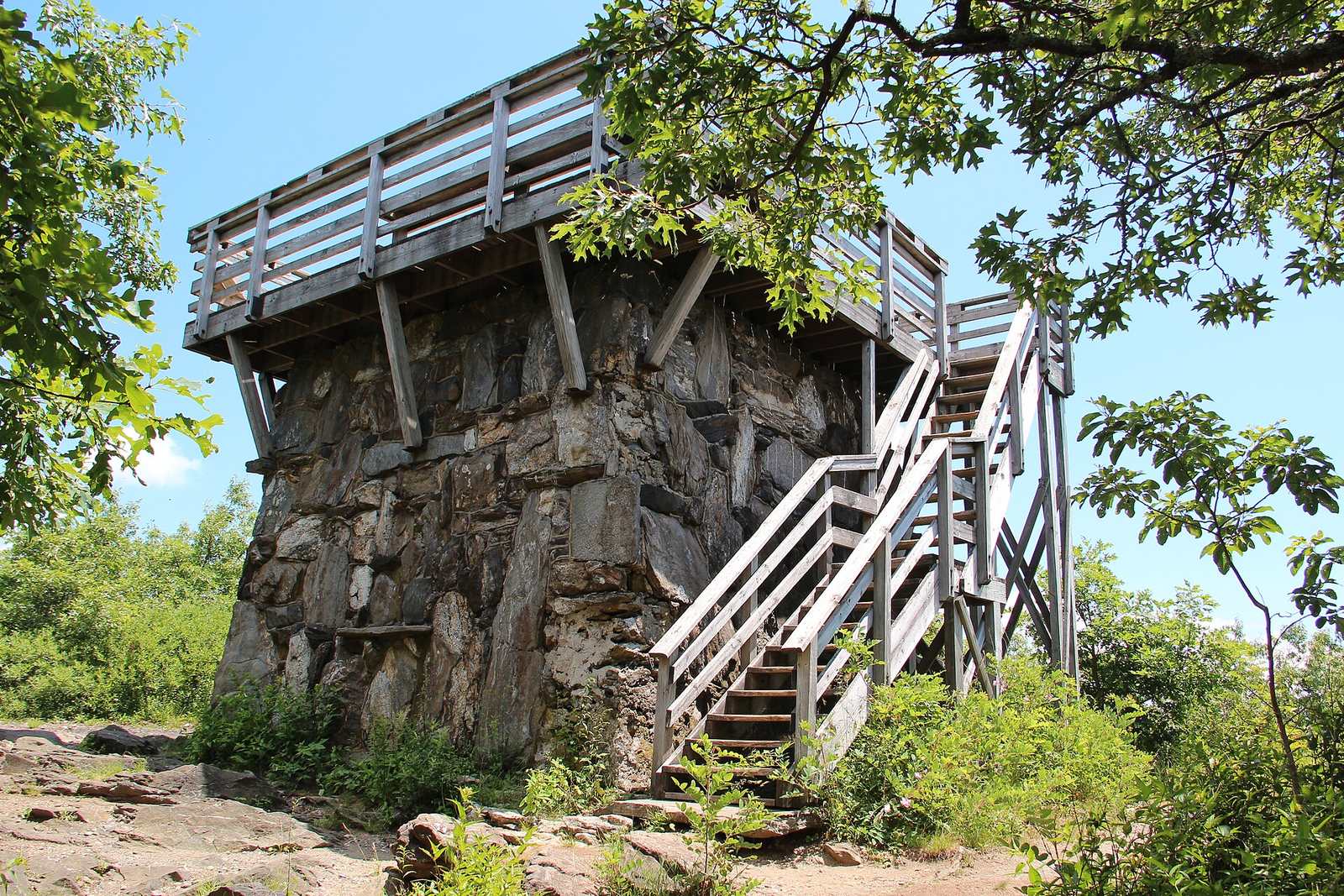
Wayah Bald in North Carolina, at 5,342 feet, where the Bartram Trail and the Appalachian Trail cross at a historic 1937 stone fire tower.
No, and this trips people up. Recreation.gov's own search for 'Bartram Trail' returns a short lakeside trail at Petersburg Campground on Thurmond Lake near Augusta -- a completely different, unrelated trail. The one covered here is the roughly 110-mile mountain trail from Rabun County, Georgia to Cheoah Bald, North Carolina.
No active conditions reported
Sign in to report trail conditions.
No questions yet
Be the first to ask about Bartram Trail.
Build your full itinerary start to finish
Add your dates and get a day-by-day plan: what needs a permit, what gear to bring, and one link to share with your whole group to coordinate every step.
No permit needed to start
Google lets you pick the sites it highlights for you. Add PermitSnag and our permit pages get marked as one of yours in AI Overviews and AI Mode.
Takes less than a minute.