Trailhead information
Table Rock State Park
Primary- No restrooms
- No water
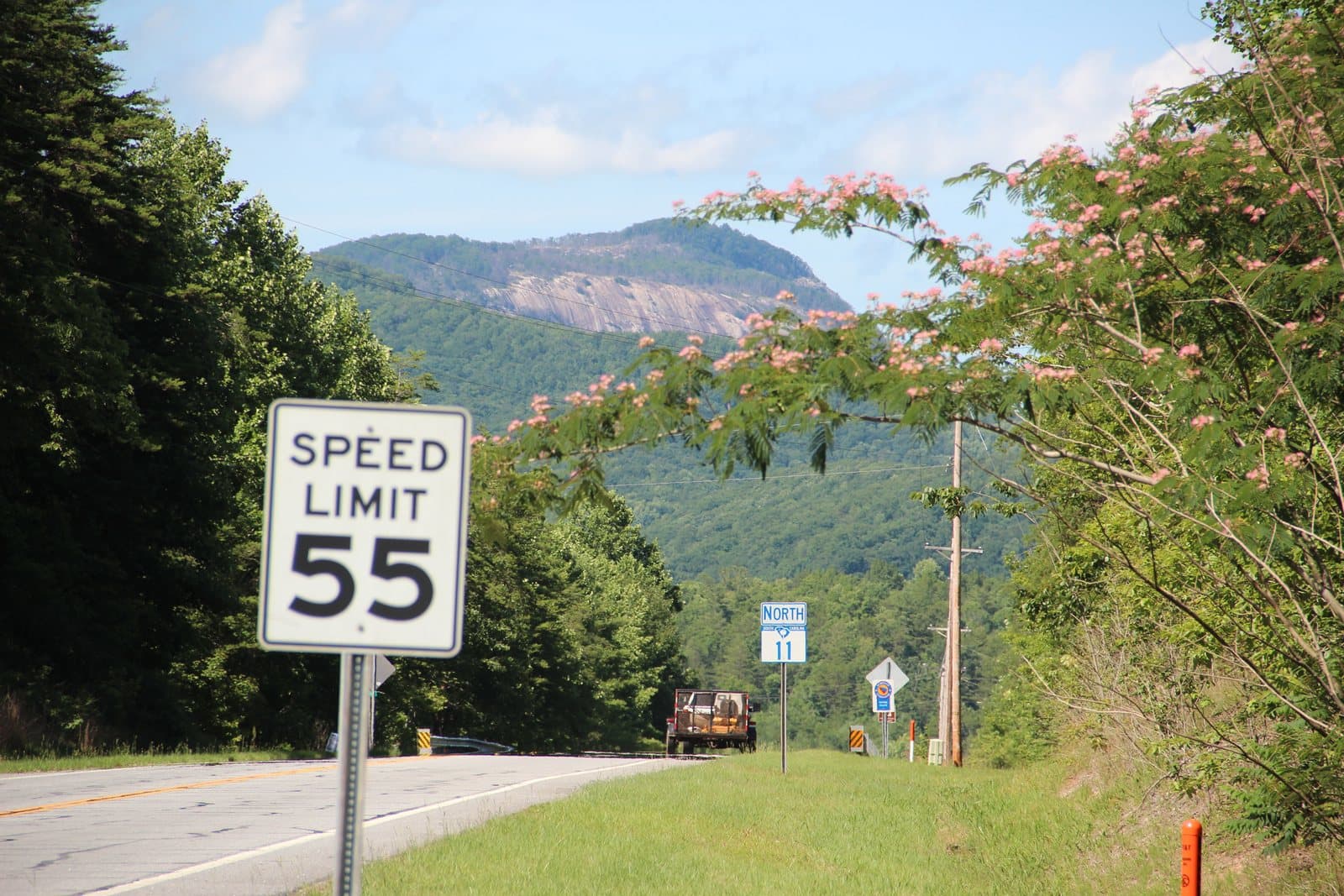
77 miles along the Blue Ridge Escarpment in Upstate South Carolina and western North Carolina, past waterfalls, Lake Jocassee and Sassafras Mountain, South Carolina's highest point. No fee to hike or camp on the trail itself.
“Walk 77 miles along the Blue Ridge Escarpment in Upstate South Carolina and western North Carolina, past waterfalls and Sassafras Mountain, South Carolina's highest point.”
Plan your Foothills Trail trip here, then get your permit from the agency.
Walk-up permit
No fee or permit is needed to hike or camp on the Foothills Trail itself. Vehicle day-use and parking fees apply only at the state park termini and the Whitewater Falls lot.
More about Foothills TrailPlanning another trip? See the permits we alert on.
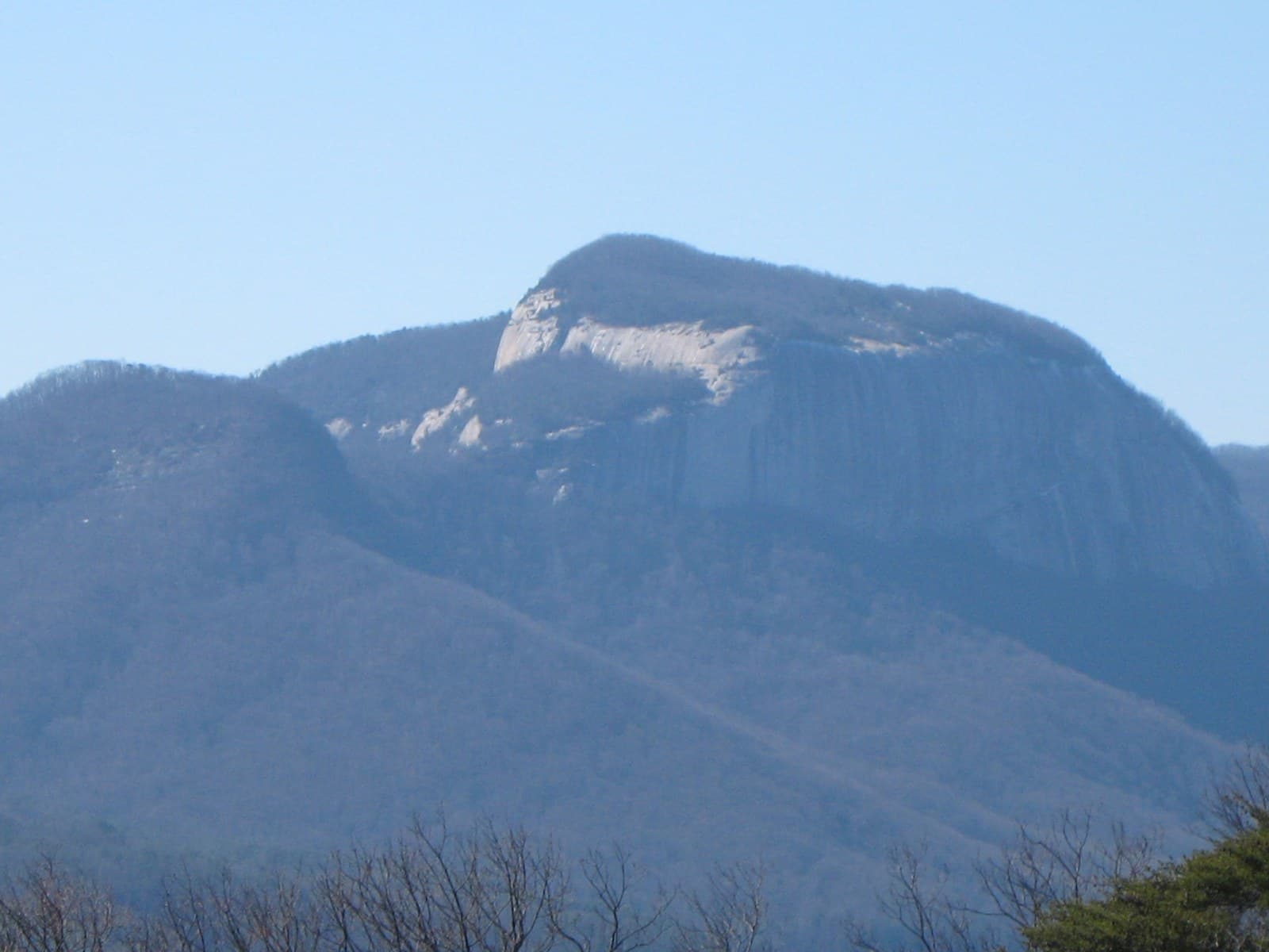
Table Rock State Park
Northern terminus of the Foothills Trail; day-use admission is $6 adults, $3.75 SC seniors, $3.50 children 6-15.
As of September 2026, the managing agency does not require a permit for Foothills Trail in Foothills Trail, South Carolina. Foothills Trail rates 5/10 on PermitSnag's demand index. The Foothills Trail route covers 77 miles, rated strenuous.
More on Foothills Trail: Live availability activity
Foothills Trail permit fee: No fee to hike or camp on the trail itself. Vehicle day-use/parking fees apply at the state park termini and the USFS Whitewater Falls lot.
Walk 77 miles along the Blue Ridge Escarpment in Upstate South Carolina and western North Carolina, past waterfalls and Sassafras Mountain, South Carolina's highest point.
77 miles along the Blue Ridge Escarpment in Upstate South Carolina and western North Carolina, past waterfalls, Lake Jocassee and Sassafras Mountain, South Carolina's highest point. No fee to hike or camp on the trail itself.
From Table Rock State Park, the route passes Mill Creek Falls, Sassafras Mountain, Chimneytop Gap, Laurel Valley, Virginia Hawkins Falls, before finishing at Oconee State Park.
The Foothills Trail Conservancy built the trail to link the region's state parks, national forest land and Duke Energy's Jocassee Gorges property into one continuous footpath along the escarpment.
Best for: Experienced hikers with excellent fitness and relevant technical skills.
Recommended experience: Should have completed 10+ mile day hikes with significant elevation gain.
Trailhead information
Trailhead information
Trailhead information
Trailhead information
Trailhead information
Trailhead information
Trailhead information
Trailhead information
Trailhead information
Trailhead information
Trailhead information
Trailhead (5,000 ft)
Today
84°
56°
Mon
84°
57°
Tue
81°
58°
Wed
83°
62°
Thu
84°
63°
Fri
81°
67°
Sat
78°
62°
47%
Emergency contacts, ranger station locations, and satellite communicator tips for Foothills Trail.
Bear canister requirements, approved container lists, and rental locations for this permit.
Gear Checklist: Required and recommended gear for Foothills Trail · Shuttle Services: Trailhead transportation options · Guide Services: Experienced wilderness guides
Some links may be affiliate links. Purchases support PermitSnag at no extra cost to you.
No quota permit. The Foothills Trail Conservancy requires every day hiker and overnight hiker to register at one of three kiosks (Table Rock State Park, Oconee State Park, or Frozen Creek at Gorges State Park), but registration has no quota and costs nothing. The only money you spend is vehicle parking: $6 a day at Table Rock, $5 a day at Oconee, and $2 a day at the Forest Service's Whitewater Falls lot. A separate SCDNR camping permit applies only if you leave the trail corridor to camp elsewhere in the Jocassee Gorges Wildlife Management Area; SCDNR states plainly that no permit is needed for primitive camping along the Foothills Trail itself.
The Foothills Trail Conservancy states the trail is 77 miles long, running from Table Rock State Park to Oconee State Park across the Blue Ridge Escarpment in upstate South Carolina and western North Carolina. The Conservancy's own guidance is that thru-hikers should plan on 5 to 10 days, though the actual number of nights depends on how many of the trail's designated campsites you use each day.
The Conservancy does not publish an official direction. Both termini, Table Rock State Park and Oconee State Park, are set up with registration kiosks and trailhead parking, so the trail is hiked both northbound and southbound in roughly equal numbers.
No. The Foothills Trail Conservancy's own FAQ says bear canisters are not required, though recommended, and that many of the trail's designated campsites have bear cables you can use instead. If a site has no cable, plan to hang your food yourself.
Nowhere official. The trail is short enough that most thru-hikers carry every meal from the start and never resupply. If you are taking longer, the Conservancy's own advice is to arrange a cache or a shuttle pickup at one of the trail's road-access points rather than count on walking into a town.
Only within the trail's own camping band, and not everywhere even there. Camping is banned inside Table Rock and Oconee State Parks and along the Whitewater River corridor between Highway 281 and the Bad Creek Access. Where the trail runs through the Chattooga Wild and Scenic River corridor, Forest Service rules add a 50-foot no-camping buffer from the trail and the river. Outside those bands, camping is allowed within roughly 100 feet of the trail.
Sassafras Mountain, at mile 9.7 from Table Rock. At 3,553 feet it is the highest point in South Carolina, and the state's own tourism agency notes the summit tower sits on the North Carolina line, so you can stand in both states at once.
Yes, but only in an established ring at a designated campsite, and only when fire danger conditions allow it. The Conservancy's FAQ says to check current burn restrictions before building one.
It doesn't. Recreation.gov's search returns no facility or permit record for the Foothills Trail; the trail's land managers, South Carolina State Parks, the Andrew Pickens Ranger District of Sumter National Forest, and the Nantahala National Forest, run their own registration and fee systems instead.
No active conditions reported
Sign in to report trail conditions.
No questions yet
Be the first to ask about Foothills Trail.
Build your full itinerary start to finish
Add your dates and get a day-by-day plan: what needs a permit, what gear to bring, and one link to share with your whole group to coordinate every step.
No permit needed to start
Google lets you pick the sites it highlights for you. Add PermitSnag and our permit pages get marked as one of yours in AI Overviews and AI Mode.
Takes less than a minute.