Trailhead information
Massachusetts state line (Southern Terminus)
Primary- No restrooms
- No water
America's oldest long-distance hiking trail: 272 miles along the spine of Vermont's Green Mountains from the Massachusetts border to the Canadian border. No permit required for individual hikers.
“Walk 272 miles along the spine of Vermont's Green Mountains, the oldest long-distance hiking trail in the United States, from Massachusetts to Canada.”
Plan your Green Mountain National Forest trip here, then get your permit from the agency.
Walk-up permit
The Long Trail needs no permit for an individual hiker or small party. Green Mountain Club: "Individual hikers do not need a permit to hike the Long Trail." Camp at GMC's caretaker-staffed sites (donation-based) or dispersed per Green Mountain National Forest rules. Only an organized group over the club's size threshold needs a Forest Service special-use permit, applied for at least 30 days ahead.
Official permit pagePlanning another trip? See the permits we alert on.
Massachusetts state line (Southern Terminus)
The Long Trail's southern terminus, where it meets the Appalachian Trail near Clarksburg, Massachusetts.
As of September 2026, the managing agency does not require a permit for Long Trail in Green Mountain National Forest, Vermont. Long Trail rates 4/10 on PermitSnag's demand index. The Long Trail route covers 272 miles, rated strenuous.
More on Long Trail: Live availability activityLong Trail Thru-Hike permit itinerary
Long Trail permit fee: Free (no permit; caretaker-staffed overnight sites are donation-based, not fee-based).
Walk 272 miles along the spine of Vermont's Green Mountains, the oldest long-distance hiking trail in the United States, from Massachusetts to Canada.
From the Massachusetts border, the trail runs north sharing its first 100 miles with the Appalachian Trail through southern Vermont's Green Mountains. At Maine Junction near Killington, the Appalachian Trail splits east while the Long Trail continues north alone through the state's central and northern peaks, including Camel's Hump, before finishing at Journey's End on the Canadian border.
The Green Mountain Club built and maintains the Long Trail, America's oldest long-distance hiking trail. It remains free of any permit for an individual hiker.
The trail follows the Green Mountains' ridgeline nearly the whole way, so days alternate between forested climbs and open summits with views across Vermont's valleys. Caretaker-staffed shelters break up the route every few miles.
Best for: Experienced hikers with excellent fitness and relevant technical skills.
Recommended experience: Should have completed 10+ mile day hikes with significant elevation gain.
Trailhead information
Trailhead information
Trailhead (5,000 ft)
Backcountry Tips
Today
53°
50°
76%
Mon
54°
48°
80%
Tue
55°
48°
37%
Wed
64°
47°
Thu
72°
51°
Fri
61°
45°
21%
Sat
52°
33°
Emergency contacts, ranger station locations, and satellite communicator tips for Long Trail.
Bear canister requirements, approved container lists, and rental locations for this permit.
Gear Checklist: Required and recommended gear for Long Trail · Shuttle Services: Trailhead transportation options · Guide Services: Experienced wilderness guides
Some links may be affiliate links. Purchases support PermitSnag at no extra cost to you.
No. The Green Mountain Club says individual hikers do not need a permit anywhere along the 272-mile Long Trail, and the whole system is free and open to the public. The only permit that exists is a Green Mountain National Forest or Vermont state special-use permit, and that only applies to organized groups over about 10 people or any group charging fees, paying leaders, or renting gear.
It is GMC's free record of finishing the whole trail, not a permit. You submit your hike and GMC processes End-to-Ender certification twice a year, in October and March, and mails a certificate, a patch, and a one-year club membership.
GMC states an average of 20 to 30 days, or roughly 3 to 4 weeks, with a separate GMC guide putting the average at 21 to 25 days. Fast hikers finish quicker and section hikers spread it over multiple trips or even years.
GMC says northbound (NOBO) is more common because you start on gentler terrain in southern Vermont and finish on the rugged, less-developed stretch north of Route 15. Southbound hikers get fewer people on trail but harder terrain right away.
No. GMC's 70 overnight sites are free and first-come, first-served. Ecologically fragile sites are staffed by a paid backcountry caretaker and run on a donation-based model, so you can donate if you want to support the work, but nobody is charged to stay.
Mud season is not a fixed date. GMC says it typically runs from the second half of March or early April through late May, when high-elevation hiking is discouraged because thawing soils erode fast under foot traffic. Closures are issued weekly based on conditions rather than a set calendar, so check GMC's trail conditions before a spring hike.
For the southern 105 miles, from the Massachusetts border north to Maine Junction just north of Killington. GMC's own page states the AT coincides with the Long Trail for 105 miles through southern Vermont, crossing Stratton and Bromley Mountains along the way, before the AT turns east toward New Hampshire and the Long Trail continues north alone.
Bear-safe food storage is mandatory across the Green Mountain National Forest, by a 2019 order, though a hard-sided canister is not the only compliant method. You can also store food in a closed vehicle or hang it 12 feet up and 6 feet out from any post or trunk. Nothing scented, including food, garbage, or toiletries, can stay in your tent.
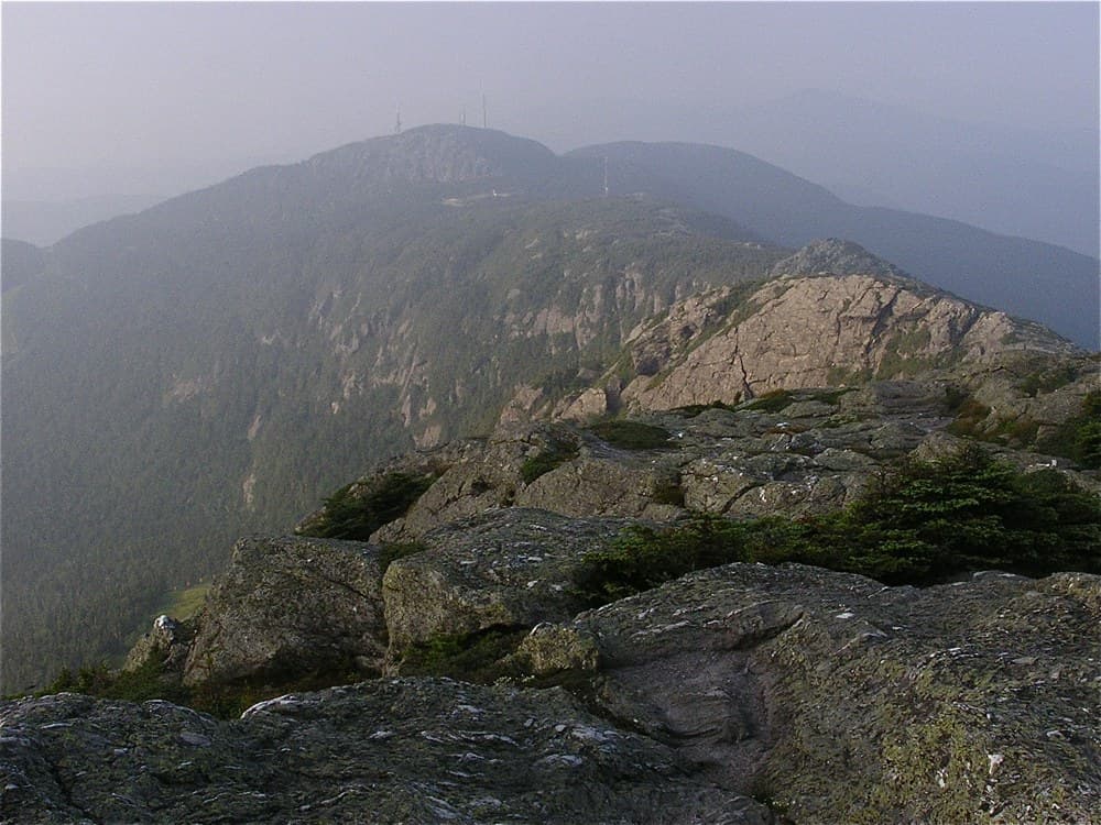
The Chin on Mount Mansfield, at 4,395 feet, Vermont's highest point. The Long Trail runs along Mansfield's summit ridge, the mountain's most famous stretch.
70 free overnight sites, GMC says, ranging from open tenting areas to three-sided lean-tos to enclosed lodges with bunks, spaced roughly a day's hike apart.
No active conditions reported
Sign in to report trail conditions.
No questions yet
Be the first to ask about Long Trail.
Build your full itinerary start to finish
Add your dates and get a day-by-day plan: what needs a permit, what gear to bring, and one link to share with your whole group to coordinate every step.
No permit needed to start
Google lets you pick the sites it highlights for you. Add PermitSnag and our permit pages get marked as one of yours in AI Overviews and AI Mode.
Takes less than a minute.