Trailhead information
Bass River State Forest
Primary- No restrooms
- No water
Wharton State Forest (NJ) · New Jersey
The Batona Trail runs 53.5 miles through the New Jersey Pine Barrens across Bass River, Wharton, and Brendan T. Byrne State Forests. All four trail campgrounds book through NJ DEP's reservation system at Wharton State Forest; this page sells a cancellation alert on that booking.
Get an alert when a night opens on your Batona Trail dates.
70% of the openings our scanner caught on Batona Trail were gone within 5 minutes.
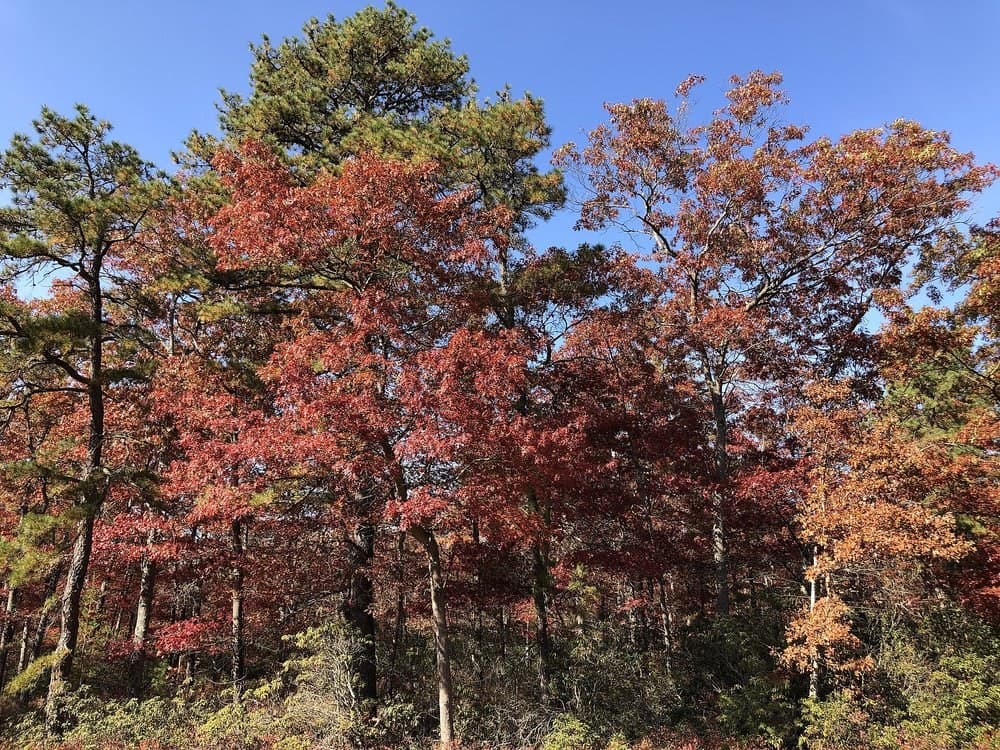
Bass River State Forest (southern trailhead)
The Batona Trail's southern end inside Bass River State Forest.
As of September 2026, Batona Trail in Wharton State Forest (NJ), New Jersey requires a permit issued via reservation. Batona Trail rates 5/10 on PermitSnag's demand index. Cancelled Batona Trail permits are re-released on the booking system, and PermitSnag alerts you the moment one opens. The Batona Trail route covers 53.5 miles, rated easy.
Sign up at New Jersey State Parks if you don't have an account. Have your payment info ready.
Permits release on a rolling basis. Check the release time for your dates.
Log in a few minutes early. Have your dates, group size, and payment ready to go.
If your dates are sold out, people cancel all the time. Set up PermitSnag alerts to catch openings instantly.
More on Batona Trail: Live availability activityWhen Batona Trail permits open upBatona Trail permit itinerary
Batona Trail permit fee: Nightly campsite fee through NJ DEP (confirm current rate at booking).
53.5 miles through the New Jersey Pine Barrens, from Bass River State Forest to Ong's Hat.
The Batona Trail crosses three New Jersey state forests, Bass River, Wharton, and Brendan T. Byrne, past four primitive campgrounds along the Pine Barrens' sandy trails and rivers. All four campgrounds book through Wharton State Forest's reservation system.
From Bass River State Forest, the trail crosses into Wharton State Forest past Batsto Village, Godfrey Bridge, Batona, and Lower Forge Campgrounds (mile 27.1), then continues through Brendan T. Byrne State Forest past Buttonwood Hill Campground to Ong's Hat at mile 52.7.
The trail runs flat and sandy through pine and oak forest, passing four primitive campgrounds and the historic ironworks village of Batsto along the way.
Best for: Experienced hikers with excellent fitness and relevant technical skills.
Recommended experience: Should have completed 10+ mile day hikes with significant elevation gain.
Trailhead information
Trailhead information
Trailhead (5,000 ft)
Backcountry Tips
Today
65°
57°
100%
Mon
63°
55°
54%
Tue
75°
57°
Wed
79°
59°
Thu
84°
61°
Fri
84°
64°
Sat
64°
51°
Emergency contacts, ranger station locations, and satellite communicator tips for Batona Trail.
Bear canister requirements, approved container lists, and rental locations for this permit.
Gear Checklist: Required and recommended gear for Batona Trail · Shuttle Services: Trailhead transportation options · Guide Services: Experienced wilderness guides
Some links may be affiliate links. Purchases support PermitSnag at no extra cost to you.
Day hiking needs nothing. Overnight camping needs a reservation at one of the primitive campgrounds inside the state forests the trail crosses.
53.5 miles, marked with half-mile posts from mile 0 to mile 52.7 at Ong's Hat.
Through Wharton State Forest's reservation system at njportal.com, or by calling the Batsto office directly.
Most backpackers take about 3 to 4 days.
Bass River State Forest, Wharton State Forest, and Brendan T. Byrne State Forest, all in New Jersey's Pine Barrens.
Godfrey Bridge, Batona, Lower Forge, and Buttonwood Hill campgrounds, all inside Wharton State Forest.
No active conditions reported
Sign in to report trail conditions.
No questions yet
Be the first to ask about Batona Trail.
Build your full itinerary start to finish
Add your dates and get a day-by-day plan: what needs a permit, what gear to bring, and one link to share with your whole group to coordinate every step.
No permit needed to start
Google lets you pick the sites it highlights for you. Add PermitSnag and our permit pages get marked as one of yours in AI Overviews and AI Mode.
Takes less than a minute.