Governor Dodge Backpack Campsites Permit
Governor Dodge State Park (WI) · Wisconsin
Six backpack sites reached on foot from the park trail system.
70% of the openings our scanner caught on Governor Dodge were gone within 5 minutes.
Plan the full trip, not just the permit
Build your full itinerary start to finish
Add your dates and get a day-by-day plan: what needs a permit, what gear to bring, and one link to share with your whole group to coordinate every step.
No permit needed to start
Governor Dodge Quick Facts
Governor Dodge Permit Facts
- As of September 2026, Governor Dodge in Governor Dodge State Park (WI), Wisconsin requires a permit issued via reservation.
- Governor Dodge is a high-demand permit, rating 7/10 on PermitSnag's demand index.
- The Governor Dodge route covers 0.5 miles.
- Cancelled Governor Dodge permits are re-released on the booking system; PermitSnag monitors availability and alerts watchers when dates open.
Key Information
Permit Details
What to Expect
Route Details
Highlights
- •DNR: "There are six backpack campsites near Hickory Ridge."
- •"All sites are about 0.5 miles from the parking lot. Water and pit toilets are near the parking lot." — so the water is at the car, not at the site.
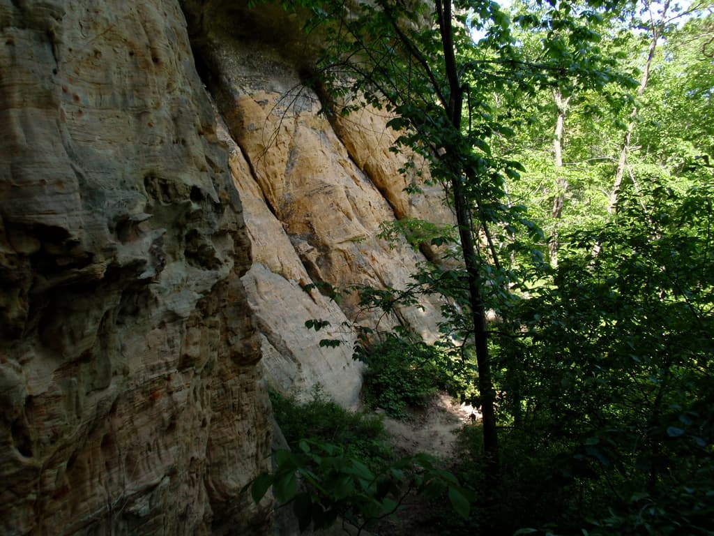
- •This is one of the state's largest parks: over 5,000 acres, two lakes, a waterfall and close to 40 miles of trail.
- •The park has over 300 campsites in total, which is why the six backpack sites are the ones that go.
- •A connector trail runs to the 40-mile Military Ridge State Trail, so the sites work as a bike-in as well as a walk-in.
Best Time to Visit
Open year-round, 6 a.m. to 11 p.m. Spring is what DNR writes about: "The spring wildflowers of the forests include bloodroot, hepatica and Dutchman's breeches," and the remnant prairies carry colour "from spring through fall." Trailhead water runs Memorial Day weekend to Oct. 1; outside that, fill jugs at the park office.
Hazards & Considerations
- !Steep, stepped trails. DNR on Stephens' Falls: "Stone steps and uneven terrain will be encountered to gain access to the falls and the trail below."
- !Water at the trailhead is seasonal — DNR runs showers and drinking water from Memorial Day weekend to Oct. 1, with jug filling at the park office outside that window.
How to Get This Permit
Create a Wisconsin DNR (GoingToCamp) account
Sign up at Wisconsin DNR (GoingToCamp) if you don't have an account. Have your payment info ready.
Know the release schedule
Permits typically release on a rolling basis. Check the specific release time for your desired dates.
Be ready when permits drop
Log in a few minutes early. Have your dates, group size, and payment ready to go.
Monitor for cancellations
If your dates are sold out, people cancel all the time. Set up PermitSnag alerts to catch openings instantly.
Difficulty Assessment
Fitness and endurance required
Climbing, scrambling, or specialized skills
Route finding and trail clarity
Difficulty of bailing out mid-route
Best For
Hikers of moderate fitness willing to put in the effort.
Recommended Experience
Basic hiking experience. Start with shorter trails if new to hiking.
About This Permit
Wisconsin DNR: "Governor Dodge State Park is one of the state's largest parks, with over 5,000 acres of steep hills, bluffs and deep valleys plus two lakes and a waterfall. Located in Wisconsin's scenic driftless area, Governor Dodge offers camping, picnicking, hiking, canoeing, biking, hunting, fishing, off-road biking, cross-country skiing and horseback riding opportunities." (dnr.wisconsin.gov/topic/parks/govdodge, read 2026-08-09.)
The Experience
Why It Matters
Governor Dodge is the driftless area at its most obvious — the corner of Wisconsin the last glacier never flattened, so it kept its bluffs and deep valleys while the rest of the state was scraped smooth. The backpack sites are the only way to sleep in that terrain here without a campground around you.
The Feeling
Half a mile is a short walk, which is the point: you can leave Madison after work and be at a site before dark. What you get for it is a park of over 5,000 acres, two lakes and Stephens' Falls, with the campground noise a ridge away.
Trailhead Information
Hickory Ridge backpack parking
The lot the six backpack sites are walked from — about half a mile each way.
Before you rely on this water
DNR puts water and pit toilets near the parking lot, not at the sites. The supply is seasonal: showers and drinking water run Memorial Day weekend to Oct. 1, and outside that jugs are filled from the spigot outside the park office.
Nearest Services
Dodgeville, about 3 miles south of the entrance.
Rules & Regulations
- •Reservations are required and can be made for the same day of arrival or up to 11 months in advance.
- •Backpack sites may be booked for a single night; family campsites carry a two-night minimum in season and three nights on holiday weekends.
- •Check-in is 3 p.m., checkout is 1 p.m.
- •No more than 14 days of camping in any 21 days.
- •A family site takes a parent or parents with dependent children plus up to two guests, or a group of no more than six people of any age.
- •The park is closed to non-campers between 11 p.m. and 6 a.m.
- •Firewood must be certified or come from within 10 miles; the park office sells it.
- •Fires in fire rings and grills only.
- •Pets on a physical leash no longer than 8 feet.
- •Wildflower picking is prohibited.
- •A vehicle admission sticker is required, and a state trail pass for anyone 16 or older biking or riding.
Gear Checklist
Required
- Water containers to carry from the trailhead tap to the site
- A pack for a half-mile walk-in — no cart is provided
- Rubbish bags; sites have no bins
Recommended
- A bike, if you are coming in on the Military Ridge State Trail
- Trekking poles for the Lost Canyon and Pine Cliff trails, which DNR describes as having several steep grades and rocky surfaces
Plan Your Trip
Gear Checklist
Required and recommended gear for Governor Dodge
Shuttle Services
Trailhead transportation options
Browse all shuttlesGuide Services
Experienced wilderness guides
Browse all guidesSome links may be affiliate links. Purchases support PermitSnag at no extra cost to you.
Key Landmarks
Stephens' Falls
A 0.5-mile trail past the falls, rock outcroppings and ferns; DNR notes stone steps and uneven terrain on the way down.
Lost Canyon Trail
A 3-mile loop from the Stephens' Falls area into the canyon the falls feed. DNR notes several steep grades.
Twin Valley Lake and Cox Hollow Lake
The park's two lakes. DNR: the 3.3-mile Mill Creek trail offers "spectacular views of both Cox Hollow and Twin Valley Lakes."
Military Ridge State Trail
40 miles, with a surfaced access trail into the park just east of County Highway Z.
Governor Dodge FAQ
How do I get a Governor Dodge permit?
Governor Dodge permits use a reservation system. PermitSnag sends lottery open, deadline, and results reminders; you can also enable cancellation alerts if spots open later.
When is the best time to visit Governor Dodge?
Check with the managing agency for current season dates. Weekdays generally have better availability than weekends.
How competitive is the Governor Dodge permit?
This permit has a demand score of 7/10, making it highly competitive. We recommend having backup dates and using PermitSnag's cancellation alerts.
What if I can't get a Governor Dodge permit?
Cancellations happen daily. Set up alerts with PermitSnag to get notified the moment a spot opens up. Pro and $19 single-permit alerts are checked about every minute, 24/7; free accounts are checked hourly.
👥Community
Trail Conditions
No active conditions reported
Sign in to report trail conditions.
Questions
No questions yet
Be the first to ask about Governor Dodge.
Trip Reports
Write ReportCan't Get a Governor Dodge Permit?
Consider these alternatives if your preferred dates aren't available.
Kettle Moraine South Backpack Sites
Similar ExperienceThree roofed shelters on the Ice Age Trail, an hour east.
Tradeoffs
A roof over the site and year-round booking, but you carry every drop of water and the walk can be up to ten miles.
Buckhorn South Backpack Sites
Easier AlternativeCart-in sites on a peninsula in the Castle Rock Flowage, with a shared cart for several of the clusters.
Tradeoffs
Easier to reach and water-adjacent, but road construction closes parts of the area through 2026 and DNR names bears.
Where to Stay
Nearby campgrounds to complete your Governor Dodge trip
A small favor
One tick helps us more than you’d think
Google lets you pick the sites it highlights for you. Add PermitSnag and our permit pages get marked as one of yours in AI Overviews and AI Mode.
Takes less than a minute.