Aravaipa Canyon Wilderness Permit
Aravaipa Canyon Wilderness · Arizona
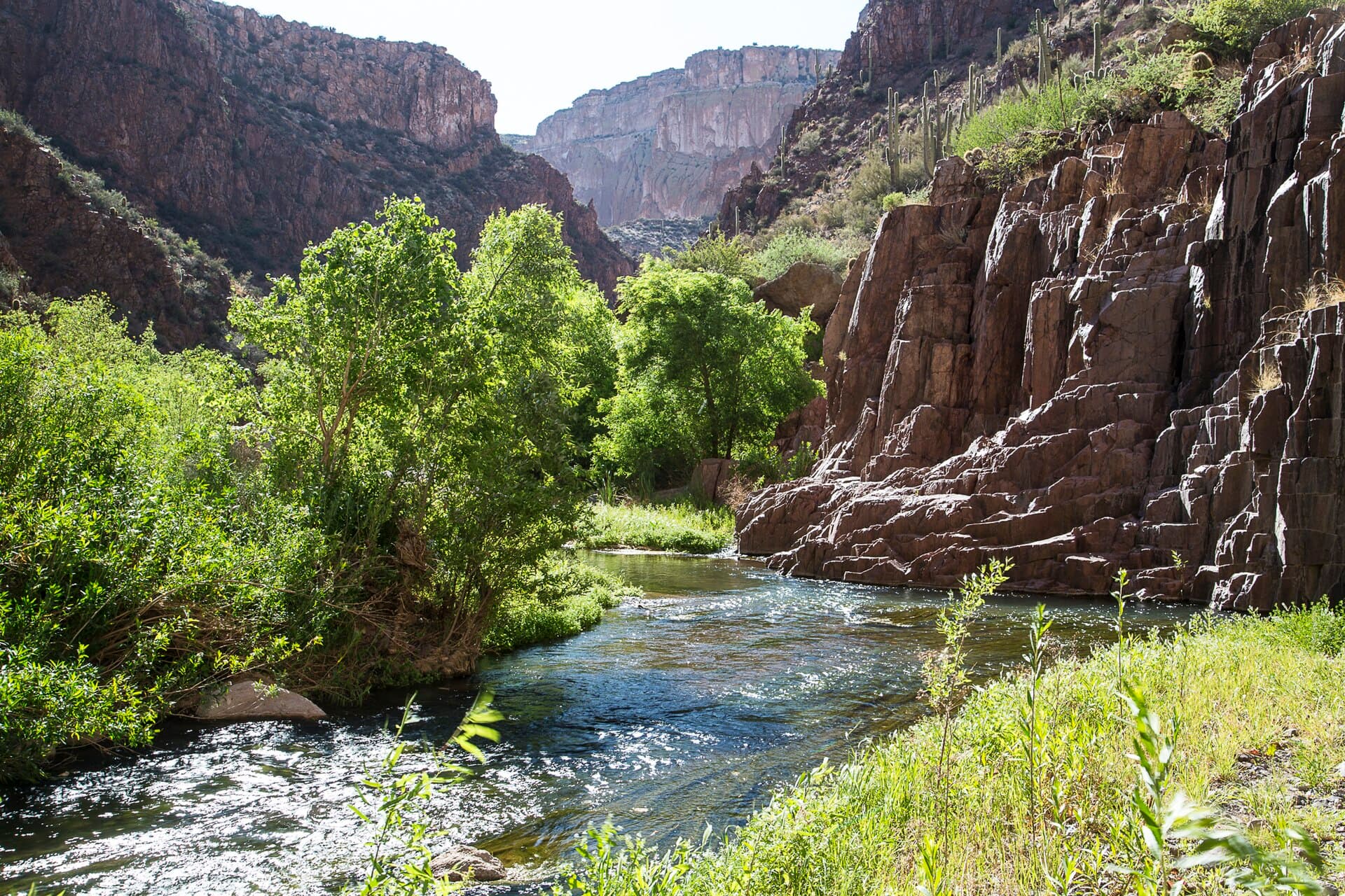
Entry permit for the permitted stretch of Aravaipa Canyon. You pick East or West trailhead and a date, then walk the creek — there are no trails, no signs and no designated campsites.
70% of the openings our scanner caught on Aravaipa Canyon were gone within 5 minutes.
Plan the full trip, not just the permit
Build your full itinerary start to finish
Add your dates and get a day-by-day plan: what needs a permit, what gear to bring, and one link to share with your whole group to coordinate every step.
No permit needed to start
Aravaipa Canyon Quick Facts
Aravaipa Canyon Permit Facts
- As of September 2026, Aravaipa Canyon in Aravaipa Canyon Wilderness, Arizona requires a permit issued via reservation.
- Aravaipa Canyon is one of the most competitive permits in the United States, rating 9/10 on PermitSnag's demand index.
- The permit season for Aravaipa Canyon runs January 1 through December 31.
- The Aravaipa Canyon route covers 12.25 miles with 430 feet of elevation gain, rated moderate.
- Cancelled Aravaipa Canyon permits are re-released on the booking system; PermitSnag monitors availability and alerts watchers when dates open.
Key Information
Key Dates
Permit Details
Pro Tips
- •Book the West Trailhead if you do not have high clearance. The East approach crosses the creek 46 miles in on dirt with no bridges.
- •You will be walking in the creek most of the way, with dozens of crossings up to knee deep. Plan on wet feet from the first mile.
- •Flash floods are the real hazard. Check the flow gauge before you go and camp high, well back from the creek.
- •Two cars per permit, and the permit number goes on each dashboard.
What to Expect
Route Details
Hazards & Considerations
- !Flash floods, which BLM describes as common in the canyon
- !Dozens of creek crossings in up to knee-deep water over slick cobble
- !No cell service — BLM recommends a personal locator beacon or satellite messenger
- !Five species of rattlesnake live in the canyon
Weather Forecast
Trailhead (2,630 ft)
Today
88°
69°
Thu
77°
64°
58%
Fri
87°
67°
26%
Sat
91°
73°
Sun
93°
74°
Mon
87°
69°
42%
Tue
85°
69°
27%
How to Get This Permit
Create a Recreation.gov account
Sign up at Recreation.gov if you don't have an account. Have your payment info ready.
Know the release schedule
Permits typically release on a rolling basis. Check the specific release time for your desired dates.
Be ready when permits drop
Log in a few minutes early. Have your dates, group size, and payment ready to go.
Monitor for cancellations
If your dates are sold out, people cancel all the time. Set up PermitSnag alerts to catch openings instantly.
Difficulty Assessment
Fitness and endurance required
Climbing, scrambling, or specialized skills
Route finding and trail clarity
Difficulty of bailing out mid-route
Best For
Intermediate hikers comfortable with long days and moderate challenges.
Recommended Experience
Experience with 6-10 mile hikes on varied terrain.
Rules & Regulations
- •Permit required year-round for all entry, including day hiking
- •Maximum group size 10 people, no combining permits
- •Maximum stay three days and two nights
- •No pets, and fishing is prohibited
- •Pack out human waste or bury it 6 to 8 inches deep, at least 200 feet from the creek
- •Groups must travel and camp at least a quarter mile apart
Plan Your Trip
Gear Checklist
Required and recommended gear for Aravaipa Canyon
Shuttle Services
Trailhead transportation options
Browse all shuttlesGuide Services
Experienced wilderness guides
Browse all guidesSome links may be affiliate links. Purchases support PermitSnag at no extra cost to you.
Key Landmarks
Landmarks (13)
Aravaipa Canyon FAQ
How many Aravaipa Canyon permits are available each day?
BLM caps the permitted part of the wilderness at 50 people per day, split 20 at the East Trailhead and 30 at the West Trailhead. Your permit is only valid for the trailhead you picked, though you can change trailheads later if space exists.
When does the Aravaipa Canyon permit window open?
Thirteen weeks, or 91 days, ahead of your entry date, at 10:00 a.m. Eastern. Arizona does not observe daylight saving, so that lands at 7:00 a.m. or 8:00 a.m. local depending on the season. Permits go live online and at the 1-877-444-6777 call center at the same moment.
How long can I stay on one Aravaipa Canyon permit?
Three days and two nights, maximum. BLM issues the permit by days rather than nights, so a day hike is a one-day permit and a two-night backpack is a three-day permit. You also need at least one day between reservations after using a full three-day permit.
Do I need a permit to day hike Aravaipa Canyon?
Yes. BLM requires a permit for all entry to the permitted portion of the wilderness, including day hiking, backpacking and hunting. There are no passes or discounts — the America the Beautiful series does not apply here.
👥Community
Trail Conditions(1)
Questions
No questions yet
Be the first to ask about Aravaipa Canyon.
Where to Stay
Nearby campgrounds to complete your Aravaipa Canyon trip
A small favor
One tick helps us more than you’d think
Google lets you pick the sites it highlights for you. Add PermitSnag and our permit pages get marked as one of yours in AI Overviews and AI Mode.
Takes less than a minute.