Walk-Up6/10
Sinkyone Railroad Camp permit
Hike-in environmental camp on the Lost Coast Trail. Pay on site, no reservations...
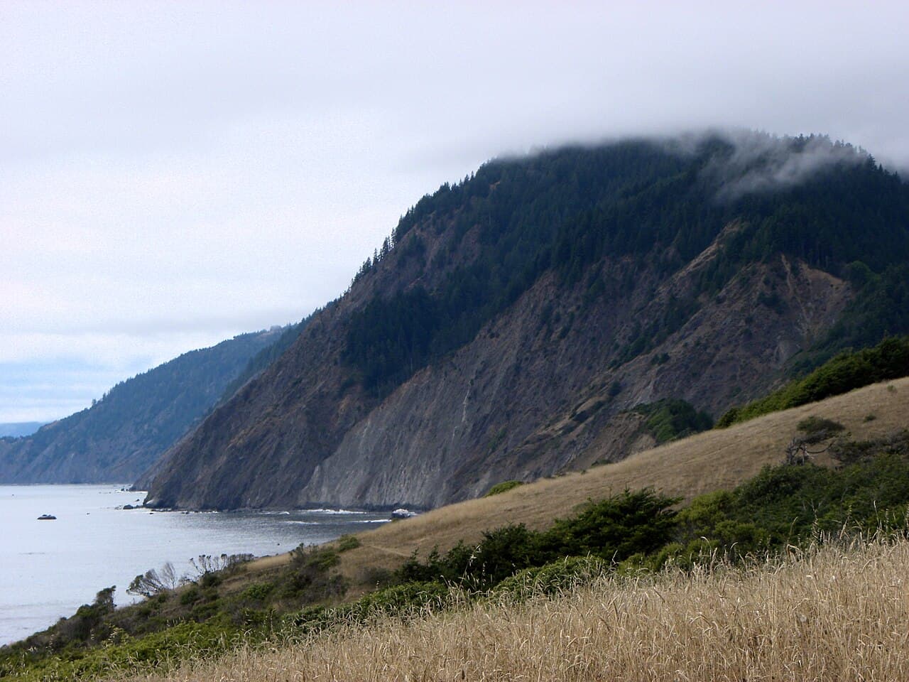
Sinkyone Wilderness State Park
Hike-in environmental camp on the Lost Coast Trail. Pay on site, no reservations.
“An environmental camp a short walk from the Needle Rock Visitor Center, at the quiet north end of Sinkyone Wilderness.”
Streamside is issued by the agency rather than through a booking calendar. Their page has the current process and any dates.
Official permit pagePlanning another trip? See the permits we watch.
Streamside is issued by the agency rather than through a booking calendar. Their page has the current process and any dates.
Official permit pagePlanning another trip? See the permits we watch.
Build your full itinerary start to finish
Add your dates and get a day-by-day plan: what needs a permit, what gear to bring, and one link to share with your whole group to coordinate every step.
No permit needed to start
You get this permit in person at the trailhead or ranger station, or by phone. There is no online reservation to race for, so availability alerts do not apply. We still track key dates and season info for your trip.
Official permit page →Summer and early autumn, when Briceland Road is open and dry. Winter closes the road entirely and the rainy season makes it impassable for passenger cars.
Trailhead (5,000 ft)
Backcountry Tips
Today
69°
54°
Mon
82°
59°
Tue
70°
55°
Wed
65°
53°
Thu
64°
53°
Fri
69°
56°
Sat
66°
55°
This permit is not sold online. Confirm where and when it is issued — and any fee — at California State Parks before your trip.
Walk-up permits are issued first-come, first-served, and quotas can fill early on weekends and holidays.
Popular trailheads may be full. Know alternative routes or dates in case your first choice is unavailable.
Fitness and endurance required
Climbing, scrambling, or specialized skills
Steep dropoffs and fall potential
Route finding and trail clarity
Difficulty of bailing out mid-route
First-time Sinkyone visitors who want the Lost Coast without committing to a long trail day — the camp is a short walk from the visitor center and its camp hosts.
Self-sufficiency. The walk is short; the remoteness is not negotiable.
Anyone in a low-clearance vehicle in wet weather, anyone needing drinking water or trash service, and anyone who cannot be hours from help.
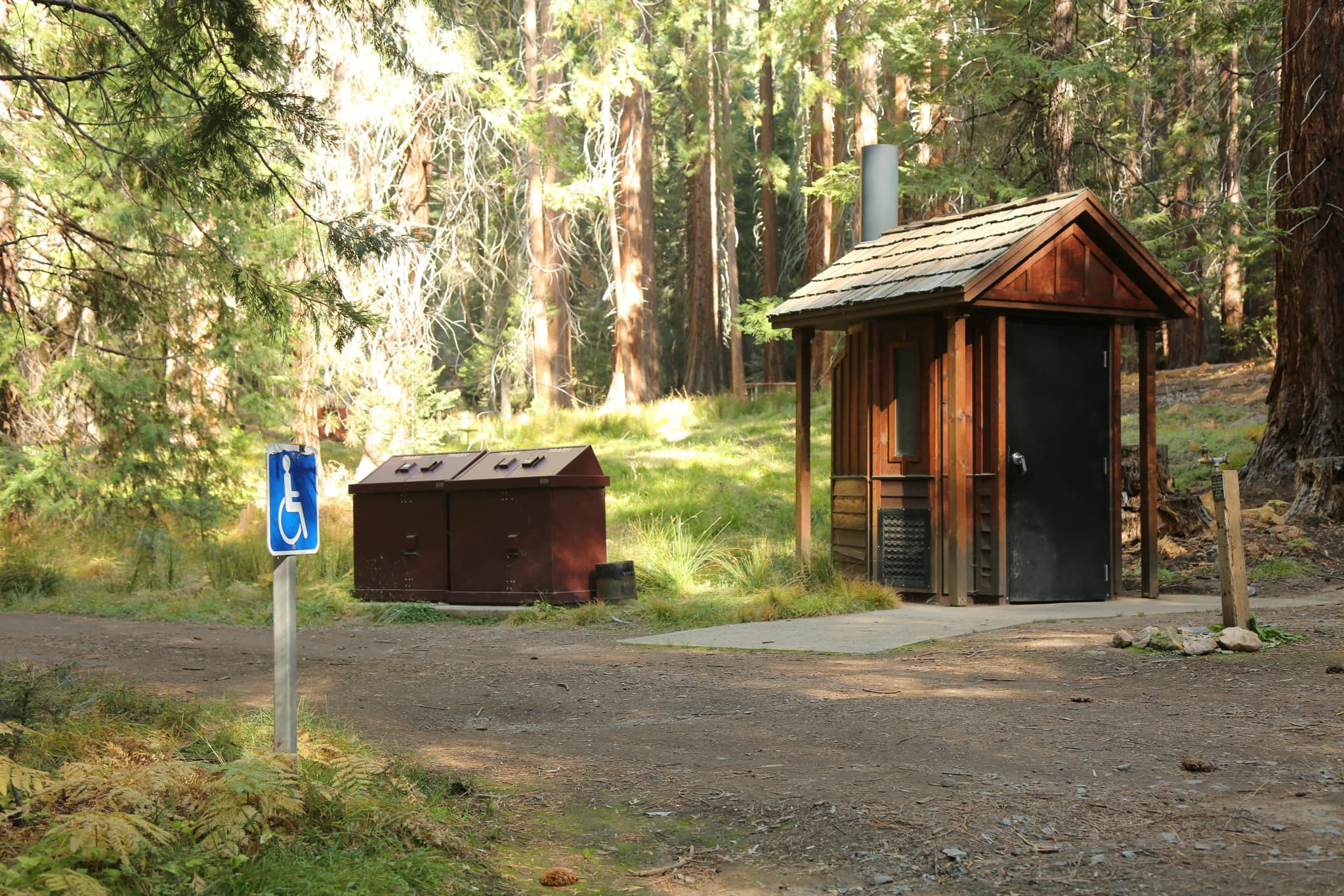
Streamside Camp is an environmental camp at the northern end of Sinkyone Wilderness State Park, grouped by the park's 2006 general plan with Jones Beach and Needle Rock as the camps easily accessible from the parking area at Needle Rock House. That document, the only agency source publishing per-camp counts, records three sites at Streamside.
The park offers eight environmental camps, two horse camps, and two primitive camps. Primitive camps offer drive-in access, while environmental camps do not. Environmental camps and horse camps cost $5 per person per night, payable at Jones Beach gate or Needle Rock, or by mail via check to the California Department of Parks and Recreation. There is no ReserveCalifornia booking for any Sinkyone camp.
The park's own framing is worth reading before you go: some aspects of the Sinkyone keep crowds away — its trails are steep and its campgrounds are primitive, there is no potable water, and you have to haul out your own trash. When wet, the park's twisting dirt roads are impassable for passenger cars.
Streamside is one of the three camps the park groups as easily accessible from the parking area at Needle Rock House, which makes it the gentlest introduction to Sinkyone — a park whose own literature warns that help may not arrive for hours.
Streamside Camp is one of Sinkyone's eight environmental camps, which do not offer drive-in access. The park's 2006 Preliminary General Plan places it with Jones Beach Camp and Needle Rock Camp as environmental camps easily accessible from the parking area at Needle Rock House, and records three sites here.
The Needle Rock Visitor Center is the hub of this end of the park. It was the home of the Calvin Cooper Stewart family that settled at Needle Rock, a small settlement established in the 1920s as a shipping point and dairy operation, and now serves as the visitor center with year-round camp hosts and interpretive materials. The barn several hundred yards away serves as a campsite with protective walls and a roof.
Environmental camps cost $5 per person per night, payable at Jones Beach gate or Needle Rock, or by mail.
The access, registration and fee point, a short walk from Streamside Camp.
Day-use parking $8 per vehicle per day for Needle Rock and Jones Beach. Camping fees $5 per person per night, payable at Jones Beach gate or Needle Rock, or by mail. Several parking places are available at the visitor center.
36 miles southwest of Garberville or Redway on Briceland Road, becoming Mendocino County Road 435; the last 3.5 miles are unpaved, steep and narrow. Closed in winter and impassable in wet weather.
Garberville or Redway, 36 miles away.
Required and recommended gear for Streamside
Trailhead transportation options
Browse all shuttlesExperienced wilderness guides
Browse all guidesSome links may be affiliate links. Purchases support PermitSnag at no extra cost to you.
The 1920s Stewart family home, now the visitor center with year-round camp hosts.
An environmental camp easily accessible from the Needle Rock House parking area.
A prominent sea stack with an ocean-carved arch visible from great distances.
A refurbished barn that shelters Lost Coast Trail thru-hikers, $30 per night for up to eight people.
Emergency contacts, ranger station locations, and satellite communicator tips for Streamside.
Bear canister requirements, approved container lists, and rental locations for this permit.
Streamside is not sold online. It is issued in person or by phone, so there is no reservation to book and no cancellation to catch. PermitSnag does not send alerts for it — check the official permit page for the current process.
Check with the managing agency for current season dates. Weekdays generally have better availability than weekends.
This permit has a demand score of 6/10, making it moderately competitive.
On this permit there is no cancellation queue and no alert to set, because nothing is re-released onto a calendar we could watch. Bring backup dates, and check the official permit page for the current process and any closures.
No active conditions reported
Sign in to report trail conditions.
No questions yet
Be the first to ask about Streamside.
Sunset from the bluffs near Needle Rock, with the arch to the north.
Morning, before the fog burns off the coastal prairie where the elk graze.
The whole park is quiet. Briceland Road's last 3.5 miles keep numbers down and the road closes entirely in winter.
Consider these alternatives if your preferred dates aren't available.
The other environmental camp easily accessible from the Needle Rock House parking area, above a beach the park says is not accessible by road.
A beach setting rather than a creek, and a fee-collection point. Slightly more walking.
An environmental camp 2.7 miles south of Needle Rock along Briceland Road, with about five parking places nearby.
Further into the park along a road open only in summer when conditions allow.
Twenty-one first-come walk-in sites in second-growth redwood above the Sonoma Coast.
Porta-potties and 21 first-come sites within a quarter mile of the parking lot. But it is a far tamer coastline, well to the south.
Nearby campgrounds to complete your Streamside trip
A small favor
Google lets you pick the sites it highlights for you. Add PermitSnag and our permit pages get marked as one of yours in AI Overviews and AI Mode.
Takes less than a minute.