Compare
Olympic Coast Trail permit
Both are reservation permits for a coastal walk, the Lost Coast in the King Range and the Olympic coast in Olympic National Park.
King Range National Conservation Area · California
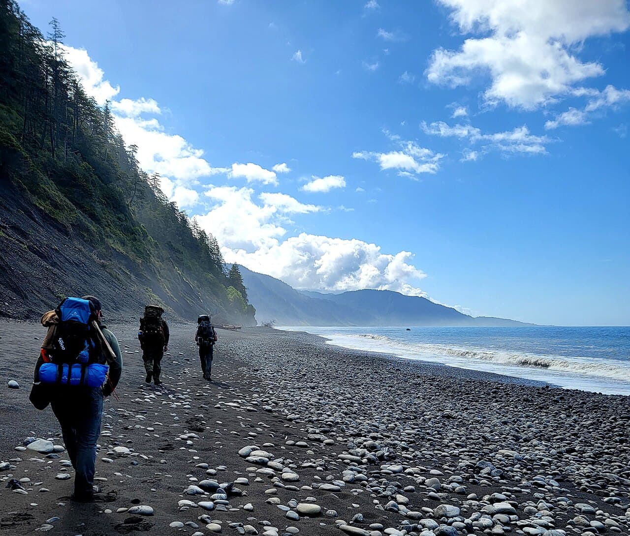
California's longest stretch of undeveloped coastline—a 25-mile beach traverse beneath the dramatic King Range where the mountains meet the sea.
70% of the openings our scanner caught on Lost Coast were gone within 10 minutes.
Build your full itinerary start to finish
Add your dates and get a day-by-day plan: what needs a permit, what gear to bring, and one link to share with your whole group to coordinate every step.
No permit needed to start
May through September offers the best weather, though fog is common year-round. Spring brings wildflowers and more dramatic seas. Fall has the most stable weather. Winter is possible but challenging due to storms and short days.
Trailhead (0 ft)
Today
65°
52°
Sun
66°
53°
Mon
76°
53°
Tue
85°
53°
Wed
80°
55°
Thu
80°
61°
Fri
76°
57°
Sign up at Recreation.gov if you don't have an account. Have your payment info ready.
Permits typically release on a rolling basis. Check the specific release time for your desired dates.
Log in a few minutes early. Have your dates, group size, and payment ready to go.
If your dates are sold out, people cancel all the time. Set up PermitSnag alerts to catch openings instantly.
Fitness and endurance required
Climbing, scrambling, or specialized skills
Steep dropoffs and fall potential
Route finding and trail clarity
Difficulty of bailing out mid-route
Experienced backpackers comfortable with route-finding, tide navigation, and remote wilderness travel.
Multi-day backpacking experience required. Ability to read and navigate by tide charts is essential.
Hikers unfamiliar with tide charts, those uncomfortable with significant isolation, or anyone with weak ankles.
The Lost Coast Trail traverses 25 miles of California's most rugged and remote coastline within the King Range National Conservation Area. It is famous for its 'impassable zones'—sections that disappear under the ocean at high tide, requiring careful planning and tide chart navigation.
Unlike traditional mountain trails, most of the Lost Coast is walked on sand, cobblestones, and slippery boulders, making progress slower than typical hiking. Most parties take 3-4 days to complete the traverse.
The 'Lost Coast' earned its name because Highway 1 was forced inland here—the King Range rises so steeply from the ocean that building a coastal road proved impossible. This 60-mile stretch remains the longest undeveloped coastline in California, a rare place where black bears roam the beaches and elephant seals haul out on the sand.
From Mattole Beach, the trail follows grassy coastal bluffs before dropping to sand. The decommissioned Punta Gorda Lighthouse appears at mile 2.4—your first navigation checkpoint and a reminder of how treacherous this coast once was for ships.
Between Sea Lion Gulch and Randall Creek, the first major impassable zone demands respect. You'll watch the tide charts, time your crossing, and scramble over bowling-ball cobbles that exhaust your ankles. Spanish Flat offers respite—and rumors of buried treasure.
The middle section passes Miller Flat's hidden surf breaks and the longest impassable stretch (5 miles). Finally, Black Sands Beach appears—dark volcanic sand marking Shelter Cove and the end of California's wildest walk.
The Lost Coast strips hiking down to its essence: you, the sea, and 25 miles of wild coastline. The rhythm is dictated not by mileage but by tides—consulting your tide chart becomes as instinctive as checking the trail. There's something primordial about navigating by sea level, watching the Pacific pulse against rocks that could trap you if you time it wrong. The reward is a coastline unchanged since the Sinkyone people walked it centuries ago.
Northern terminus of the Lost Coast Trail at the mouth of the Mattole River.
Small parking area fills on weekends. No overnight parking for multi-day trips—arrange shuttle.
Remote location. 3 hours from Eureka via winding roads. Last gas in Petrolia.
Petrolia (20 miles) has a small store. Full services in Garberville (40 miles) or Eureka (70 miles).
Southern terminus with easier road access. Most hikers end here after hiking north to south.
Larger parking area with overnight options. Shuttle companies operate from here.
25 miles from US 101 via Shelter Cove Road. Paved but winding.
Shelter Cove has restaurants, a small store, and a motel.
Required and recommended gear for Lost Coast
Trailhead transportation options
Browse all shuttlesExperienced wilderness guides
Browse all guidesSome links may be affiliate links. Purchases support PermitSnag at no extra cost to you.
Lost Coast permits use a reservation system. PermitSnag sends lottery open, deadline, and results reminders; you can also enable cancellation alerts if spots open later.
Check with the managing agency for current season dates. Weekdays generally have better availability than weekends.
This permit has a demand score of 8/10, making it highly competitive. We recommend having backup dates and using PermitSnag's cancellation alerts.
Cancellations happen daily. Set up alerts with PermitSnag to get notified the moment a spot opens up. Pro and $19 single-permit alerts are checked about every minute, 24/7; free accounts are checked hourly.
No active conditions reported
Sign in to report trail conditions.
Sunset from the beach anywhere along the route offers dramatic light against the King Range peaks. Punta Gorda Lighthouse at golden hour is iconic.
Early morning fog creates moody, ethereal conditions. Clear days offer better mountain-and-sea compositions.
Weekdays in spring and fall have the fewest hikers. The trail is relatively uncrowded even in peak season due to permit limits.
Consider these alternatives if your preferred dates aren't available.
The southern 35 miles from Shelter Cove to Usal Beach through Sinkyone Wilderness is less crowded and has no tide restrictions.
More road-accessible but rougher trail conditions. Less dramatic coastline but more solitude.
Day hikes from Black Sands Beach or Mattole Beach let you experience the Lost Coast without the full commitment.
No overnight permit needed for day use. Misses the full experience but allows a taste of the coastline.
Nearby campgrounds to complete your Lost Coast trip
A small favor
Google lets you pick the sites it highlights for you. Add PermitSnag and our permit pages get marked as one of yours in AI Overviews and AI Mode.
Takes less than a minute.