Lost Coast Trail Overnight Permit: Late-Summer Beach Traverse Notes
Aug 15-18, 20263 min read
P
PermitSnag Team
83 reports
4.0
Difficulty
3
Scenery
5
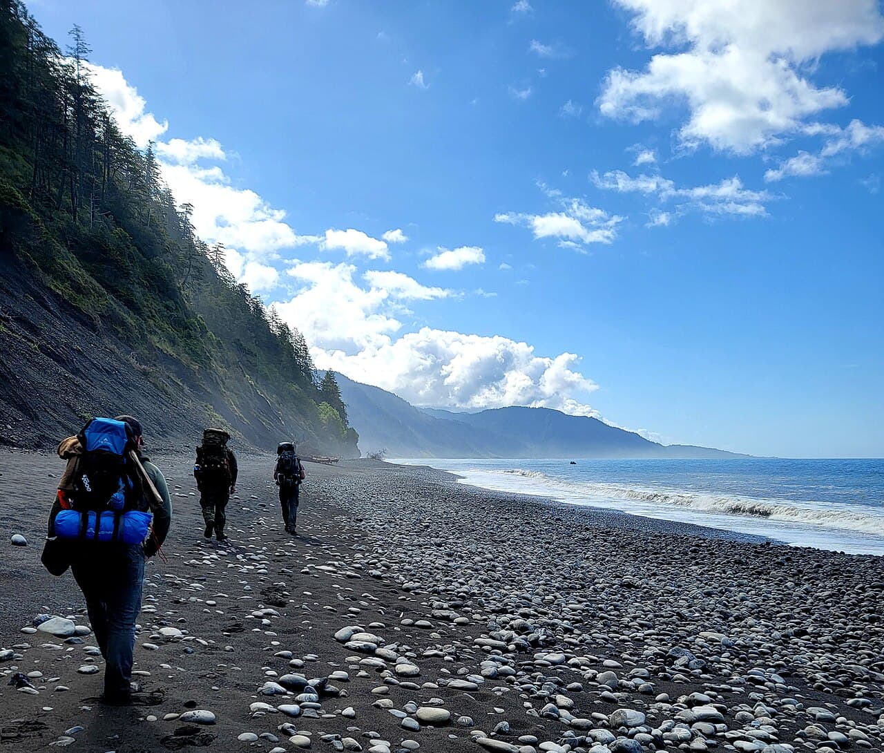
The Lost Coast Trail is 25 miles of undeveloped beach and headland walking under the King Range, and it's the one stretch of California coast where no highway ever got built. That's the draw and the catch—there's no bail-out road, no cell service to speak of, and the trail itself is a mix of sand, cobble, and rock that never lets you settle into a normal hiking pace.
This is a zone permit through BLM, booked as a reservation on recreation.gov (permit #445864), covering the whole corridor rather than individual campsites. That means you get flexibility on where you camp night to night, but you still need the permit in hand before you start, typically picked up or printed ahead of your entry date. Check the current listing for exact cost and any quota numbers before you book—those details shift and aren't worth guessing at.
Mid-August is peak season here. Days are warm on the beach (60s to mid-70s), mornings usually start under a marine layer that burns off by late morning, and afternoon wind on the exposed stretches can be steady. Expect company. This is one of the busiest windows of the year for the corridor, so don't count on solitude at the standard camp areas near Sea Lion Gulch or Big Flat—get moving early if you want first pick of a flat, sheltered spot.
The defining logistics issue on this trail isn't mileage, it's tides. Several sections are only passable at low tide, and getting caught on the wrong side of a headland when the water's up means either a long wait or a scramble you don't want to be doing with a full pack. Pull a current tide table for your exact dates before you go and build your daily mileage around the low-tide windows, not the other way around.
On water: there's no verified source list for this corridor in current trail data, so don't plan around specific creeks by name. The standard approach is to carry a filter and treat everything you pull from streams coming off the King Range, and to check current conditions with the BLM field office or recent trip reports before you commit to a water plan, since flow drops off through late summer.
Elevation-wise, this isn't a climbing trail—you're walking a coastline—but the corridor's overall track shows more total descent than gain across its length, and the short pitches up onto bluffs or around headlands add up in a way that surprises people expecting flat beach walking the whole way. Pack weight matters more here than on a typical inland trail because soft sand adds real effort to every mile.
Common mistakes: underestimating how much slower beach travel is than trail miles (plan on a materially slower pace than your normal per-mile time), not checking tides against your actual daily start times, and packing too much gear on the assumption it's a flat coastal stroll. It isn't. Also worth noting: fog and wind can roll in fast even on a clear morning, so don't leave rain shells behind just because the forecast looks dry.
A few practical notes for camp: pick sites above the high tide line and check the wrack line for how far storm surge has reached recently. Firewood is scarce to nonexistent on much of the beach, so a stove is standard, not optional.
— Compiled by the PermitSnag team from agency info, ranger updates, and public trip logs.
Conditions at Time of Trip
Aug 2026Weather
Foggy mornings clearing by midday, 60-75F on the beach, steady afternoon wind on exposed stretches
Trail
Soft sand and cobble beach walking, no shade, tide-dependent impassable sections
Water
No verified source list for this corridor—plan to filter from creeks and confirm current flow before
Crowds
Crowded
💡Tips from the Trip
💡
General
- •Get a current tide table for your exact dates before booking your itinerary—several stretches are impassable at high tide
- •Start beach-walking segments early in the tide window since soft sand and cobble slow your pace well below normal trail miles
- •Camp above the wrack line and check for recent storm surge marks before setting up
- •Book the zone permit on recreation.gov ahead of time and confirm current fee and any quota details on the listing itself
- •Carry a stove—firewood is scarce along most of the beach corridor
- •Pack layers even on a clear forecast, since fog and wind can shift conditions fast on exposed headlands
Was this helpful?