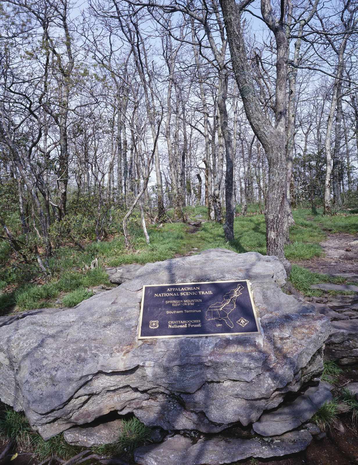
Walk 287.6 miles from Springer Mountain, Georgia to Big Creek in Great Smoky Mountains National Park, crossing three states, six wilderness areas, and the longest single trail inside the Smokies.
“Walk 287.6 miles from Springer Mountain, Georgia through six wilderness areas to Big Creek in Great Smoky Mountains National Park.”
Plan your Benton MacKaye Trail trip here, then get your permit from the agency.
Walk-up permit
How to get BMT Thru-Hike
No permit covers the whole Benton MacKaye Trail. It is free, self-register camping on national forest land for almost all of its 287.6 miles. The one gate is the ~13 miles inside Great Smoky Mountains National Park at the northern end, where the park's own backcountry permit applies, a scannable Recreation.gov permit with a cancellation alert.
More about Benton MacKaye TrailPlanning another trip? See the permits we alert on.
BMT Thru-Hike permit season
- route distance, point to point
- 287.6mi
BMT Thru-Hike elevation profile
Springer Mountain (Southern Terminus, shared with the Appalachian Trail) to Big Creek (Northern Terminus)Springer Mountain (Southern Terminus, shared with the Appalachian Trail)
The BMT and the AT share their southern terminus at Springer Mountain; the two trails interweave and cross four times in the first seven miles.
- Mile
- 0
- Elevation
- 3,782 ft
BMT Thru-Hike landmarks
BMT Thru-Hike campgrounds
How to get a BMT Thru-Hike permit
No permit needed.
- Free outside Great Smoky Mountains National Park (self-registration/no permit on national forest land); inside the park, the standard NPS backcountry permit applies: $6 non-refundable reservation fee plus $8 per person per night
As of September 2026, the managing agency does not require a permit for BMT Thru-Hike in Benton MacKaye Trail, Georgia. BMT Thru-Hike rates 4/10 on PermitSnag's demand index. The BMT Thru-Hike route covers 287.6 miles, rated strenuous.
- Permit required
- No
- Type
- Thru-Hike
- Location
- Southern Appalachian Mountains (Blue Ridge), GA
How this permit is issued
More on BMT Thru-Hike: Live availability activityBenton MacKaye Trail Thru-Hike permit itinerary
How much a BMT Thru-Hike permit costs
BMT Thru-Hike permit fee: Free outside Great Smoky Mountains National Park (self-registration/no permit on national forest land); inside the park, the standard NPS backcountry permit applies: $6 non-refundable reservation fee plus $8 per person per night.
The BMT Thru-Hike hike
- Distance
- 287.6 miles
- Route Type
- Point to Point
- Duration
- 3-5 weeks for a full thru-hike (BMTA Thru-Hikers' Guide; no single official figure published)
- Difficulty
- Strenuous
- High Point
- 5,842 ft
Walk 287.6 miles from Springer Mountain, Georgia through six wilderness areas to Big Creek in Great Smoky Mountains National Park.
About this permit
The Benton MacKaye Trail runs 287.6 miles from Springer Mountain, Georgia (sharing its start with the Appalachian Trail) to Big Creek in Great Smoky Mountains National Park, crossing three states and six wilderness areas. It is free to hike outside the park; inside it, the park's standard backcountry permit applies.
The route
From Springer Mountain, the trail heads northwest through Georgia's Cohutta Wilderness, crossing Big Frog Mountain near the Tennessee line. It follows the Hiwassee and Tellico rivers through Tennessee's Cherokee National Forest, then swings into North Carolina's Nantahala National Forest past Fontana Dam and Fontana Lake. The final miles enter Great Smoky Mountains National Park, climbing Mount Sterling before ending at Big Creek.
Why it matters
The trail is named for Benton MacKaye, and shares its southern terminus at Springer Mountain with the Appalachian Trail before splitting west into the quieter Cohutta Wilderness and Cherokee National Forest.
How hard the BMT Thru-Hike hike is
- Physical DemandFitness and endurance required5/5
- Technical SkillClimbing, scrambling, or specialized skills2/5
- NavigationRoute finding and trail clarity2/5
- CommitmentDifficulty of bailing out mid-route4/5
Best for: Experienced hikers with excellent fitness and relevant technical skills.
Recommended experience: Should have completed 10+ mile day hikes with significant elevation gain.
When to hike BMT Thru-Hike
Weather Forecast
Trailhead (5,000 ft)
Today
66°
51°
Mon
68°
52°
Tue
72°
49°
Wed
75°
53°
Thu
75°
54°
Fri
75°
57°
21%
Sat
73°
57°
52%
BMT Thru-Hike rules, gear and safety
Rules & regulations
- 01Great Smoky Mountains National Park requires its standard backcountry permit ($6 reservation fee + $8/person/night) for the trail's northern miles inside the park.
- 02Outside the park, camping on national forest land is free with no permit or registration.
Safety & planning
Emergency Info
Emergency contacts, ranger station locations, and satellite communicator tips for BMT Thru-Hike.
Food Storage
Bear canister requirements, approved container lists, and rental locations for this permit.
Gear Checklist: Required and recommended gear for BMT Thru-Hike · Shuttle Services: Trailhead transportation options · Guide Services: Experienced wilderness guides
Some links may be affiliate links. Purchases support PermitSnag at no extra cost to you.
BMT Thru-Hike FAQ
Do I need a permit to hike the Benton MacKaye Trail?
Only for the part inside Great Smoky Mountains National Park. Outside the park, on Chattahoochee-Oconee, Cherokee and Nantahala National Forest land (including the Cohutta Wilderness), no permit is required. Once you cross into the park near Fontana Dam, you need a Great Smoky Mountains backcountry permit, booked on Recreation.gov, for every night you camp inside the park boundary.
How long is a Benton MacKaye Trail thru-hike?
287.6 miles, from Springer Mountain, Georgia to Big Creek in Great Smoky Mountains National Park, per the Benton MacKaye Trail Association's current official mileage. Most thru-hikers take three to five weeks.
Does the Benton MacKaye Trail share a start with the Appalachian Trail?
Yes. Both trails start on Springer Mountain and cross each other four times in the first seven miles before splitting at Long Creek Falls. They meet again about 180 miles later near Fontana Dam and largely share the corridor through the Smokies to the BMT's Big Creek terminus near Davenport Gap.
Can I hike southbound (SOBO) on the Benton MacKaye Trail?
Yes, the trail is hiked in both directions, though the Benton MacKaye Trail Association's own mile markers and trip-planning tables are published northbound (NOBO) from Springer Mountain.
Do I need a bear canister for the Great Smoky Mountains backcountry permit?
No canister is required, but every backcountry permit holder must hang all food, cookware, toiletries and trash on the park's cable food-storage system at each campsite or shelter -- if you carry a canister anyway, you still have to hang it on the cable.
How far in advance do I need to book the Great Smoky Mountains backcountry permit for a Benton MacKaye Trail hike?
Recreation.gov opens each night of your itinerary exactly one month before that night's date. There is no lottery; it is a straightforward, site-specific reservation, so you build your GSMNP itinerary a campsite and shelter at a time as your dates come into that window.
Is there a group size limit in the Cohutta Wilderness on the Benton MacKaye Trail?
Only for large parties. The Forest Service requires a group permit for more than 75 people; anyone hiking as an individual or a normal-size group needs nothing at all.
What is the highest point on the Benton MacKaye Trail?
Mount Sterling, at 5,842 feet, inside Great Smoky Mountains National Park near the trail's northern end -- the Benton MacKaye Trail Association calls it the BMT's highpoint.
BMT Thru-Hike trail conditions and trip reports
Trail Conditions
No active conditions reported
Sign in to report trail conditions.
Questions
No questions yet
Be the first to ask about BMT Thru-Hike.
Trip Reports
Write ReportAlternatives to a BMT Thru-Hike permit
Where to stay near BMT Thru-Hike
- Frank Gross CampgroundChattahoochee-Oconee National Forest
- Deep Hole Recreation AreaChattahoochee-Oconee National Forest
- Sandy Bottoms Recreation Area Campground (Clayton, Ga)Chattahoochee-Oconee National Forest
- All Georgia campgrounds
Plan the full trip, not just the permit
Build your full itinerary start to finish
Add your dates and get a day-by-day plan: what needs a permit, what gear to bring, and one link to share with your whole group to coordinate every step.
No permit needed to start
One tick helps us more than you’d think
Google lets you pick the sites it highlights for you. Add PermitSnag and our permit pages get marked as one of yours in AI Overviews and AI Mode.
Takes less than a minute.