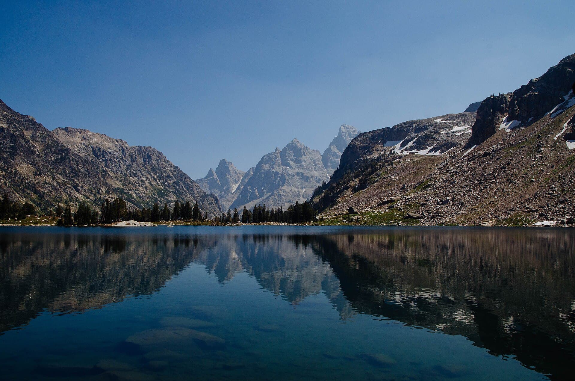
Teton Crest Trail Permit: Route
Teton Crest Trail permits are booked by advance reservation in Grand Teton National Park. The route covers 39 miles.
Traverse the spine of America's most dramatic mountain range, where jagged peaks pierce the sky and alpine meadows explode with wildflowers at every turn.
This guide covers the Teton Crest Trail permit.
4 nights on the NPS Granite Canyon to String Lake variant
Duration
39 miles
Distance
9,000'
Elevation Gain
strenuous
Difficulty
About Teton Crest Trail
The Teton Crest Trail is widely regarded as one of America's premier high-altitude backpacking routes, traversing the dramatic backbone of the Teton Range through Grand Teton National Park and the adjacent Jedediah Smith Wilderness. This 40-mile journey stays above 8,000 feet for nearly its entire length, crossing alpine passes, skirting pristine lakes, and offering constantly changing perspectives of the iconic peaks. The Grand Teton—at 13,775 feet the highest summit in the range—serves as a constant companion. Unlike many backcountry destinations, the TCT requires advance planning due to highly competitive permit reservations. However, the trail's passage through permit-free wilderness (Alaska Basin) offers options for those who couldn't secure park permits.
The Teton Crest Trail offers the most concentrated mountain grandeur in the lower 48 states. These peaks have inspired mountaineers and artists for generations, and the trail provides intimate access to their vertical splendor.
The Teton Crest Trail
- Distance
- 39 miles
- Route type
- point-to-point
- Elevation gain
- 9,000 ft
- High point
- 10,700 ft
- Low point
- 6,800 ft
- Trip length
- 4 nights on the NPS Granite Canyon to String Lake variant
- Difficulty
- strenuous
Entry points: Jackson Hole Aerial Tram, String Lake Trailhead
Northwest Wyoming. Nearest town: Jackson
Points along the route
- Jackson Hole Aerial Tram (Rendezvous Mountain)Mile 0, 10,450 ft
- Marion LakeMile 6.28, 9,254 ft
- Death Canyon ShelfMile 10.32, 9,449 ft
- Alaska BasinMile 14.34, 9,505 ft
- Hurricane PassMile 17.08, 10,367 ft
- Lake SolitudeMile 25.03, 9,038 ft
- Paintbrush DivideMile 27.34, 10,700 ft
- String Lake TrailheadMile 35.39, 6,878 ft
Teton Crest Trail permit detailsandAll Grand Teton National Park permits
The Experience
Each step brings the Grand Teton closer, its summit growing impossibly large against the Wyoming sky. At Death Canyon Shelf, you walk a narrow bench between vertical walls and a thousand-foot drop, fully immersed in the mountains. By sunset at Alaska Basin, you understand why people return year after year.
Starting from the Aerial Tram at Teton Village (or hiking up from Phillips Pass), you quickly enter high alpine terrain. Marion Lake offers the first taste of Teton grandeur before Death Canyon Shelf provides arguably the most dramatic trail miles in America. Alaska Basin—technically in the Jedediah Smith Wilderness and permit-free—serves as base camp for many. From here, Hurricane Pass leads to South Fork Cascade Canyon, then Paintbrush Divide (the trail's highest point at 10,700 feet), before the final descent to String Lake.
What to Expect
Sustained high-altitude hiking above 8,000 feet for 4-5 days
Dramatic exposed sections along Death Canyon Shelf
Multiple high passes above 10,000 feet
Abundant wildflowers in July and early August
Active grizzly bear habitat requiring bear canister
Potential for afternoon thunderstorms daily in summer
Get Teton Crest Trail Alerts
Be first to know when cancellations happen.
Permit Requirements
Backcountry camping permit required within Grand Teton National Park
IGBC-approved bear canister required, unless the campsite has a bear-proof metal box
Up to six people on an individual permit; groups of 7-12 must camp in designated group sites
Wood and charcoal fires only at Jackson, Leigh, Bearpaw and Trapper lakes, in the established metal rings. Fires are not allowed in any mountain camping area
Camp at designated sites only within park boundaries
Alaska Basin is Forest Service land, not a park camping zone — Caribou-Targhee National Forest rules apply there and NPS charges no nightly fee
No camping within 200 feet of water or the trail
Gear & Preparation
Required Gear
- •Bear canister (required in GTNP)
- •Water filter (streams may be far between)
- •Layered clothing for rapid weather changes
- •Rain gear and warm insulation
- •Map/GPS (trail well-marked but complex route)
Recommended Gear
- •Trekking poles for steep terrain
- •Gaiters for snow crossings
- •Sun protection (high UV at altitude)
- •Microspikes if hiking before August
- •Satellite communicator (limited cell service)
Hazards & Safety
Altitude sickness possible above 10,000 feet
Afternoon thunderstorms with lightning above treeline
Snow on passes can persist into late July
Grizzly bears are common throughout the area
Death Canyon Shelf has significant exposure
Limited water sources between alpine lakes
Cold nights (can drop below freezing even in summer)
Best Time to Visit
Mid-July through mid-September. Snow clears from high passes by late July most years. August offers the most reliable weather and trail conditions. September brings fall colors and fewer crowds but colder nights.
100+ wilderness permits, extensive backcountry experience
This guide is based on personal experience obtaining wilderness permits and is regularly updated to reflect current policies and strategies.
Frequently Asked Questions
How do I get a Teton Crest Trail permit?
+
Teton Crest Trail permits require advance reservations. Book online as soon as reservations open for your desired dates.
When is the best time to visit Teton Crest Trail?
+
Mid-July through mid-September. Snow clears from high passes by late July most years. August offers the most reliable weather and trail conditions. September brings fall colors and fewer crowds but colder nights.
How long is the Teton Crest Trail route?
+
The route is 39 miles, as a point-to-point.
How difficult is the Teton Crest Trail route?
+
Experienced backpackers comfortable with high altitude and variable mountain weather. Those who can handle 10+ mile days with significant elevation change.
Where does the Teton Crest Trail route start?
+
The permit covers 2 entry points: Jackson Hole Aerial Tram, String Lake Trailhead.
What gear do I need for the Teton Crest Trail route?
+
Essential gear includes: Bear canister (required in GTNP), Water filter (streams may be far between), Layered clothing for rapid weather changes, Rain gear and warm insulation, Map/GPS (trail well-marked but complex route).
Don't Miss Your Teton Crest Trail Permit
Cancellations happen every day. PermitSnag monitors Teton Crest Trail availability 24/7 and alerts you the moment a spot opens up.
Get Permit Alerts