The Subway Permit: Route and Dates
The Subway permits get cancelled and re-released through the season in Zion National Park, and they are drawn by lottery to begin with. The route covers 9.5 miles.
This guide covers the The Subway permit.
$6 application + $10/person
Permit Cost
6-10 hours
Duration
9.5 miles
Distance
2,000'
Elevation Gain
strenuous
Difficulty
About The Subway
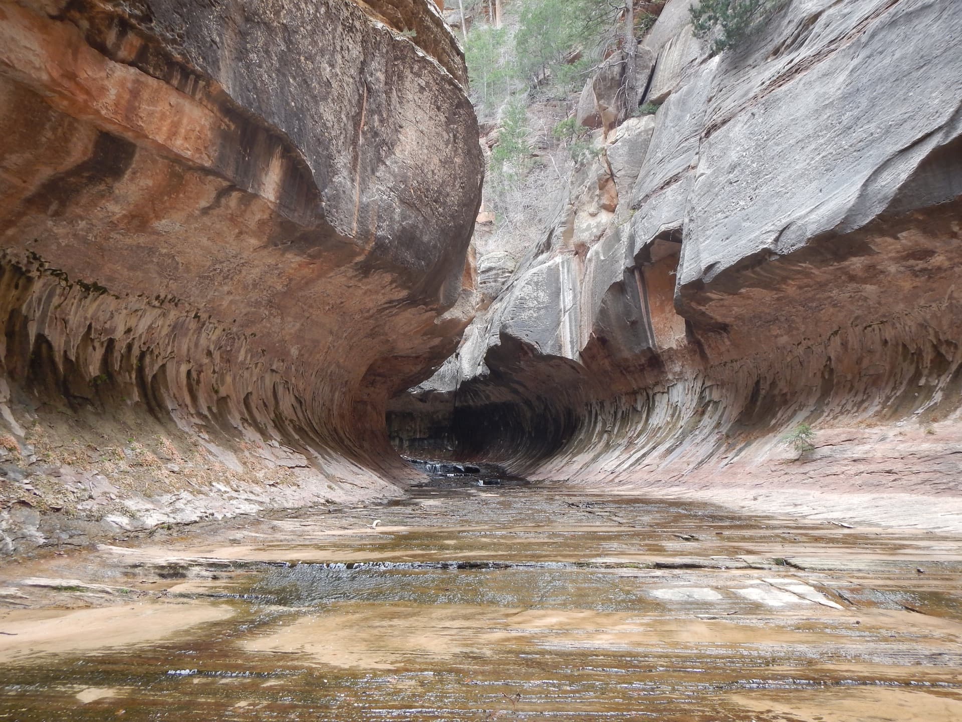
Technical canyoneering through a tube-shaped slot canyon—one of Zion's most spectacular and photogenic routes.
The The Subway route
- Distance
- 9.5 miles
- Route type
- point-to-point
- Elevation gain
- 2,000 ft
- High point
- 6,600 ft
- Low point
- 5,000 ft
- Trip length
- 6-10 hours
- Difficulty
- strenuous
Entry points: Wildcat Canyon Trailhead (Top-Down Start), Left Fork Trailhead (Bottom-Up Start / Top-Down Exit)
Colorado Plateau. Nearest town: Springdale
Points along the route
- Wildcat Canyon TrailheadMile 0, 6,973 ft
- Russell GulchMile 1.5, 6,200 ft
- Keyhole FallsMile 4, 5,400 ft
- The Subway FormationMile 5.5, 5,356 ft
- The North PoleMile 5.7, 5,386 ft
- Emerald PoolsMile 5.8, 5,000 ft
- The CascadesMile 6.5, 4,800 ft
- Left Fork TrailheadMile 9.5, 5,100 ft
Get The Subway Alerts
Be first to know when cancellations happen.
Pro Tips
One permit covers both the top-down canyoneering route and the bottom-up hike, so pick your direction after you win
Miss the quarterly lottery and you still have two shots: unclaimed reservations hit the calendar at 10am Mountain on the 15th of the following month, and the Canyoneering Daily Lottery runs two days out
Zion will not let you guide or be guided here, so bring your own rope skills
The permit is a reservation, not a permit — you still pick up the paper at the Zion Canyon Visitor Center wilderness desk the day before or the day of
100+ wilderness permits, extensive backcountry experience
This guide is based on personal experience obtaining wilderness permits and is regularly updated to reflect current policies and strategies.
Frequently Asked Questions
How do I get a The Subway permit?
+
Two ways. Cancelled The Subway permits return to the booking system through the season, and PermitSnag alerts you the moment one opens. The other way is the lottery, so apply during the application window as well.
When is the best time to visit The Subway?
+
Summer (June-September) offers the warmest water temperatures but also highest flash flood risk. Spring and fall are ideal with moderate temperatures. Winter is possible but requires full wetsuits.
How long is the The Subway route?
+
The route is 9.5 miles, as a point-to-point. Plan on 6-10 hours.
How difficult is the The Subway route?
+
Top-down: Experienced canyoneers with rappelling skills. Bottom-up: Strong hikers comfortable with river travel and scrambling.
Where does the The Subway route start?
+
The permit covers 2 entry points: Wildcat Canyon Trailhead (Top-Down Start), Left Fork Trailhead (Bottom-Up Start / Top-Down Exit).
What if I don't win the The Subway lottery?
+
Cancelled permits return to the booking system through the season. PermitSnag checks The Subway and alerts you when one opens, so a lost draw is not the end of the trip.
Don't Miss Your The Subway Permit
Cancellations happen every day. PermitSnag monitors The Subway availability 24/7 and alerts you the moment a spot opens up.
Get Permit Alerts