Walk-Up8/10
Wind Rivers Cirque of the Towers permit
Iconic granite amphitheater. On-trail access from Big Sandy....
Bridger-Teton National Forest / Wind River Range
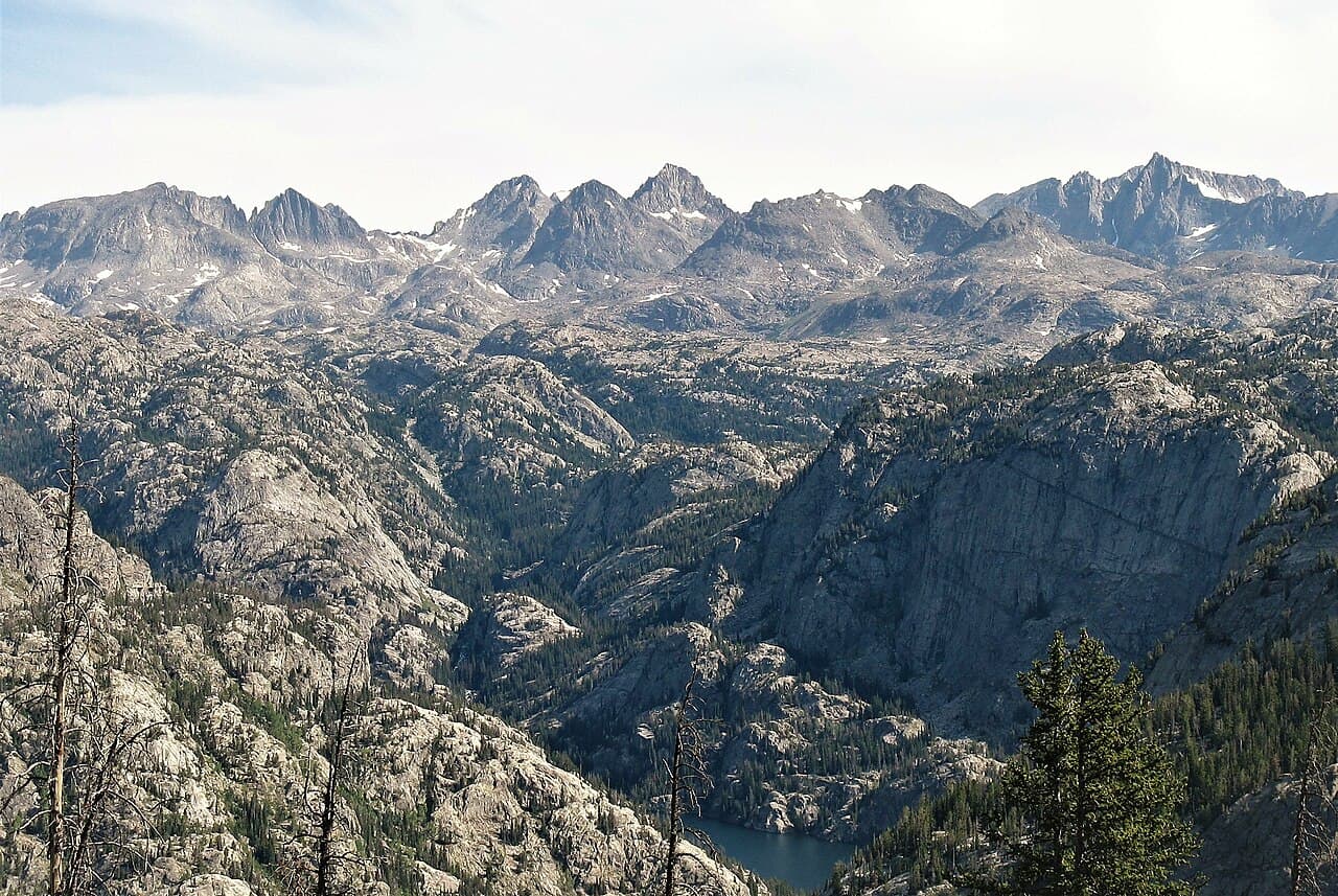
America's premier off-trail alpine traverse—80 miles of glacier crossings, 12,000-foot passes, and route-finding through the largest wilderness in the Lower 48.
“Navigate by map and compass through 80 miles of Wyoming's most spectacular alpine terrain—where trails end and true mountain travel begins.”
Wind River High Route is issued by the agency rather than through a booking calendar. Their page has the current process and any dates.
Official permit pagePlanning another trip? See the permits we watch.
Wind River High Route is issued by the agency rather than through a booking calendar. Their page has the current process and any dates.
Official permit pagePlanning another trip? See the permits we watch.
Build your full itinerary start to finish
Add your dates and get a day-by-day plan: what needs a permit, what gear to bring, and one link to share with your whole group to coordinate every step.
No permit needed to start
You get this permit in person at the trailhead or ranger station, or by phone. There is no online reservation to race for, so availability alerts do not apply. We still track key dates and season info for your trip.
Official permit page →Late July through early September. Before mid-July, passes may be snow-choked requiring technical mountaineering. After mid-September, winter storms begin. August offers the best balance of conditions and reduced mosquitoes.
Trailhead (8,000 ft)
Backcountry Tips
Today
64°
43°
Sun
65°
46°
Mon
55°
34°
36%
Tue
64°
38°
Wed
66°
45°
Thu
63°
46°
44%
Fri
66°
44°
38%
This permit is not sold online. Confirm where and when it is issued — and any fee — at U.S. Forest Service before your trip.
Walk-up permits are issued first-come, first-served, and quotas can fill early on weekends and holidays.
Popular trailheads may be full. Know alternative routes or dates in case your first choice is unavailable.
Fitness and endurance required
Climbing, scrambling, or specialized skills
Steep dropoffs and fall potential
Route finding and trail clarity
Difficulty of bailing out mid-route
Expert mountaineers with extensive off-trail experience and strong navigation skills.
Should have completed multiple off-trail alpine routes and be proficient with map/compass navigation, glacier travel, and Class 3 scrambling.
Anyone without significant off-trail alpine experience or comfort with glacier travel.
The Wind River High Route is an approximately 80-mile off-trail traverse through Wyoming's Wind River Range, following the Continental Divide between Green River Lakes and Big Sandy. The route is approximately 65% off-trail, requiring advanced navigation and mountaineering skills.
Most hikers complete the route in 6-8 days. The route was first documented by Alan Dixon ('Adventure Alan') and later expanded by Andrew Skurka. Multiple variations exist with distances ranging from 80-97 miles.
The Wind River High Route is America's answer to the Haute Route—an off-trail traverse through the largest wilderness in the contiguous United States. Unlike the CDT which passes through the range on maintained trails, the WRHR links alpine passes and glacial basins via a route that exists only on maps and in the minds of experienced mountaineers. It's perhaps the finest alpine traverse in the Lower 48.
From Green River Lakes, the route heads south along the Continental Divide, immediately leaving maintained trails. The first major challenge is Knapsack Col—a 12,200-foot pass that deposits you into the legendary Titcomb Basin, surrounded by Wyoming's highest peaks.
The middle section traverses the heart of the range: Indian Basin, the Bonneville Lakes, and the approach to the Cirque of the Towers via Texas Pass. Each day involves 3,000+ feet of off-trail elevation change, boulder-hopping across vast talus fields, and careful navigation with map and compass.
The Cirque of the Towers is the route's climax—a granite amphitheater that draws rock climbers from around the world. The final miles descend past Lonesome Lake (where camping is prohibited) and over Jackass Pass before the long exit to Big Sandy Trailhead.
There is no trail. You stand at the base of Knapsack Col, studying the talus field and the glacier beyond, choosing your line up 1,500 feet of boulder-strewn slope. Above, Titcomb Basin waits—a vast granite amphitheater where turquoise lakes reflect spires that rival the Tetons. For seven days, you navigate by pass and peak, by drainage and divide, linking basins that most hikers never see. By the time you descend to Big Sandy, you've completed something that feels less like hiking and more like mountaineering without ropes.
Northern terminus. Long dirt road access from Pinedale.
Primitive camping available. Fee required for some areas.
From Pinedale, take FR 111 approximately 55 miles. Gravel road, passable by most vehicles.
Pinedale (55 miles) has full services including gear shops.
Southern terminus. Most common exit point.
Popular trailhead for Cirque of the Towers. Can be crowded.
From Pinedale, approximately 45 miles on dirt roads. High clearance recommended for final miles.
Pinedale (45 miles) has full services. Shuttle services available.
Required and recommended gear for Wind River High Route
Trailhead transportation options
Browse all shuttlesExperienced wilderness guides
Browse all guidesSome links may be affiliate links. Purchases support PermitSnag at no extra cost to you.
Emergency contacts, ranger station locations, and satellite communicator tips for Wind River High Route.
Bear canister requirements, approved container lists, and rental locations for this permit.
Wind River High Route is not sold online. It is issued in person or by phone, so there is no reservation to book and no cancellation to catch. PermitSnag does not send alerts for it — check the official permit page for the current process.
Check with the managing agency for current season dates. Weekdays generally have better availability than weekends.
This permit has a demand score of 6/10, making it moderately competitive.
On this permit there is no cancellation queue and no alert to set, because nothing is re-released onto a calendar we could watch. Bring backup dates, and check the official permit page for the current process and any closures.
No active conditions reported
Sign in to report trail conditions.
No questions yet
Be the first to ask about Wind River High Route.
No trip reports yet
Be the first to share your experience at Wind River High Route.
Write the First ReportSunrise in Titcomb Basin with alpenglow on the surrounding spires is the route's signature shot. The Cirque of the Towers at golden hour is equally spectacular.
Early morning light illuminates the granite walls. Late afternoon storms create dramatic cloud compositions.
The WRHR itself sees few hikers due to difficulty. Titcomb Basin and the Cirque can be busy; weekdays and shoulder season offer more solitude.
Consider these alternatives if your preferred dates aren't available.
On-trail access to the route's most famous destination via Big Sandy Trailhead.
See the Cirque without the full off-trail commitment. Trail is established and navigation straightforward.
On-trail access to Titcomb Basin from Elkhart Park Trailhead.
Established trail to one of the route's highlights. No technical navigation required.
Follow the CDT through the Wind Rivers on maintained trails.
Trail-based but still spectacular scenery. Misses the truly remote basins.
Nearby campgrounds to complete your Wind River High Route trip
A small favor
Google lets you pick the sites it highlights for you. Add PermitSnag and our permit pages get marked as one of yours in AI Overviews and AI Mode.
Takes less than a minute.