Summit Climb
Permit required April 1 - October 31 to climb to the crater rim of Mount St. Hel...
View Mt. St. Helens Summit Permit permit details and availabilityWe watch this permit around the clock. When a cancellation posts, we send you an alert so you can book before the spot is gone. Pro and $12 single-permit alerts are checked about every minute. Free accounts are checked hourly.

Mount St. Helens National Volcanic Monument
Eight designated campsites on the ridgelines above Spirit Lake, one permit per site per night, released a month at a time.
“Eight tent pads on the ridges above Spirit Lake, one party each, in the blast zone of the eruption that flattened 230 square miles of forest.”
Booked one camp per night— we watch your whole trip window
Late July through September, once the snowdrifts are gone and both approach roads are open. May and June permits are sellable but the Forest Service does not guarantee the area is reachable on May 1.
Sign up at Recreation.gov if you don't have an account. Have your payment info ready.
Permits typically release on a rolling basis. Check the specific release time for your desired dates.
Log in a few minutes early. Have your dates, group size, and payment ready to go.
If your dates are sold out, people cancel all the time. Set up PermitSnag alerts to catch openings instantly.
Snowbound. The permit season opens May 1 but the Forest Service says access is not guaranteed and snowdrifts often remain until July.
Fitness and endurance required
Climbing, scrambling, or specialized skills
Steep dropoffs and fall potential
Route finding and trail clarity
Difficulty of bailing out mid-route
Experienced backpackers who want a designated site to themselves and are comfortable on narrow ridge trail.
Prior multi-day backpacking, water treatment, and enough judgement to turn around on an exposed traverse.
Anyone uncomfortable with heights — the Forest Service says so outright about Whittier Ridge — or a first backpacking trip.
All overnight camping in the Mount Margaret Backcountry requires a permit, and the permit is tied to a specific campsite on a specific night. There are eight designated sites — Panhandle, Ridge, Margaret, Obscurity, Snow, Bear, Dome and Shovel — and Recreation.gov issues one permit per site per night, except at Ridge Camp, which takes two. Group size is four people, or eight at Ridge Camp.
Permits are released one month at a time on the first day of the preceding month at 7:00 a.m. Pacific: May permits on April 1, June permits on May 1, and so on through the November 1-30 release on October 1. The season runs May 1 through November 30, but the Forest Service is blunt that the area is often snowbound until late spring or early summer and that snowdrifts often remain until July.
Because each site is one party, a single cancellation is the whole opening. Print the permit within 14 days of entry — it must be printed by 10 a.m. on the day you start or it is cancelled.
The Mount Margaret Backcountry sits in the northeast corner of the National Volcanic Monument Congress set aside in 1982 to let the 1980 eruption's aftermath run its course. Camping is capped at eight designated sites and one permit per site per night, which makes it one of the hardest small permits in Washington to land and one of the quietest places to sleep in the Cascades.
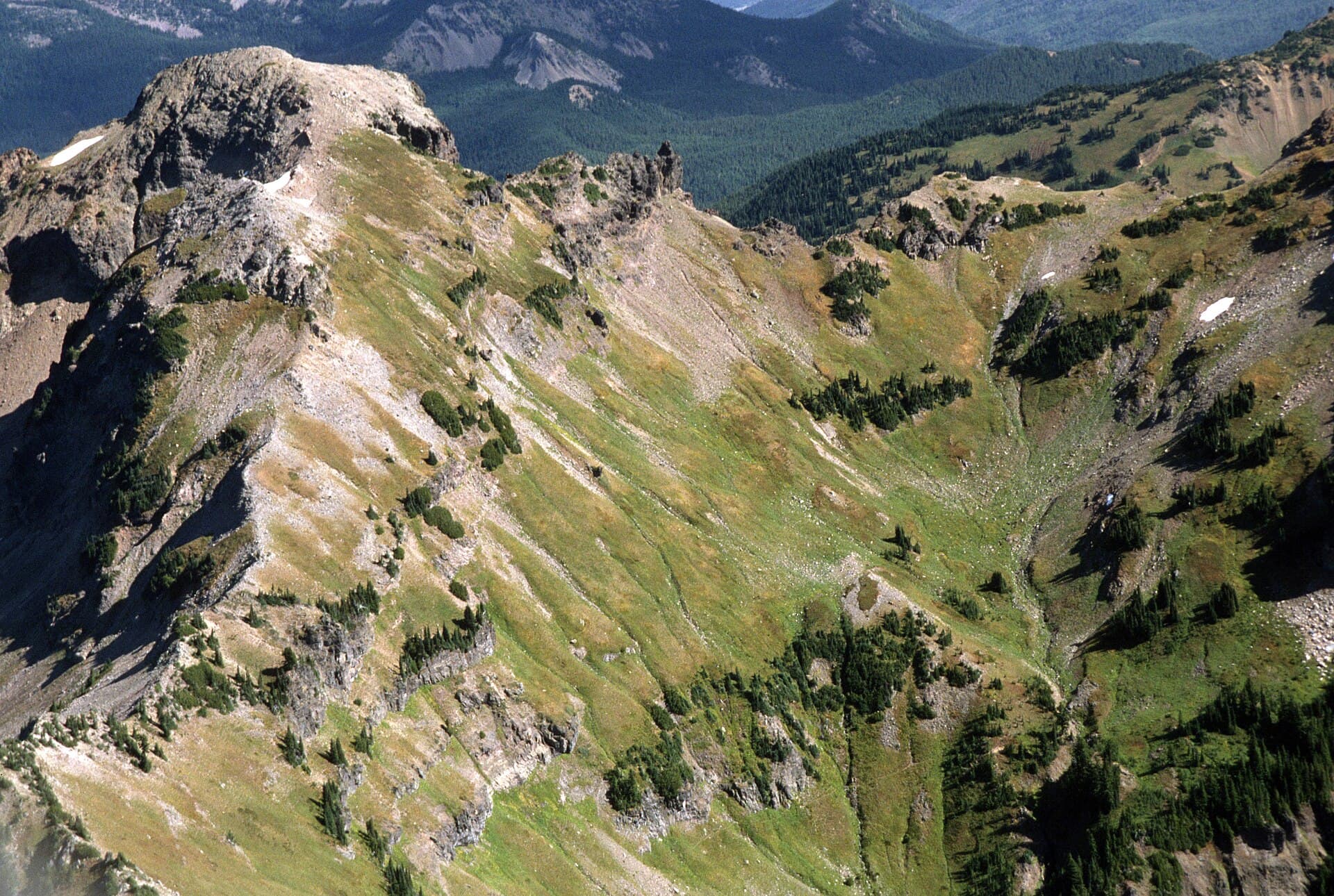
There are two ways in and they open at different times of year. The South Coldwater Trailhead off State Route 504 is the late-spring and summer approach; Norway Pass off Forest Road 26 is the late-summer approach and, per the Forest Service, Forest Road 99 and Forest Road 26 normally open from the end of June through November.
Once you are on the ridge system the trails are narrow and steep and can climb over 2,000 feet. The Forest Service singles out Whittier Ridge Route #214 as extremely challenging, very narrow, crossing steep cliffs, and unsuitable for inexperienced hikers or anyone uncomfortable with heights. Every other route into the camps avoids it.
The eight camps — Panhandle, Ridge, Margaret, Obscurity, Snow, Bear, Dome and Shovel — each have a raised tent pad and a composting toilet, and you must camp on the pad. Ridge Camp is the only one that takes two permits and eight people; everywhere else it is one party of four.
You climb through downed timber that has been lying in the same direction since May 1980, then break out onto open ridge where the whole story is laid out at once: the crater, the pumice plain, and Spirit Lake still carrying its raft of bleached logs. Mount Rainier stands to the north and Mount Adams to the east. There are no trees to hang food from and usually nobody else in sight.
Late-summer access to the Boundary Trail and the eastern camps.
No water at the trailhead. The Forest Service publishes per-camp water location maps and warns that water availability may change through the summer at Ridge Camp and the camps along the Boundary Trail. Treat everything you find.
A Northwest Forest Pass or Interagency Pass is required to park, or $5 per vehicle per day. Your overnight permit includes two parking passes.
Forest Road 99 and Forest Road 26 normally open from the end of June through November. Forest Road 25 has been closed as a through route by a slide, so check the Gifford Pinchot road status before you drive.
Randle, on Highway 12, for fuel and groceries.
Late spring and summer access from the State Route 504 side of the monument.
No water at the trailhead; carry what you need to the first camp and treat all backcountry sources.
Recreation pass required. The permit's two included parking passes cover either trailhead.
I-5 exit 49, then State Route 504 east for 42 miles into the monument. Upper 504 has been closed at milepost 45.2 by a slide in recent seasons — check current conditions.
Castle Rock, at the I-5 end of State Route 504.
Required and recommended gear for Mount Margaret
Trailhead transportation options
Browse all shuttlesExperienced wilderness guides
Browse all guidesSome links may be affiliate links. Purchases support PermitSnag at no extra cost to you.
Late spring and summer access from State Route 504 via the Coldwater Lake road.
Late-summer access off Forest Road 26. A recreation pass is required to park here, and your permit includes two.
Extremely challenging, very narrow, crosses steep cliffs. The Forest Service calls it unsuitable for inexperienced hikers or anyone uncomfortable with heights.
Designated site with a raised tent pad and composting toilet. One permit, four people.
The only camp that takes two permits a night and up to eight people. Water availability here changes through the summer.
Designated site with a raised tent pad and composting toilet, under Mount Margaret itself.
Designated site with a raised tent pad and composting toilet.
One month at a time, on the first day of the preceding month at 7:00 a.m. Pacific. May permits go out April 1, June permits May 1, and so on through the November 1-30 release on October 1.
Four, except at Ridge Camp, which allows two permits a night and up to eight people in total.
No. Camping is limited to the eight designated sites and you must use the provided tent pad. Dispersed camping without a permit is authorised north of the Green River only.
The Forest Service asks you to carry and use a bear-resistant food canister because most sites lack trees for hanging food.
The crater faces roughly southwest from the Mount Margaret ridges, so late light hits it square while the blast zone below goes gold.
Early morning for Spirit Lake, which sits in shadow until the sun clears the east ridge and then lights up the log raft.
Eight sites total means the backcountry is never crowded. The day-hiker traffic thins out within the first two miles of either trailhead.
Consider these alternatives if your preferred dates aren't available.
The 30-mile circumnavigation of the volcano itself, on the other side of the monument.
No reservation to win and no designated sites, but a much harder route and no camping in the Blast Zone.
The climbing permit for the south side of the volcano, a separate Recreation.gov product.
A day out rather than a night in, and its own quota to beat.
The Forest Service authorises dispersed camping without a permit north of the Green River only.
No quota and no fee, but you give up the ridge sites, the tent pads and the crater views.
Permit Directory
Find permits for day hikes, overnight backpacking, thru-hikes, canyoneering, and river trips across federal and state lands.
Day-use, overnight, and wilderness permits at America's crown jewels
Sierra Nevada, Lost Coast, and backcountry access
Red rock canyons, slot canyon permits, and desert wilderness
USFS wilderness areas with quota systems
Multi-day point-to-point traverses and epic long-distance trails
Multi-day rafting and river access permits
Backcountry camping and trail permits
High-altitude summit permits and technical climbing routes