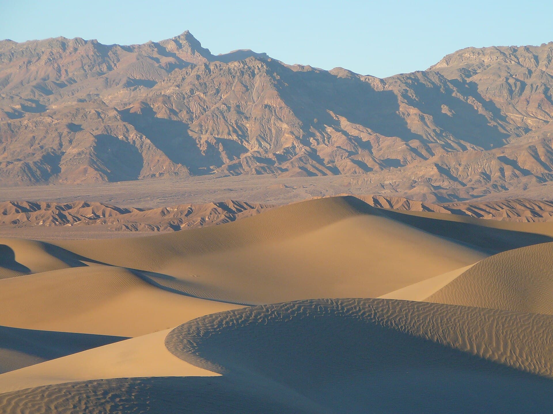
Death Valley Cottonwood-Marble Canyon Permit
Death Valley National Park · California
The only Death Valley backpacking route that needs a wilderness permit. Book the direction you plan to walk the loop, then camp where you like inside the two canyon zones.
70% of the openings our scanner caught on Cottonwood-Marble were gone within 5 minutes.
Plan the full trip, not just the permit
Build your full itinerary start to finish
Add your dates and get a day-by-day plan: what needs a permit, what gear to bring, and one link to share with your whole group to coordinate every step.
No permit needed to start
Cottonwood-Marble Quick Facts
Cottonwood-Marble Permit Facts
- As of September 2026, Cottonwood-Marble in Death Valley National Park, California requires a permit issued via reservation.
- The permit season for Cottonwood-Marble runs October 1 through April 30.
- The Cottonwood-Marble route covers 27 miles with 3,882 feet of elevation gain, rated strenuous.
- Cancelled Cottonwood-Marble permits are re-released on the booking system; PermitSnag monitors availability and alerts watchers when dates open.
Key Information
Key Dates
Permit Details
Pro Tips
- •Book six months out for a winter weekend. Permits release on a rolling six month window.
- •Cancel more than seven days ahead and the $4 use fee comes back. The $6 reservation fee never does.
- •Fill up at Cottonwood Springs even if you feel fine. Deadhorse is the first source to go dry.
- •Check road conditions before you drive. Cottonwood and Marble Canyon Roads close after storms.
What to Expect
Route Details
Highlights
- •26 to 28 miles of wash and canyon walking with 3,882 feet of gain
- •No trail signs and no maintained tread. You navigate by canyon
- •Springs that run in winter and disappear in summer
- •A vertical 8 foot dryfall in Deadhorse Canyon that must be downclimbed
- •Ten campsites along Cottonwood Canyon Road and four along Marble Canyon Road for the night before
Best Time to Visit
October through April. Recreation.gov flags May 1 through September 30 as SUMMER BACKPACKING NOT RECOMMENDED and October 1 through April 30 as peak season. Spring water is usually reliable between December and March.
Hazards & Considerations
- !Temperatures frequently range above 100F from May through September and the Park Service does not recommend summer backpacking here
- !Springs are seasonal. Deadhorse Canyon is known to dry up first
- !The 8 foot dryfall in Deadhorse Canyon is a real downclimb with a pack on
- !A chokestone blocks the passage between the middle and lower Marble narrows and has to be bypassed
- !Flash flooding in the narrows during monsoon storms
- !Little to no cell reception anywhere in the park, and rescue is not a certainty
How to Get This Permit
Create a Recreation.gov account
Sign up at Recreation.gov if you don't have an account. Have your payment info ready.
Know the release schedule
Permits typically release on a rolling basis. Check the specific release time for your desired dates.
Be ready when permits drop
Log in a few minutes early. Have your dates, group size, and payment ready to go.
Monitor for cancellations
If your dates are sold out, people cancel all the time. Set up PermitSnag alerts to catch openings instantly.
When to Go
Conditions
Warming fast. March is excellent and April is the last comfortable month before the heat sets in.
Crowd Level
ModerateAdvantages
- +Springs still running
- +Wildflowers on the bajada in good years
Challenges
- !Heat builds quickly after mid-April
- !Wind
Difficulty Assessment
Fitness and endurance required
Climbing, scrambling, or specialized skills
Steep dropoffs and fall potential
Route finding and trail clarity
Difficulty of bailing out mid-route
Best For
Desert backpackers comfortable navigating without a trail, carrying heavy water, and downclimbing a short dryfall.
Recommended Experience
Prior off-trail desert travel and route finding from a map. You should have carried a full day of water before.
Not Recommended For
Anyone without 4x4 access to the trailhead, first time backpackers, or anyone who has not desert hiked before.
About This Permit
Death Valley protects over 3,190,400 acres of designated wilderness, roughly 93% of the park, and you can camp in almost all of it without asking anyone. The Cottonwood-Marble Canyon loop is the exception. The National Park Service calls it the most popular backpacking route in the park and requires a wilderness permit year round for every overnight trip on it.
The loop runs 26 to 28 miles with 3,882 feet of gain and takes two to three nights. There are no signs and no maintained trail, so you are following wash bottoms and reading the canyon. Permits open six months ahead of your start date and same day permits stay available online until 11:59pm on the day you leave.
The Experience
Why It Matters
Death Valley protects over 3.1 million acres of designated wilderness, and almost none of it needs a permit. This loop does, because it is the route people actually walk. It is also the rare Death Valley trip with water, which is why it fills the shoulder seasons while the rest of the park's backcountry stays empty.
The Route
Most people park where Cottonwood Canyon Road meets Marble Canyon Road and walk the loop clockwise, up Cottonwood and down Marble. Cottonwood Canyon Road runs 8.5 miles of deep sand and rocky wash before the canyon narrows and the springs start showing up. Cottonwood Springs is the most reliable of the three seasonal sources and the usual first camp.
From the springs the route climbs over a divide and drops into Deadhorse Canyon, where a vertical 8 foot dryfall has to be downclimbed. Deadhorse is the first source to dry up, so nobody should plan on filling there.
Marble Canyon closes down into the narrows that give the route its reputation. An enormous chokestone blocks the passage between the middle and lower narrows, and getting past it means backtracking to an alternate trail rather than forcing it. Marble Canyon Road runs the last 1.8 miles back to the cars.
The Feeling
The first eight miles are sand and gravel road walking with the Cottonwood Mountains getting slowly larger. Then the canyon closes in, the walls go from tan to polished grey, and the sound of your own footsteps comes back at you off rock that has been dry for a thousand years. Cottonwood Springs arrives as an actual surprise: cottonwoods, running water, birds, in the middle of the driest place in North America.
Trailhead Information
Cottonwood-Marble Canyon Road junction
The standard start and finish. Park at the junction of Cottonwood Canyon Road and Marble Canyon Road.
Before you rely on this water
No water at the trailhead. The nearest tap is Stovepipe Wells, 10.5 miles of rough road away.
Parking
Informal parking at the road junction. Rec.gov limits a permit to four vehicles.
Getting There
From CA-190 enter Stovepipe Wells Campground and turn onto Cottonwood Marble Road at the airport sign. The first eight miles are deep sand, then 2.1 miles of gravel and small boulders. High clearance 4x4 required, and flat tires are common.
Nearest Services
Stovepipe Wells has fuel, a store and a ranger station. Furnace Creek Visitor Center is open 8am to 5pm daily.
Rules & Regulations
- •A wilderness permit is required year round for every overnight stay on the Cottonwood-Marble Canyon loop
- •One permit covers up to 12 people and four vehicles. Larger groups split up and camp, hike and eat at least half a mile apart
- •The entry and exit selections on Recreation.gov indicate the direction you walk the loop, not where you camp
- •Driving off designated roads is prohibited
- •Bury human waste at least six inches deep and 200 feet from water, and pack out toilet paper
- •Permit holders must carry a digital or printed copy for the whole trip
Gear Checklist
Required
- Capacity for at least a gallon of water per person per day
- Paper map and compass. There is no cell service on most park roads
- Sun protection that covers you, because there is no shade in the washes
- A vehicle with 4x4 and high clearance, plus a real spare
- Shoes you do not mind soaking at the springs
Recommended
- Satellite messenger, since rescue can be many hours away
- Gaiters for the deep sand approach
- Extra tire plug kit. Flats are a common consequence of the road
- Water filter for spring water
Plan Your Trip
Gear Checklist
Required and recommended gear for Cottonwood-Marble
Shuttle Services
Trailhead transportation options
Browse all shuttlesGuide Services
Experienced wilderness guides
Browse all guidesSome links may be affiliate links. Purchases support PermitSnag at no extra cost to you.
Key Landmarks
Landmarks (7)
Cottonwood-Marble FAQ
How do I get a Death Valley wilderness permit?
Reserve it on Recreation.gov permit 4675343. Permits open six months before your start date and same day permits stay online until 11:59pm on the day you leave. There are no in-person permits for this route, though staff at Furnace Creek Visitor Center and Stovepipe Wells Ranger Station will help you book one.
Is a Death Valley wilderness permit required for all backpacking?
No. The permit covers overnight trips on the Cottonwood-Marble Canyon loop only. The rest of the park's 3.1 million acres of wilderness does not require one.
Is the Cottonwood-Marble Canyon permit hard to get?
Recreation.gov states there are currently no quota limits for advance reservations in either the Cottonwood Canyon or Marble Canyon zones for non-commercial groups. The bottleneck is the road, not the permit.
Do I need a 4x4 for the Cottonwood-Marble Canyon permit trailhead?
Yes. Recreation.gov requires you to confirm your vehicle is high clearance with 4WD or AWD. The first eight miles of Cottonwood Marble Road are deep sand and the last stretch is gravel and small boulders.
How much does the Death Valley wilderness permit cost?
A $6 non-refundable reservation fee plus a $4 per permit recreation use fee. The park entrance fee is separate.
👥Community
Trail Conditions
No active conditions reported
Sign in to report trail conditions.
Questions
No questions yet
Be the first to ask about Cottonwood-Marble.
Trip Reports
Write ReportNo trip reports yet
Be the first to share your experience at Cottonwood-Marble.
Write the First ReportPhotography Guide
Golden Hour
Late afternoon light rakes down the Marble Canyon narrows and turns the polished walls copper for about twenty minutes.
Best Light
Canyon interiors photograph best in the reflected light around midday. The open bajada shots work at sunrise and sunset.
Beat the Crowds
Even in peak season this loop sees a handful of parties a week. Walking counterclockwise puts you against the flow and gets you the narrows alone.
Classic Shots
- 📍Marble Canyon upper narrows with a person for scale
- 📍Cottonwood Springs greenery framed by bare rock
- 📍The chokestone wedged between the narrows walls
- 📍Cottonwood Mountains from the alluvial fan at first light
Can't Get a Cottonwood-Marble Permit?
Consider these alternatives if your preferred dates aren't available.
Great Sand Dunes backcountry
Similar ExperienceAnother sand and mountain permit where you camp at large beyond a ridgeline rather than at a numbered site.
Tradeoffs
Much shorter approach and no 4x4 needed, but cold nights at 8,000 feet instead of desert warmth.
Guadalupe Mountains wilderness
Similar ExperienceDesert mountain backpacking in west Texas with designated campgrounds and no water at all.
Tradeoffs
You carry every drop, but the trails are real trails and the trailheads are paved.
Big Bend backcountry
Same AreaChihuahuan Desert backcountry camping with a similar carry-your-water profile.
Tradeoffs
Far from California, but the permit is easier to get and the season is the same.
Where to Stay
Nearby campgrounds to complete your Cottonwood-Marble trip
A small favor
One tick helps us more than you’d think
Google lets you pick the sites it highlights for you. Add PermitSnag and our permit pages get marked as one of yours in AI Overviews and AI Mode.
Takes less than a minute.