Reservation8/10
Olympic Wilderness permit
The single overnight permit for backpacking anywhere in Olympic National Park's ...
Olympic National Park · Washington
Coastal wilderness camping.
70% of the openings our scanner caught on Ozette Coast were gone within 10 minutes.
Build your full itinerary start to finish
Add your dates and get a day-by-day plan: what needs a permit, what gear to bring, and one link to share with your whole group to coordinate every step.
No permit needed to start
The park calls April through October the best season. July through September gives the driest boardwalk and the calmest surf, but it is also when the coastal water sources dry up, so plan to carry. Spring and autumn bring bigger swell, wetter planking and far fewer people. Permits are limited year round on this stretch of coast.
Trailhead (5,000 ft)
Backcountry Tips
Today
54°
42°
62%
Sun
55°
42°
50%
Mon
55°
34°
Tue
58°
37°
Wed
66°
42°
Thu
73°
46°
Fri
73°
50°
Sign up at National Park Service if you don't have an account. Have your payment info ready.
Permits typically release on a rolling basis. Check the specific release time for your desired dates.
Log in a few minutes early. Have your dates, group size, and payment ready to go.
If your dates are sold out, people cancel all the time. Set up PermitSnag alerts to catch openings instantly.
Wet boardwalk, big swell, and the water sources still running. The park's best-season window opens in April.
Fitness and endurance required
Climbing, scrambling, or specialized skills
Steep dropoffs and fall potential
Route finding and trail clarity
Difficulty of bailing out mid-route
First-time coastal backpackers and families who can read a tide table. Nine miles with 100 feet of elevation is genuinely easy walking.
None beyond basic backpacking, plus the willingness to read a tide chart and set your schedule from it.
Anyone who will not plan around the tide. The exposure rating here is entirely about being caught by a rising tide at a headland, and about the ladders and ropes you use to escape one - not about the terrain being hard.
The Ozette Triangle is a 9.2-mile loop: boardwalk from the Ozette Ranger Station out to Cape Alava, three miles of open beach south to Sand Point, and boardwalk back. The park rates it easy, gives elevation as sea level to 100 feet, lists no river crossings on the loop, and calls April through October the best season.
Camping needs an Olympic wilderness permit reserved on Recreation.gov - $6 per permit plus $8 per person per night for anyone 16 or over. The park lists the Ozette Coast from Yellow Banks to Point of the Arches as a quota area with permits limited year round, but publishes no per-night number for it; what Recreation.gov shows bookable is the practical limit. Summer-season reservations for May 15 through October 15 are released on April 15 at 7:00 am Pacific and nothing is held for same-day walk-ups.
Two rules matter more here than anywhere else in the park. The first is tides: the park publishes specific tidal restriction points along this coast - a 6-foot restriction 7.9 miles south of the Ozette Ranger Station trailhead, a 5-foot restriction at 4.9 miles, 5-foot and 4-foot restrictions 0.7 miles south of the Ozette River, and 4- to 6-foot restrictions between Point of the Arches and Seafield Creek - and states plainly that certain sections of the route are physically impassable during higher tides. Carry a tide chart; they are available at visitor centers and coastal ranger stations.
The second is food. Bear canisters are required along the entire Olympic wilderness coast, and here the animal that actually gets your food is the raccoon. The park's own wording: raccoons can easily get food bags hung in trees, so always store all food, garbage, and scented items in bear canisters on the coast. Canisters are free to borrow at Wilderness Information Centers.
One more thing worth knowing in August: the park warns that later into the summer the Wedding Rocks, Sand Point and South Sand Point water sources typically dry up, and that parties should carry in the water they will need while staying at those locations.
The Ozette Triangle is the easiest way into Olympic's wilderness coast, and the only one where the walking in and out is on boardwalk rather than headland scrambles. It is also on Makah and Ozette ancestral ground: the Wedding Rocks petroglyphs sit between the two camps, and the stretch between Cape Alava and the south side of the Ozette River is the Ozette Indian Reservation, where camping is prohibited outright.
The loop is 9.2 miles: boardwalk out to Cape Alava, three miles of beach south past Wedding Rocks to Sand Point, and boardwalk back to Ozette. Elevation runs from sea level to about 100 feet and the park rates it easy, with a best season of April through October and no river crossings on the loop itself.
The beach section is the part that needs planning. The park is direct about it: be prepared to hike over headland trails during high tides, some headlands cannot be rounded during the lowest of tides, and bring a map and a tide chart to plan your route. Headland trails are marked with red and black targets, and cable ladders or fixed ropes may be on site to assist climbing - leather gloves are worth carrying for the ropes. The safest time to round a headland is within one to two hours before low tide.
Three miles of cedar planking through bog and forest, and then the trees stop and there is the Pacific with Ozette Island offshore. Camp is on the sand above the tide line, driftwood everywhere, and the surf runs all night. In the morning the tide decides what time you leave.
Both legs of the Triangle start here. NPS says the three miles of boardwalk out to Cape Alava or Sand Point can be extremely slick, and that soft-soled shoes grip it better than stiff lug soles.
NPS asks visitors to check with the Washington State Department of Transportation before travelling, because SR 112 has been subject to frequent closure and detours from flooding and landslides.
Bear canisters are required for any overnight stay in Olympic's wilderness. NPS loans them at two places, the Port Angeles Wilderness Information Center and the Quinault Rain Forest Ranger Station, so pick one up before you drive out to Ozette.
Paddle access to the Lake Ozette boat-in camps. Recreation.gov puts Erickson's Bay about 4 miles out and warns of high winds, 1-2 foot waves and cold water on the lake.
NPS says the boat-in campsites on Lake Ozette are non-quota, so a permit for a lake site is not a reservation for that site. Sites stay first come, first served, and for anything other than Erickson's Bay the Wilderness Information Center books them by phone or email.
Required and recommended gear for Ozette Coast
Trailhead transportation options
Browse all shuttlesExperienced wilderness guides
Browse all guidesSome links may be affiliate links. Purchases support PermitSnag at no extra cost to you.
End of the Ozette Road, 21 miles off Highway 112 and paved. Check WSDOT before driving - SR 112 has been subject to frequent closure and detours from flooding and landslides.
The westernmost point in the contiguous United States and the north camp. Ozette Island sits offshore.
Between Cape Alava and Sand Point, with the petroglyphs. A camp area, but the park notes water and pit toilets are not available here.
The south camp, at the far end of the beach section. No campfires here or anywhere between the headland north of Yellow Banks and the headland at Wedding Rocks.
Part of the Ozette Indian Reservation and always closed to the public.
Yes, for any overnight. Olympic National Park wilderness permits are reserved on Recreation.gov at $6 per permit plus $8 per person per night for anyone 16 or over. The park lists the Ozette Coast from Yellow Banks to Point of the Arches as a quota area with permits limited year round. Day hiking the loop needs no permit.
9.2 miles, by the park's own trail page - roughly three miles of boardwalk out to Cape Alava, three miles of beach, and three miles of boardwalk back from Sand Point. Elevation runs from sea level to about 100 feet and the park rates it easy. The park does not publish separate distances to Cape Alava and Sand Point.
Yes. The park says to bring a map and a tide chart to plan your route, and states that certain sections of this route are physically impassable during higher tides. It publishes specific restriction heights - including a 5-foot restriction 4.9 miles south of the Ozette trailhead and a 6-foot restriction at 7.9 miles. Charts are available at visitor centers and coastal ranger stations.
Not reliably in late summer. The park warns that later into the summer the Wedding Rocks, Sand Point and South Sand Point water sources typically dry up, and that parties should carry in the water they need while staying there. Wedding Rocks has no pit toilets either. Treat whatever you find.
Yes. All food, garbage and scented items must be stored in a park-approved bear canister along the entire Olympic National Park wilderness coast. The park is explicit that this is partly about raccoons, which climb trees and can easily get food bags hung there. Canisters are free to borrow at Wilderness Information Centers.
Not at Sand Point. Open fires are prohibited between the headland north of Yellow Banks and the headland at Wedding Rocks, including the Sand Point area. Bring a stove.
No. Camping is prohibited on the Ozette Indian Reservation, which is the stretch between the Cape Alava and South Side of Ozette River campsites, and Cannonball Island is always closed to the public. Where you can camp on sand, the park requires you to camp above the high tide water line.
No active conditions reported
Sign in to report trail conditions.
No questions yet
Be the first to ask about Ozette Coast.
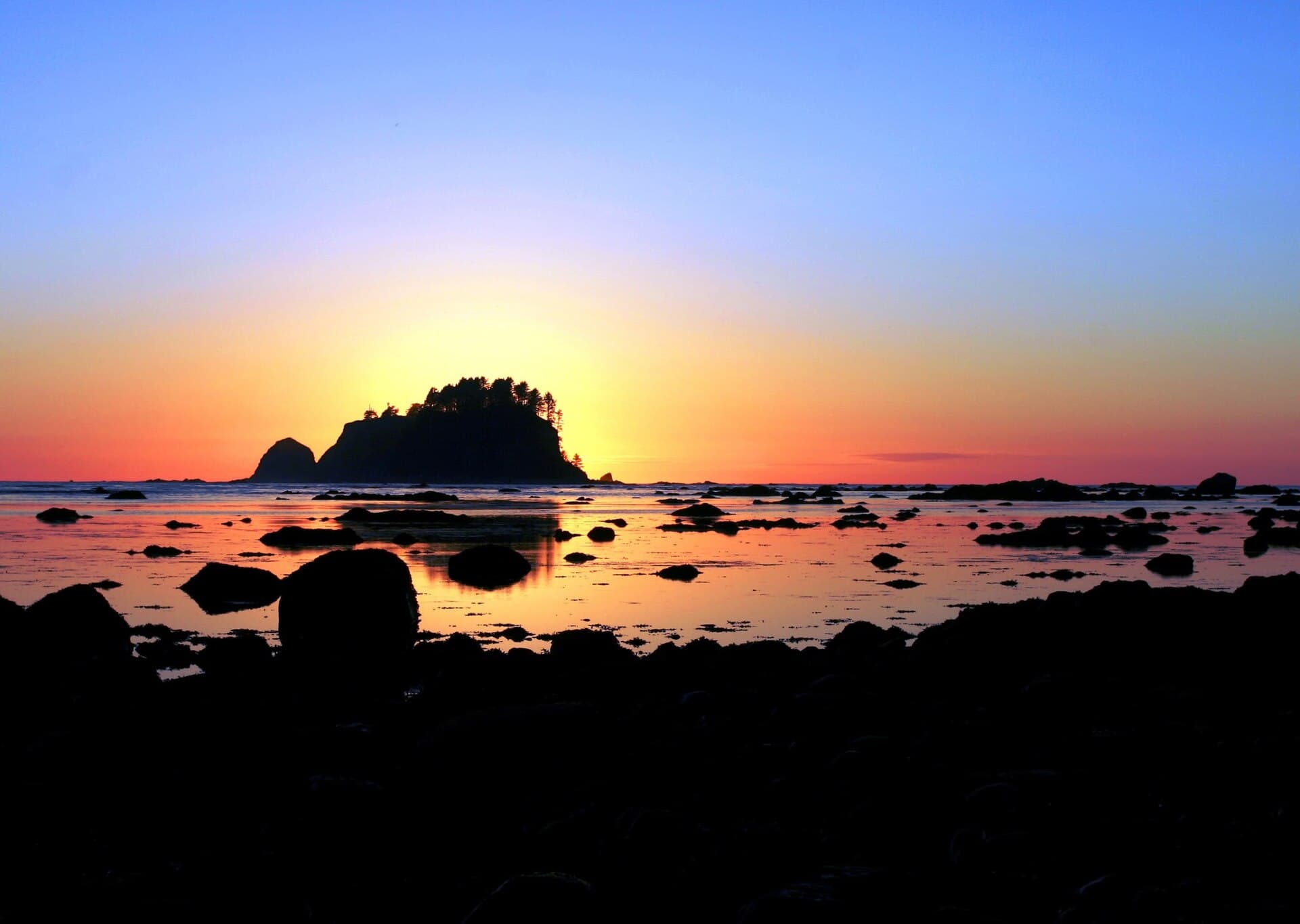
Sunset from Cape Alava with Ozette Island offshore - you are at the westernmost point in the contiguous US, so the sun goes down over open water.
Low afternoon sun raking across the Wedding Rocks petroglyphs brings out the carving that midday flattens out.
The boardwalk carries day-hikers to Cape Alava and back, and they are gone by late afternoon. Camp at Sand Point rather than Cape Alava if you want the quieter end.
Consider these alternatives if your preferred dates aren't available.
The longer wilderness coast routes, north and south, on the same permit system and the same tide rules.
Much more committing - more headlands, more rope ladders and more sections that cannot be rounded at any tide. The Ozette Triangle is the introduction to it.
13 miles up the East Fork Quinault to a waterfall-ringed meadow and the 1930s chalet.
Inland rainforest instead of coast, and no tide to plan around - but river fords instead, plus a washout a third of a mile before the chalet.
The park-wide overnight wilderness permit for Olympic's non-quota areas.
Easier to book, but the coast from Yellow Banks to Point of the Arches is limited year round and has to be booked as the quota area it is.
Nearby campgrounds to complete your Ozette Coast trip
A small favor
Google lets you pick the sites it highlights for you. Add PermitSnag and our permit pages get marked as one of yours in AI Overviews and AI Mode.
Takes less than a minute.