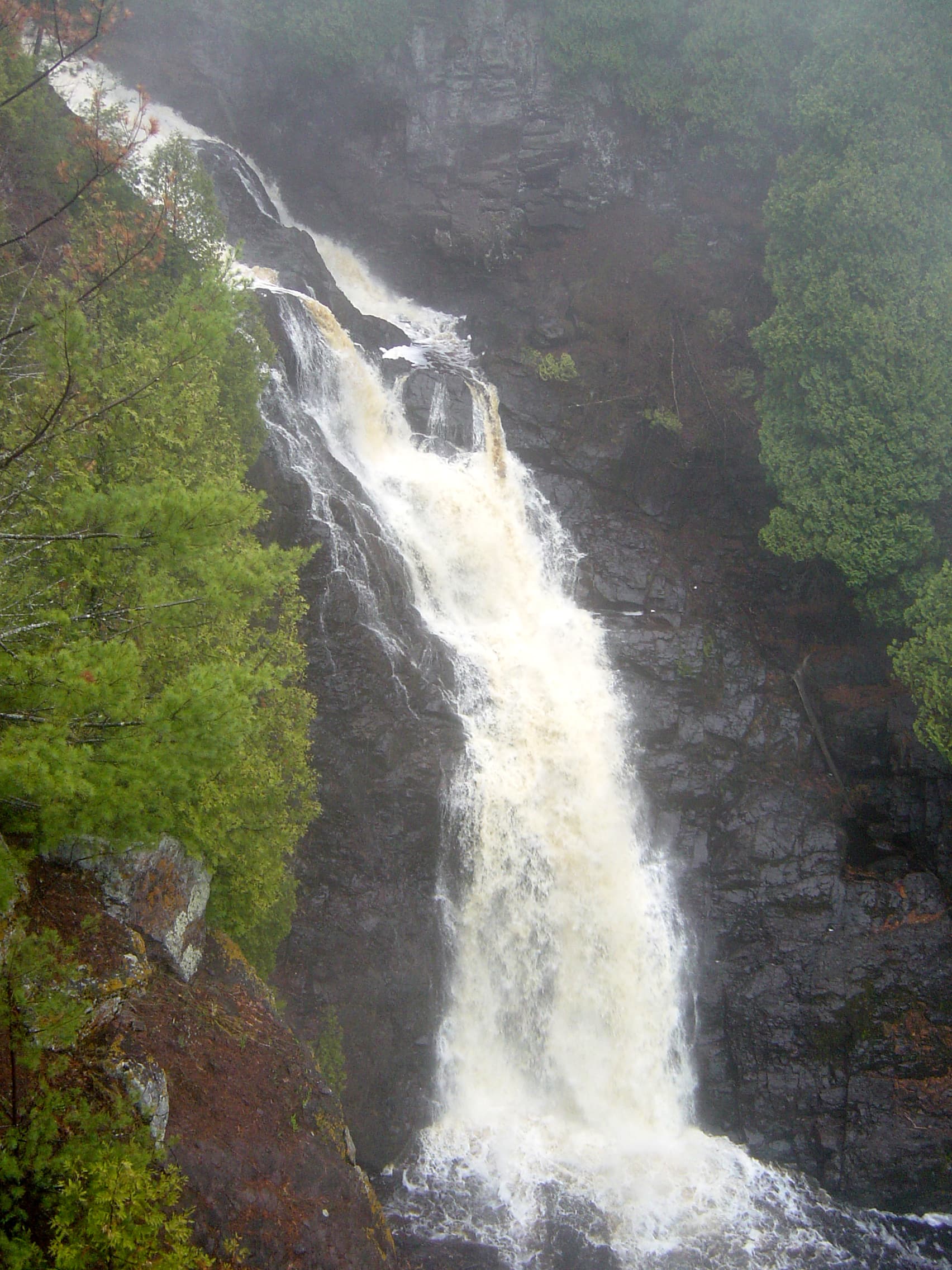
Pattison Backpack Camp Area Permit
Pattison State Park (WI) · Wisconsin
Three backpack sites in the park backcountry above the Black River.
70% of the openings our scanner caught on Pattison Backpack were gone within 5 minutes.
Plan the full trip, not just the permit
Build your full itinerary start to finish
Add your dates and get a day-by-day plan: what needs a permit, what gear to bring, and one link to share with your whole group to coordinate every step.
No permit needed to start
Pattison Backpack Quick Facts
Pattison Backpack Permit Facts
- As of September 2026, Pattison Backpack in Pattison State Park (WI), Wisconsin requires a permit issued via reservation.
- Pattison Backpack is a high-demand permit, rating 7/10 on PermitSnag's demand index.
- The Pattison Backpack route covers 1.6 miles.
- Cancelled Pattison Backpack permits are re-released on the booking system; PermitSnag monitors availability and alerts watchers when dates open.
Key Information
Permit Details
What to Expect
Route Details
Highlights
- •DNR: "Pattison State Park has one campground with 59 family campsites and also offers three backpack campsites."
- •"The backpack sites are about 1.6 miles from the parking area."
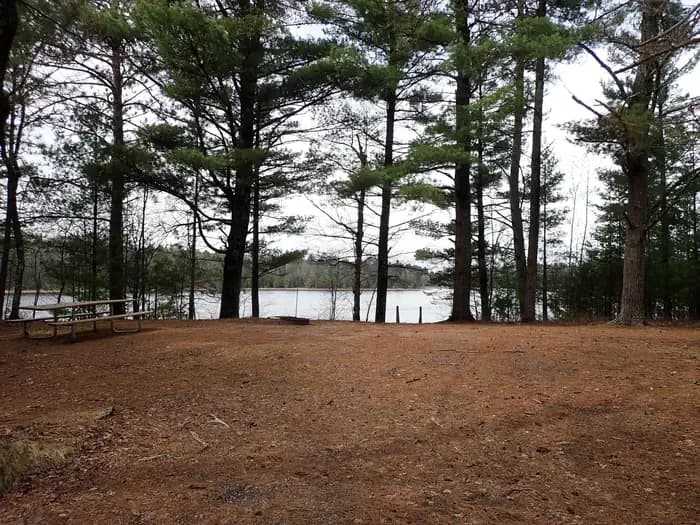
- •"They have vault toilets, tables and fire rings. Water must be carried in; garbage must be carried out."
- •The park is 1,400 acres on the Black River, twenty minutes south of Superior and the Lake Superior shore.
- •Showers and flush toilets in the main campground run in summer only.
Best Time to Visit
Open year-round, 6 a.m. to 11 p.m. Showers and flush toilets in the main campground are summer-only, and state park water systems are weather-dependent from roughly Oct. 1 through May 15 — the backpack sites have no water in any season, so that only changes where you fill up.
Hazards & Considerations
- !Cliffs on the Black River. DNR describes the river trail as "moderately steep" for half a mile downhill, where "the adjacent cliffs give a pronounced view of the Douglas Fault."
- !No water at the sites, on a 1.6-mile carry.
- !Wisconsin state park water systems are weather-dependent and may be off from roughly Oct. 1 through May 15.
How to Get This Permit
Create a Wisconsin DNR (GoingToCamp) account
Sign up at Wisconsin DNR (GoingToCamp) if you don't have an account. Have your payment info ready.
Know the release schedule
Permits typically release on a rolling basis. Check the specific release time for your desired dates.
Be ready when permits drop
Log in a few minutes early. Have your dates, group size, and payment ready to go.
Monitor for cancellations
If your dates are sold out, people cancel all the time. Set up PermitSnag alerts to catch openings instantly.
Difficulty Assessment
Fitness and endurance required
Climbing, scrambling, or specialized skills
Route finding and trail clarity
Difficulty of bailing out mid-route
Best For
Hikers of moderate fitness willing to put in the effort.
Recommended Experience
Basic hiking experience. Start with shorter trails if new to hiking.
About This Permit
Wisconsin DNR: "Pattison State Park features the highest waterfalls in Wisconsin and the fourth highest waterfall east of the Rocky Mountains. Big Manitou Falls is 165 feet high and Twin Little Manitou Falls is 31 feet high. This 1,400-acre park also has a lake with a beach, a nature center, camping and scenic hiking trails." (dnr.wisconsin.gov/topic/parks/pattison, read 2026-08-09.)
The Experience
Why It Matters
Big Manitou Falls is 165 feet — DNR calls it the fourth highest waterfall east of the Rocky Mountains — and the Black River drops another 31 feet over Little Manitou Falls upstream. Three backpack sites is the entire backcountry inventory of the park that holds both.
The Feeling
The river has been at this a while: it starts at Black Lake on the Wisconsin–Minnesota border, runs 22 miles, and then falls off the Douglas Fault. From the sites you are past the day-use crowds at the overlooks, with vault toilets, a table and a fire ring, and whatever water you carried.
Rules & Regulations
- •Reservations run up to 11 months ahead; backpack sites may be booked for a single night.
- •Check-in is 3 p.m., checkout is 1 p.m.
- •No more than 14 days of camping in any 21 days.
- •A family site takes a parent or parents with dependent children plus up to two guests, or a group of no more than six people of any age.
- •The park is closed to non-campers between 11 p.m. and 6 a.m.
- •Firewood must be certified or come from within 10 miles; the park office sells it.
- •Fires in fire rings and grills only; carry out all rubbish.
- •Pets on a physical leash no longer than 8 feet.
- •A vehicle admission sticker is required.
Gear Checklist
Required
- All water for the stay — DNR states it must be carried in
- A pack for a 1.6-mile walk-in
- Rubbish bags
Recommended
- A head torch for the falls overlooks after dark
- Grippy footwear for the steep trail down to the Black River
Plan Your Trip
Gear Checklist
Required and recommended gear for Pattison Backpack
Shuttle Services
Trailhead transportation options
Browse all shuttlesGuide Services
Experienced wilderness guides
Browse all guidesSome links may be affiliate links. Purchases support PermitSnag at no extra cost to you.
Key Landmarks
Big Manitou Falls
165 feet — Wisconsin's highest, and per DNR the fourth highest east of the Rockies. A pedestrian tunnel under Highway 35 leads to overlooks on both sides of the river.
Little Manitou Falls
31 feet, upstream, where the Black River drops before forming Interfalls Lake.
Interfalls Lake
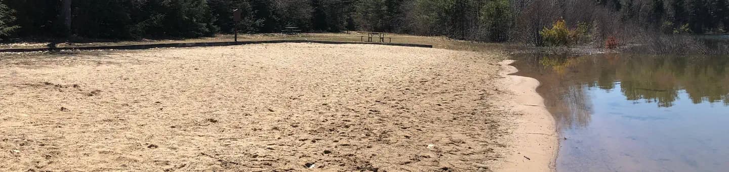
Circled by the 2-mile Beaver Trail; the park's beach is here.
Douglas Fault
Visible in the cliffs a quarter-mile downstream of Big Manitou Falls, on the steep river trail.
Pattison Backpack FAQ
How do I get a Pattison Backpack permit?
Pattison Backpack permits use a reservation system. PermitSnag sends lottery open, deadline, and results reminders; you can also enable cancellation alerts if spots open later.
When is the best time to visit Pattison Backpack?
Check with the managing agency for current season dates. Weekdays generally have better availability than weekends.
How competitive is the Pattison Backpack permit?
This permit has a demand score of 7/10, making it highly competitive. We recommend having backup dates and using PermitSnag's cancellation alerts.
What if I can't get a Pattison Backpack permit?
Cancellations happen daily. Set up alerts with PermitSnag to get notified the moment a spot opens up. Pro and $19 single-permit alerts are checked about every minute, 24/7; free accounts are checked hourly.
👥Community
Trail Conditions
No active conditions reported
Sign in to report trail conditions.
Questions
No questions yet
Be the first to ask about Pattison Backpack.
Trip Reports
Write ReportNo trip reports yet
Be the first to share your experience at Pattison Backpack.
Write the First ReportCan't Get a Pattison Backpack Permit?
Consider these alternatives if your preferred dates aren't available.
Copper Falls Backpack Campsite
Same AreaOne site two miles in on the Bad River, an hour and a half east on the North Country Trail.
Tradeoffs
A gorge and a National Scenic Trail instead of a 165-foot waterfall — but it is a single site, so it is either open or gone.
Chippewa Moraine Backcountry Sites
Similar ExperienceThree outpost sites on the Ice Age Trail south of here, including one reached by canoe.
Tradeoffs
Shorter walk-ins, no waterfall.
Where to Stay
Nearby campgrounds to complete your Pattison Backpack trip
A small favor
One tick helps us more than you’d think
Google lets you pick the sites it highlights for you. Add PermitSnag and our permit pages get marked as one of yours in AI Overviews and AI Mode.
Takes less than a minute.