Skip to content

Get alerted when this permit opens

We watch this permit around the clock. When a cancellation posts, we send you an alert so you can book before the spot is gone. Pro and $12 single-permit alerts are checked about every minute. Free accounts are checked hourly.

Pro scans every minute · free hourlyPRO
SMS and push (Pro)PRO
Fast Lane booking linkPRO
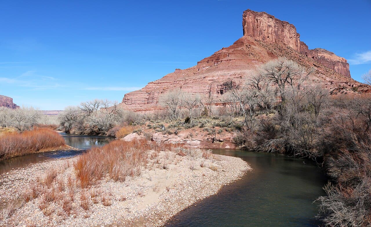
Dolores River (Gateway to Dewey Bridge) wilderness permit area in Colorado Plateau Rivers - backcountry hiking destination
ReservationRiver AccessModerate Demand

Dolores River (Gateway to Dewey Bridge) Permit

Colorado Plateau Rivers

32 miles from Gateway, Colorado to Dewey Bridge, Utah. Unlimited permits, but a runoff season so short that most years it barely happens.

Multi-day river adventure through Colorado Rivers.

Watch a launch date— the rest of the trip follows it

Watch Lower Dolores launch dates

You reserve a launch date, not campsites — the rest of the trip follows it downstream. Give us the launches you'd take and the size of your party, and we'll alert you when one frees up.

This permit caps parties at 25.

We checkPro about every minute · free hourly
Demand
Low
4/10
Method
Reservation
Cost
$6 non-refundable reservation fee
Booking Method
Reservation

Lower Dolores Quick Facts

Permit RequiredYes
Booking MethodReservation
Demand LevelLow4/10
Cost$6 non-refundable reservation fee
Max Group Size25 people

Lower Dolores Permit Facts

  • As of August 2026, Lower Dolores in Colorado Plateau Rivers, Wild & Scenic Rivers requires a permit issued via reservation.
  • The Lower Dolores route covers 32 miles with rated strenuous.
  • Cancelled Lower Dolores permits are re-released on the booking system; PermitSnag monitors availability and alerts watchers when dates open.

Key Information

Permit Details

TypeRiver Access
Booking MethodReservation
Demand Level4/10
LocationColorado Plateau

What to Expect

Route Details

Distance
32 miles
Route Type
Point to Point
Duration
2-3 days
Difficulty
Strenuous

Highlights

  • Technical rapids, side-canyon hiking and few other boaters
  • Stateline Rapid, a mile-long Class IV rock garden at the state line
  • A season that in many years does not open at all
  • No potable water, and silty river water that is hard to filter
  • A take-out on the Colorado River at Dewey Bridge, not on the Dolores

Best Time to Visit

BLM says flows typically peak between late April and early May in high water years. Check the gauge against the craft-specific minimums before you commit to a shuttle.

Hazards & Considerations

  • !Stateline Rapid, Class IV, requires scouting at all water levels
  • !Flows that can vanish mid-trip on an unregulated desert river
  • !No potable water anywhere on the run
  • !Search and rescue handled by Grand County, with long response times

How to Get This Permit

1

Create a Recreation.gov account

Sign up at Recreation.gov if you don't have an account. Have your payment info ready.

2

Know the release schedule

Permits typically release on a rolling basis. Check the specific release time for your desired dates.

3

Be ready when permits drop

Log in a few minutes early. Have your dates, group size, and payment ready to go.

4

Monitor for cancellations

If your dates are sold out, people cancel all the time. Set up PermitSnag alerts to catch openings instantly.

When to Go

Peak: OctoberShoulder: March-April

Conditions

Mild temperatures. Occasional rain. Wildflowers in lower elevations.

Crowd Level

Moderate

Advantages

  • +Pleasant temperatures
  • +Fewer crowds than fall
  • +Wildflowers

Challenges

  • !Unpredictable weather
  • !Some areas still muddy
  • !Flash flood risk

Difficulty Assessment

Physical Demand5/5

Fitness and endurance required

Technical Skill2/5

Climbing, scrambling, or specialized skills

Navigation2/5

Route finding and trail clarity

Commitment4/5

Difficulty of bailing out mid-route

Best For

Experienced hikers with excellent fitness and relevant technical skills.

Recommended Experience

Multi-day backpacking or river experience recommended.

About This Permit

The permit itself is not the hard part on the Lower Dolores. BLM issues an unlimited number of them and opens the whole year on January 1. The hard part is water. BLM's own words are that the Lower Dolores has a very short, erratic and often non-existent boating season, with flows typically peaking between late April and early May.

The run starts just upstream of the Dolores River Bridge in Gateway, Colorado and takes out 32 miles downstream on the Colorado River at Dewey Bridge. The crux is Stateline Rapid, a Class IV rock garden about a mile long that starts at the Colorado-Utah border and that BLM says needs scouting at all water levels.

Because permits are unlimited, watch the gauge rather than the calendar. BLM lists suggested minimums of 200 cfs for canoes, packrafts, kayaks and inflatable kayaks, 800 cfs for rafts under 14 feet, and 1,000 cfs for rafts larger than 14 feet.

The Experience

Why It Matters

Lower Dolores offers a multi-day journey through some of America's most remote wilderness. River permits protect both the resource and the experience, ensuring uncrowded campsites and pristine conditions.

Rules & Regulations

  • Permits are unlimited and the whole year opens on January 1
  • Group size is 1 to 25
  • Permit holders must be 18 or older
  • One person may hold up to three permits at a time
  • The alternate trip leader must be entered at booking and cannot be changed afterward
  • A printed permit must be carried on the trip, available to print 14 days before launch
  • Pets are allowed on the Dolores
  • Private and non-commercial use only

Gear Checklist

Required

  • All drinking water, at least a gallon per person per day
  • Human waste carry-out system
  • Printed permit

Safety & Planning

🚨

Emergency Info

Emergency contacts, ranger station locations, and satellite communicator tips for Lower Dolores. Sign up to track this permit.

🐻

Food Storage

Bear canister requirements, approved container lists, and rental locations for this permit. Sign up to track this permit.

Lower Dolores FAQ

Is the Dolores River permit hard to get?

No. BLM states there is no limit on the number of permits issued and releases the entire year on January 1. Water is the constraint, not the permit.

What flow do I need for a Dolores River trip?

BLM suggests minimums of 200 cfs for canoes, packrafts, kayaks and inflatable kayaks, 800 cfs for rafts under 14 feet, and 1,000 cfs for rafts larger than 14 feet.

How long is the Lower Dolores River permit section?

32 miles, from the put-in just above the Dolores River Bridge in Gateway, Colorado to the Dewey Bridge Recreation Site on the Colorado River in Utah.

👥Community

Trail Conditions

Questions

Trip Reports

Write Report

Photography Guide

Golden Hour

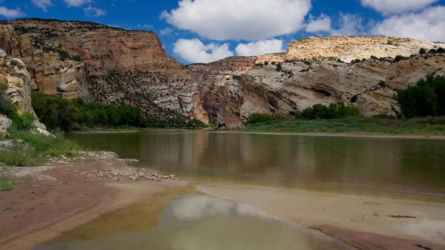
Canyon walls glow during sunset. Position your camp for the best evening light angles.

Best Light

Midday can work in deep canyons where direct light penetrates. Morning offers reflections on calm water.

Beat the Crowds

River trips have built-in crowd control via permits. Focus on timing with natural light.

Classic Shots

  • 📍Boat perspective through rapids
  • 📍Canyon wall reflections
  • 📍Camp setup on river beach
  • 📍Wildlife along the shore

Permit Directory

Browse Backcountry Permits

Find permits for day hikes, overnight backpacking, thru-hikes, canyoneering, and river trips across federal and state lands.