Skip to content

Get alerted when this permit opens

We watch this permit around the clock. When a cancellation posts, we send you an alert so you can book before the spot is gone. Pro and $12 single-permit alerts are checked about every minute. Free accounts are checked hourly.

Pro scans every minute · free hourlyPRO
SMS and push (Pro)PRO
Fast Lane booking linkPRO
Canyonlands Day Use Backcountry Permit wilderness permit area in Canyonlands National Park - backcountry hiking destination
First-Come, First-ServedDay UseHigh Demand

Canyonlands Day Use Backcountry Permit

Canyonlands National Park

The day-use permit for driving or riding White Rim, Elephant Hill, Salt Creek/Horse Canyon and Lavender Canyon. One permit per vehicle, motorcycle or bike, released one day ahead.

The one-day version of the White Rim — 100 miles of shelf road below the Island in the Sky mesa, on a permit that only exists for 24 hours before you go.

Get availability alerts

Be notified instantly when Canyonlands Day Use permits become available due to cancellations.

Join 2,800+ permit hunters using PermitSnag
We checkPro about every minute · free hourly
Demand
High
7/10
Method
First-Come, First-Served
Season
Year-round
Cost
$6 reservation fee (free if issued in person on the day)
Booking Method
First-Come, First-Served

Canyonlands Day Use Quick Facts

Permit RequiredYes
Booking MethodFirst-Come, First-Served
Demand LevelHigh7/10
SeasonYear-round
Cost$6 reservation fee (free if issued in person on the day)
Max Group Size3 people

Canyonlands Day Use Permit Facts

  • As of August 2026, Canyonlands Day Use in Canyonlands National Park, Utah & BLM requires a permit issued via first-come, first-served.
  • Canyonlands Day Use is a high-demand permit, rating 7/10 on PermitSnag's demand index.
  • The Canyonlands Day Use route covers 100 miles with 7,500 feet of elevation gain, rated strenuous.
  • Cancelled Canyonlands Day Use permits are re-released on the booking system; PermitSnag monitors availability and alerts watchers when dates open.

Key Information

Key Dates

SeasonYear-round

Permit Details

TypeDay Use
Booking MethodFirst-Come, First-Served
Demand Level7/10
LocationSoutheast Utah, UT

Pro Tips

  • The whole booking window is 24 hours: NPS releases permits "online at 8:00 a.m. MT one day in advance until 8:00 a.m. MT the day of the trip"
  • Every vehicle, motorcycle and bike in your group needs its own permit, entered by its own driver or rider
  • Half the White Rim vehicle quota never goes online — NPS holds 25 of the 50 back for in-person, first-come first-served issue at a visitor center
  • Shafer Trail down to Potash Road needs no day-use permit at all
  • Salt Creek/Horse Canyon and Lavender Canyon need a gate lock combination you get from the Needles Visitor Center or the Backcountry Permit Office

What to Expect

Route Details

Distance
100 miles
Elevation Gain
7,500 ft
Route Type
Loop
Duration
12+ hours for the full White Rim loop
Difficulty
Strenuous

Highlights

  • A one-day booking window opening at 8:00 a.m. MT the day before
  • One permit per vehicle, motorcycle or bike, each entered by its own driver or rider
  • A mandatory NPS video for the road you booked before you can issue the permit
  • Self-issue: you print or download the permit PDF from your Recreation.gov reservations
  • At least twelve hours for the full White Rim loop, driving or riding
  • No cell service and no water anywhere on these roads

Best Time to Visit

Spring and fall. NPS flags May and June specifically as the months when Green River high water can flood the west side of the White Rim and make the full loop impossible, and the roads have no shade or water for a summer attempt.

Hazards & Considerations

  • !Steep exposed sections NPS names by hand: Shafer Trail, Lathrop Canyon Road, Murphy Hogback, Hardscrabble Hill and the Mineral Bottom switchbacks
  • !High water on the Green River in May-June, which NPS says can flood the west side and make a complete loop impossible
  • !Flash flood damage and quicksand, which NPS warns can make roads impassable
  • !Recovery cost: NPS puts towing on these roads at over $1,000 in one place on the permit and over $2,000 in another
  • !Heat with no shade and no water
  • !Mountain bikers with no support: NPS says "Do not rely on others for assistance"

How to Get This Permit

1

Create a Recreation.gov account

Sign up at Recreation.gov if you don't have an account. Have your payment info ready.

2

Know the release schedule

Permits typically release on a rolling basis. Check the specific release time for your desired dates.

3

Be ready when permits drop

Log in a few minutes early. Have your dates, group size, and payment ready to go.

4

Monitor for cancellations

If your dates are sold out, people cancel all the time. Set up PermitSnag alerts to catch openings instantly.

When to Go

Peak: March-May and September-OctoberShoulder: Late February and November

Conditions

The prime season for a one-day loop: cool mornings, long enough days.

Crowd Level

High

Advantages

  • +Best temperatures for a twelve-hour day
  • +Longest daylight without the summer heat

Challenges

  • !Highest competition for the 25 online White Rim vehicle permits
  • !May brings the first Green River high water that can close the west side

Difficulty Assessment

Physical Demand4/5

Fitness and endurance required

Technical Skill4/5

Climbing, scrambling, or specialized skills

Exposure Risk4/5

Steep dropoffs and fall potential

Navigation2/5

Route finding and trail clarity

Commitment4/5

Difficulty of bailing out mid-route

Best For

Experienced low-range 4WD drivers and fit mountain bikers who want the White Rim or the Needles roads in a single day and can book on 24 hours' notice.

Recommended Experience

Technical four-wheel driving on ledges and steep exposed shelf road, or the fitness and mechanical self-sufficiency to ride 100 unsupported miles.

Not Recommended For

Anyone with an AWD crossover, anyone who needs to book weeks ahead, and anyone attempting the full 100-mile loop without twelve hours of daylight in hand.

About This Permit

Canyonlands requires a day-use permit for every four-wheel-drive vehicle, motorcycle and mountain bike travelling four roads: White Rim, Elephant Hill, Salt Creek/Horse Canyon and Lavender Canyon. It is a separate Recreation.gov product from the overnight backcountry permit, and it does not allow camping.

The release schedule is unusually tight. NPS: "Permit reservations are available online at 8:00 a.m. MT one day in advance until 8:00 a.m. MT the day of the trip." There is no advance booking, so a date's permits exist for a single 24-hour window and then stop existing.

Quotas are set per road and per mode. White Rim Road carries 50 vehicles a day, but only 25 of those go online — NPS holds the other 25 plus any online leftovers for first-come, first-served issue in person at a visitor center, with no fee. The Needles roads are much tighter: 24 vehicles on Elephant Hill, 10 on Salt Creek/Horse Canyon, 8 on Lavender Canyon.

The Experience

Why It Matters

Almost everything written about the White Rim assumes you are camping on it. Plenty of people are not: they are riding or driving the loop in a day, and that trip needs a completely different permit from the overnight one, released on a completely different schedule. Miss the distinction and you show up at Shafer with a permit for the wrong thing, or with none at all. The same permit covers the Needles 4WD roads, which have far smaller quotas and fill faster than the White Rim does.

The Route

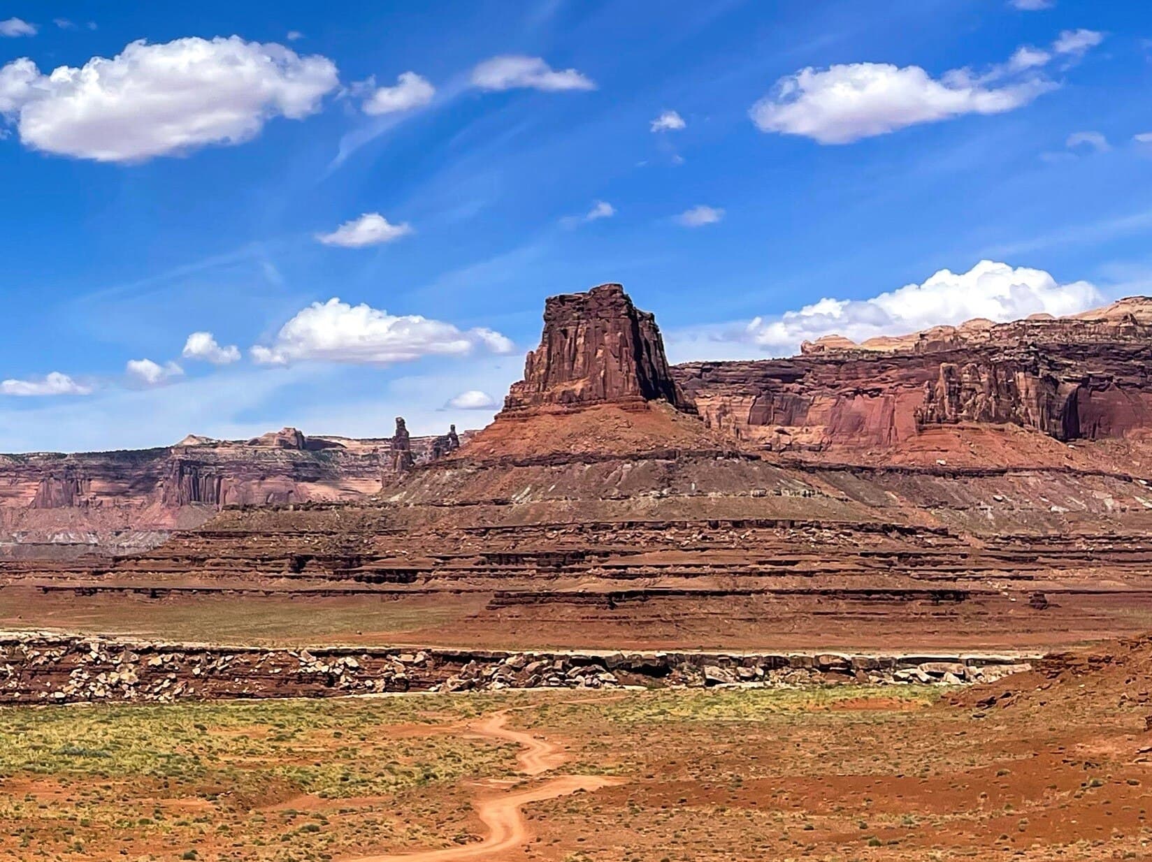
The White Rim Road runs 100 miles around and below the Island in the Sky mesa. NPS names the hard parts outright: "The steep, exposed sections of the Shafer Trail, Lathrop Canyon Road, Murphy Hogback, Hardscrabble Hill, and the Mineral Bottom switchbacks make the White Rim loop a challenging adventure for both vehicles and mountain bikes." Most parties go clockwise, dropping Shafer and climbing out at Mineral Bottom.

The Needles roads are a different proposition — about 50 miles of them, all of which NPS says "require experienced four-wheel driving skills." Elephant Hill is the famous one, a staircase of ledges with a reverse-only section. Salt Creek/Horse Canyon and Lavender Canyon are gated, so you collect a lock combination before you go.

During high water on the Green River in May and June, NPS warns that sections of road on the west side of the White Rim can flood, which turns the loop into an out-and-back with no notice.

The Feeling

You drop off the mesa on the Shafer switchbacks in the first grey light and the road unspools along a bench 1,000 feet above the Colorado, with the Island rim above you the whole way. Nothing about it is technical for long stretches, and then Murphy Hogback or Hardscrabble arrives and reminds you what low range is for. NPS's own estimate for the full loop is at least twelve hours, and by hour ten the light is going and the mesa still looks the same distance away.
Trailhead Information

White Rim Road (Island in the Sky)

Primary

The 100-mile loop below the Island in the Sky mesa. NPS quota: 50 vehicles a day, 25 of them online and 25 held for in-person issue, and 50 mountain bikes a day.

Restrooms
No water
No Service

Before you rely on this water

No water on the road. Carry everything for at least a twelve-hour day.

Parking

Access from the Island in the Sky mesa via Shafer Trail or from Mineral Bottom Road.

Getting There

High-clearance low-range 4WD required; NPS does not permit AWD, ATVs, UTVs or OHVs. Up to 3 vehicles may travel together — beyond that, NPS asks you to separate by at least 30 minutes or 0.5 miles.

Nearest Services

Moab, about 40 minutes from the Island in the Sky entrance.

Elephant Hill Road (The Needles)

Alternate

The Needles district's technical 4WD road. NPS quota: 24 vehicles a day, 3 per group; 12 mountain bikes a day.

Restrooms
No water
No Service

Before you rely on this water

No water. The Needles visitor center is the last reliable source.

Getting There

NPS: the Needles roads "require experienced four-wheel driving skills. Inexperienced drivers or motorcyclists should not attempt these roads. There is a high risk of vehicle damage."

Nearest Services

Monticello or Moab; the Needles Visitor Center is the closest staffed point.

Salt Creek / Horse Canyon Road (The Needles)

Alternate

Gated canyon road. NPS quota: 10 vehicles a day, 3 per group; 7 mountain bikes a day.

Restrooms
No water
No Service

Before you rely on this water

No water, and the creek is not a reliable source.

Getting There

NPS: Salt Creek/Horse Canyon "require a gate lock combination. You must issue the permit via your user profile or contact The Needles Visitor Center or Backcountry Permit Office."

Nearest Services

Monticello.

Lavender Canyon Road (The Needles)

Alternate

The smallest quota on the permit. NPS: 8 vehicles a day, 3 per group; 7 mountain bikes a day.

Restrooms
No water
No Service

Before you rely on this water

No water anywhere on this road.

Getting There

Gated, like Salt Creek/Horse Canyon, and needs the same lock combination.

Nearest Services

Monticello.

Rules & Regulations

  • Each vehicle, motorcycle and mountain bike must have its own permit in possession, printed or on a mobile device
  • High-clearance low-range 4WD only; NPS does not permit AWD, ATVs, UTVs or OHVs even if street legal and registered
  • Motorcycles must be equipped and licensed for interstate travel
  • Up to 3 vehicles or motorcycles may travel together; larger parties must separate by at least 30 minutes or 0.5 miles
  • Mountain bike group limits differ by road: 15 on White Rim, 12 on Elephant Hill, 7 on Salt Creek/Horse Canyon and Lavender Canyon
  • No overnight travel or camping on this permit
  • Salt Creek/Horse Canyon and Lavender Canyon require a gate lock combination obtained from the park
  • Permits are non-refundable and cannot be changed — NPS says to cancel and rebook instead

Gear Checklist

Required

  • High-clearance low-range 4WD vehicle, or a mountain bike you can fix in the field
  • All water for the day; there is none on any of these roads
  • Full-size spare, recovery gear and the ability to use them
  • The printed or downloaded permit PDF

Recommended

  • Satellite messenger — there is no cell service on the loop
  • A second vehicle in the party, since NPS advises travelling in groups of 2-3 self-rescue-capable vehicles
  • More daylight than you think you need for a one-day White Rim attempt

Key Landmarks

7,500ft
Gain
7,500ft
Loss
⛰️
7,500ft
High
📏
100.0mi
Distance
📐
1.4%
Avg Grade
Click on a marker to view details6 landmarks

Landmarks (6)

Safety & Planning

🚨

Emergency Info

Emergency contacts, ranger station locations, and satellite communicator tips for Canyonlands Day Use. Sign up to track this permit.

🐻

Food Storage

Bear canister requirements, approved container lists, and rental locations for this permit. Sign up to track this permit.

Canyonlands Day Use FAQ

When do Canyonlands day use permits become available?

NPS: "Permit reservations are available online at 8:00 a.m. MT one day in advance until 8:00 a.m. MT the day of the trip." That is the entire booking window — there is no advance calendar, so the permit for a given date only exists for 24 hours.

How many Canyonlands day use permits are issued per day?

It depends on the road and on whether you are driving or riding. NPS publishes: White Rim Road 50 vehicles a day (25 online, 25 in person) and 50 mountain bikes; Elephant Hill Road 24 vehicles and 12 mountain bikes; Salt Creek/Horse Canyon 10 vehicles and 7 mountain bikes; Lavender Canyon 8 vehicles and 7 mountain bikes.

Do I need a Canyonlands day use permit for the Shafer Trail?

No. NPS is explicit: "A day use permit is NOT required to drive Shafer Trail to Potash Road." The permit covers White Rim Road, Elephant Hill, Salt Creek/Horse Canyon and Lavender Canyon.

Can I camp on a Canyonlands day use permit?

No. NPS: "This permit does not allow overnight camping. Book an Overnight Backcountry Permit to camp overnight." The overnight permit is a different Recreation.gov product with named campsites and its own release schedule.

Does an AWD vehicle work for a Canyonlands day use permit?

No. NPS requires "a high-clearance, low-range 4WD vehicle" and states "The park does NOT permit all-wheel drive (AWD), ATVs, UTVs or OHVs (even street legal and registered) on these roads." Motorcycles must be equipped and licensed for interstate travel.

👥Community

Trail Conditions

Questions

Trip Reports

Write Report

Photography Guide

Golden Hour

First light on the Shafer switchbacks and last light along the western bench near Hardscrabble. Midday on the White Rim is flat and hot in every direction.

Best Light

Early morning, which is also when you should be starting a one-day attempt on the loop.

Beat the Crowds

Fifty vehicles and fifty bikes a day is not empty, but the loop is 100 miles long and NPS asks groups of more than three to separate by 30 minutes or half a mile, which spreads everyone out.

Classic Shots

  • 📍The Shafer switchbacks stacked below the Island in the Sky rim
  • 📍A vehicle or rider on the shelf road with the Colorado 1,000 feet below
  • 📍The White Crack promontory looking south to the Needles
  • 📍Elephant Hill's ledges from below

Permit Directory

Browse Backcountry Permits

Find permits for day hikes, overnight backpacking, thru-hikes, canyoneering, and river trips across federal and state lands.