Walk-Up8/10
Mt. Hood Timberline Trail permit
Circle Oregon's most iconic peak on a 41-mile loop through alpine meadows, past ...
12-mile loop from Timberline Lodge through Mount Hood's famous wildflower meadows.
“Nearly 3,000 feet up a forested ridge to an alpine meadow the Forest Service calls one of the best wildflower displays on Mount Hood.”
Paradise Park is issued by the agency rather than through a booking calendar. Their page has the current process and any dates.
Official permit pagePlanning another trip? See the permits we watch.
Paradise Park is issued by the agency rather than through a booking calendar. Their page has the current process and any dates.
Official permit pagePlanning another trip? See the permits we watch.
Build your full itinerary start to finish
Add your dates and get a day-by-day plan: what needs a permit, what gear to bring, and one link to share with your whole group to coordinate every step.
No permit needed to start
You get this permit in person at the trailhead or ranger station, or by phone. There is no online reservation to race for, so availability alerts do not apply. We still track key dates and season info for your trip.
Official permit page →The Recreation Pass window of May 1 to October 31 brackets the practical season. Wildflowers in the meadows are the reason most people come, and they follow snowmelt — high summer rather than early summer in a heavy year. Late September gives you the clearest views of the mountain and the emptiest trail.
Trailhead (5,000 ft)
Backcountry Tips
Today
66°
46°
Sun
60°
45°
29%
Mon
53°
40°
69%
Tue
59°
38°
Wed
69°
39°
Thu
73°
41°
Fri
76°
43°
This permit is not sold online. Confirm where and when it is issued — and any fee — at U.S. Forest Service before your trip.
Walk-up permits are issued first-come, first-served, and quotas can fill early on weekends and holidays.
Popular trailheads may be full. Know alternative routes or dates in case your first choice is unavailable.
The Recreation Pass requirement starts May 1, but the upper meadows are still under snow.
Fitness and endurance required
Climbing, scrambling, or specialized skills
Steep dropoffs and fall potential
Route finding and trail clarity
Difficulty of bailing out mid-route
Strong day hikers and backpackers who want the meadows without the full Timberline Trail commitment.
Comfort with a sustained 3,000-foot climb.
Anyone expecting water on the way up. There is none at the trailhead and the Forest Service says so.
Paradise Park is an alpine meadow on the southwest flank of Mount Hood, reached by Paradise Park Trail #778 from Forest Road 2639-021. Mt. Hood National Forest describes it as climbing a forested ridge above the north side of the Zigzag River and eventually accessing the Pacific Crest National Scenic Trail and Paradise Park itself, with outstanding views of the mountain and meadows known for outstanding wildflowers.
The trail begins at 2,800 feet and ends at Paradise Park Loop Trail #757 at 5,760 feet, with the trail continuing a further half mile through alpine meadows to a viewpoint at 6,240 feet. Summing the Forest Service's own segment distances gives about 6.35 miles to the #757 junction and 6.85 to the viewpoint.
The Forest Service lists one requirement on this trail's page: a valid Recreation Pass at the Paradise Park Trailhead from May 1 to October 31, plus wilderness restrictions. It also lists water availability at the trailhead as No. Free self-issued wilderness permits are the norm in this wilderness — the Forest Service states on its Ramona Falls page that they are required from May 15 to October 15 where provided at a portal — so fill one out if there is a box on your way in.
Paradise Park is where the Pacific Crest Trail crosses the southwest flank of Mount Hood, and the Forest Service description of Trail #778 is unusually specific about the reward: an outstanding view of Mount Hood while passing through meadows known for outstanding wildflowers.
Mt. Hood National Forest maps Trail #778 segment by segment. It begins at Forest Road 2639-021 at 2,800 feet and climbs gradually before starting up several switchbacks to a flat point after 1.7 miles. It continues northwest 0.7 mile to a ridgeline, then follows that ridgeline and climbs 3.25 miles to the junction with Zigzag Mountain Trail #775, with nice views of the Zigzag Canyon along the way.
Continue straight on #778 and after 0.2 mile you reach the junction with the Pacific Crest Trail #2000. From there it is another 0.5 mile through meadows and more open forest to Paradise Park Loop Trail #757, at 5,760 feet — the old end of the trail. It carries on a further 0.5 mile through alpine meadows to a spectacular viewpoint at 6,240 feet.
Add those segments up and it is about 6.35 miles to the #757 junction and 6.85 to the viewpoint. Part of the trail was reconstructed in 1999, turning the steeper sections into more gradual switchbacks, and the Forest Service notes that while it follows a ridgeline it is not an exposed ridge that would be precarious for stock.
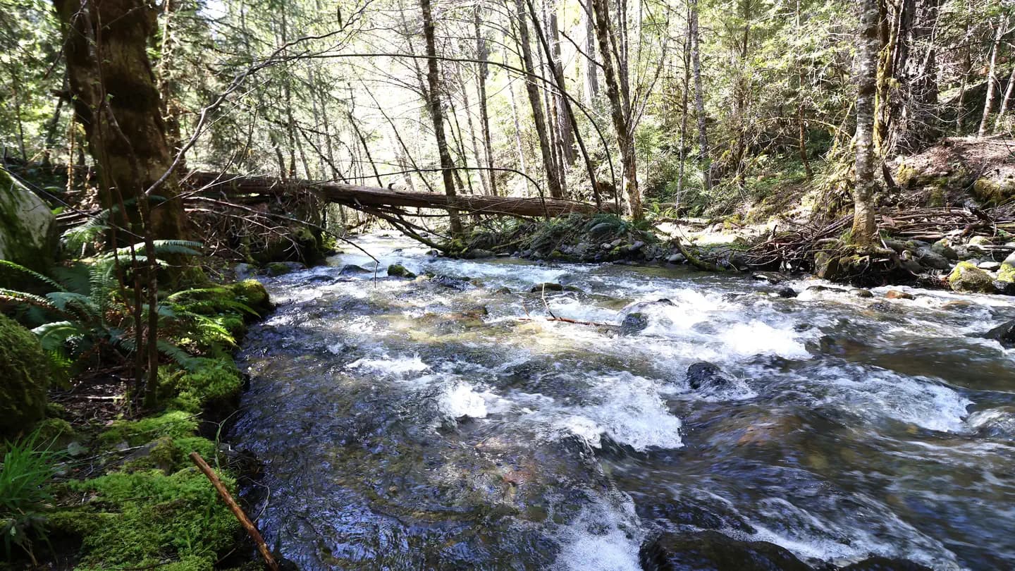
A long forested ridge with the Zigzag Canyon opening up below you, then the trees thin and the meadows start and the mountain fills the sky.
The start of Paradise Park Trail #778, at 2,800 feet.
A valid Recreation Pass is required from May 1 to October 31.
From Sandy: follow US-26 east 22 miles and turn left (north) at Kiwanis Camp Road / Forest Road 2639, about 0.6 mile east of milepost 48. Travel 1.2 miles to Forest Road 2639-021, turn left and park near the end of the road.
Sandy or Zigzag, Oregon.
Required and recommended gear for Paradise Park
Trailhead transportation options
Browse all shuttlesExperienced wilderness guides
Browse all guidesSome links may be affiliate links. Purchases support PermitSnag at no extra cost to you.
Emergency contacts, ranger station locations, and satellite communicator tips for Paradise Park.
Bear canister requirements, approved container lists, and rental locations for this permit.
Mt. Hood National Forest lists one requirement on the Paradise Park Trail #778 page: a valid Recreation Pass at the Paradise Park Trailhead from May 1 to October 31, plus wilderness restrictions. The forest also states, on its Ramona Falls page, that free self-issued wilderness permits are required in the Mount Hood Wilderness from May 15 to October 15 where provided at a portal — so fill one out if there is a box at the trailhead.
The Forest Service publishes it in segments: 1.7 miles to a flat point, 0.7 mile to the ridgeline, 3.25 miles along the ridgeline to the Zigzag Mountain Trail #775 junction, 0.2 mile to the PCT #2000 junction, then 0.5 mile to Paradise Park Loop Trail #757. That totals about 6.35 miles one way, with a further 0.5 mile to a viewpoint at 6,240 feet.
The trail begins at Forest Road 2639-021 at 2,800 feet and ends at Paradise Park Loop Trail #757 at 5,760 feet, so about 2,960 feet of gain. Continuing to the viewpoint at 6,240 feet makes it roughly 3,440 feet.
No. Mt. Hood National Forest lists water availability at this trailhead as No. Carry everything you need for a sustained climb.
No active conditions reported
Sign in to report trail conditions.
No questions yet
Be the first to ask about Paradise Park.
Evening light on Mount Hood from the meadows, which face the right way for it.
Late September mornings, when the air clears and the mountain reads sharp.
The 3,000-foot climb does most of the filtering. Weekdays and late September do the rest.
Consider these alternatives if your preferred dates aren't available.
A 7-mile loop with 1,000 feet of gain to a waterfall on columnar basalt, on the same forest.
A third of the climbing, but an unbridged glacial river crossing that the Forest Service says will never be bridged.
A short hike off the Timberline Trail to the stone shelter, with views over the Bull Run watershed.
Higher and later to melt out — often through June — with a different aspect on the mountain.
The full circumnavigation of Mount Hood, which passes through Paradise Park.
A multi-day commitment with several glacial river crossings rather than a long day.
Nearby campgrounds to complete your Paradise Park trip
A small favor
Google lets you pick the sites it highlights for you. Add PermitSnag and our permit pages get marked as one of yours in AI Overviews and AI Mode.
Takes less than a minute.