Cottonwood Campground: Permit, Route and Dates
Cottonwood Campground permits get cancelled and re-released through the season in Grand Canyon National Park, and they are drawn by lottery to begin with. The route covers 6.8 miles.
The halfway camp on the North Kaibab - 6.8 miles and 4,161 feet below the North Rim, and the only sensible place to break the longest corridor trail in the canyon.
This guide covers the Cottonwood Campground permit.
$10 per permit or lottery application, plus $15 per person per night below the rim. Park entrance fees are paid separately on arrival.
Permit Cost
2 days
Duration
6.8 miles
Distance
4,161'
Elevation Gain
strenuous
Difficulty
About Cottonwood Campground
Cottonwood Campground is the corridor's north-side halfway house: 6.8 miles below the North Kaibab Trailhead at 4,080 feet, with an emergency phone, toilets, picnic tables, pack poles and metal food storage cans. The park calls it a small campground and publishes no site count. There is no ranger station here - the nearest is at Manzanita Rest Area, 1.4 miles up-trail. Recreation.gov sells a standard division, a large group division and a stock/Arizona Trail site. Access is seasonal at the top rather than the bottom. North Rim roads and services close December 1 and Highway 67 stays shut until May 15, so the trailhead is simply unreachable by vehicle for half the year, and last-minute in-person permits for this campground exist only between May 15 and October 31. Then there is the closure that changes everything. From 11:59 pm on October 15, 2026 the park closes the North Kaibab Trail from the Redwall Bridge - about 2.5 miles north of Manzanita - to the northern end of Cottonwood Campground, and states plainly that traditional rim-to-rim hiking will not be possible beginning October 16, 2026, through approximately February 2027. Recreation.gov has already created a Cottonwood division accessed from the South Rim to handle it. Water is the other thing to get right. The park's mileage table gives Cottonwood a mid-May to mid-October window for the tap, but that is what the campground is plumbed for, not what is running. Water here comes off the Transcanyon Waterline, and the park publishes a live per-location status on its Key Hiking Messages page because, in its own words, these statuses are current but can change suddenly due to breaks in the waterline. On August 9, 2026 that page read water OFF due to pipeline break at Cottonwood, at Manzanita and at Bright Angel Campground, and all water off on the North Rim itself. Its own North Kaibab handout puts it bluntly: potable water stations should be considered a gift and not relied upon.
Every rim-to-rim hiker passes through here, and most of the ones who enjoy it sleep here. The North Kaibab is 14 miles from trailhead to the Colorado River, with more vertical than either South Rim trail, and Cottonwood is the one designated campground in the middle of it. It is also the campground that goes away for a while: from 11:59 pm on October 15, 2026 the park closes the North Kaibab between the Redwall Bridge and the north end of Cottonwood Campground, and traditional rim-to-rim hiking stops until roughly February 2027.
The Cottonwood Campground route
- Distance
- 6.8 miles
- Route type
- out-and-back
- Elevation gain
- 4,161 ft
- High point
- 8,241 ft
- Low point
- 4,080 ft
- Trip length
- 2 days
- Difficulty
- strenuous
Entry points: North Kaibab Trailhead, Bright Angel Campground / Phantom Ranch
Colorado Plateau. Nearest town: Jacob Lake, AZ
Points along the route
- North Kaibab TrailheadMile 0, 8,241 ft
- Supai Tunnel
- Manzanita Rest Area
- Cottonwood CampgroundMile 6.8, 4,080 ft
- Ribbon FallsMile 8.4, 3,720 ft
- Bright Angel CampgroundMile 14, 2,480 ft
Cottonwood Campground permit detailsandAll Grand Canyon National Park permits
The Experience
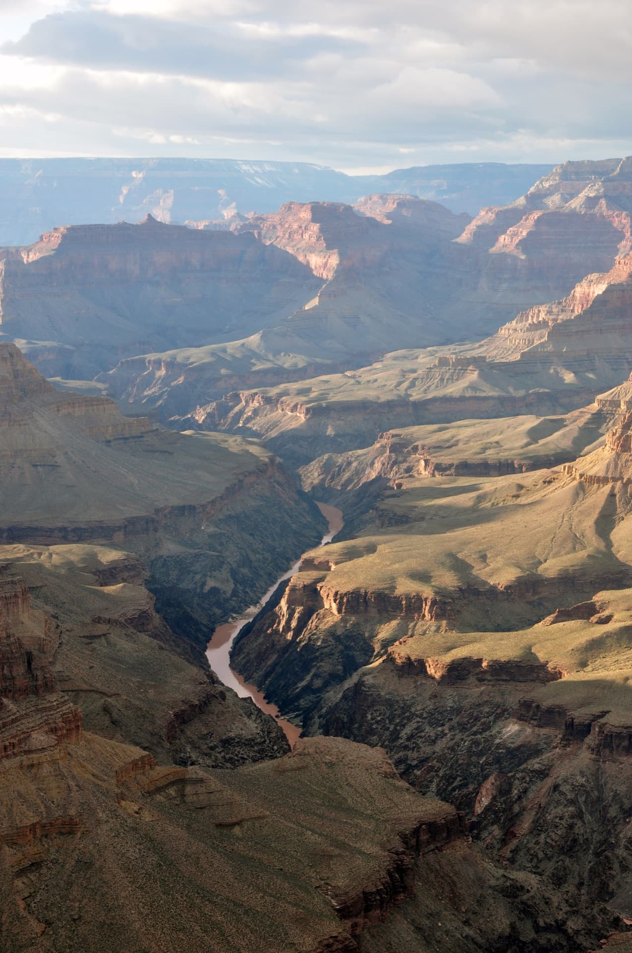
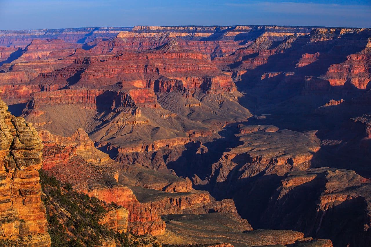
Warmer than the rim by a long way and drier than the river. The canyon here is wide enough to see sky, with Bright Angel Creek running past camp and the walls stepping back in terraces. It is a quieter place than the South Rim corridor - fewer people, no ranger station, and a long way from anywhere in either direction.
From the North Kaibab Trailhead at 8,241 feet the trail drops fast through Coconino Sandstone, past Supai Tunnel and the Redwall Bridge, then down the Roaring Springs drainage. Manzanita Rest Area sits 1.4 miles above camp with a toilet, shaded benches and the corridor's ranger station. Cottonwood Campground is at 4,080 feet, 6.8 miles from the trailhead by the park's mileage table - though the same handout's sidebar says 7 miles.
Below camp it is 1.6 miles to Ribbon Falls, where the bridge is gone and you have to find a place to ford the creek, and then 7.2 more miles to Bright Angel Campground and the river. That makes Cottonwood the natural first night of a north-to-south rim-to-rim, and the natural last night coming the other way.
What to Expect
6.8 miles below the North Kaibab Trailhead by the park's mileage table; its own handout sidebar says 7
A 4,161-foot climb back to the rim - more vertical than either South Rim corridor trail
Emergency phone and toilets. No ranger station; that is at Manzanita, 1.4 miles up-trail
Picnic table, pack pole and metal food storage can at each site
Ribbon Falls is 1.6 miles below camp and the bridge is gone - you ford the creek to reach it
Bright Angel Campground and the Colorado River are 7.2 miles further down
The trailhead is unreachable by vehicle December 1 to May 14
Get Cottonwood Campground Alerts
Be first to know when cancellations happen.
Permit Requirements
A backcountry permit is required and must be in your possession while below the rim
Groups larger than eleven people may not camp in the same campground or use area; the park issues more permits for small groups (1-6) than large groups (7-11)
Two nights maximum per campground per hike, or four nights in the Corridor between November 15 and February 28
Wood and charcoal fires are prohibited; fossil-fuel backpacking stoves are allowed
Store all food and scented items in the metal cans provided
Pack out all trash, including toilet paper
Pets are not allowed below the rim
The North Kaibab is closed between the Redwall Bridge and the north end of this campground from 11:59 pm on October 15, 2026 to approximately February 2027
Gear & Preparation
Required Gear
- •Water treatment - a filter or chemical purification. The park's own North Kaibab guidance is to treat the taps as a gift and not rely on them
- •At least 3 litres of carrying capacity per person
- •Electrolytes for the climb out
- •Sun hat and long sleeves; the burned section above Supai Tunnel has no shade left
- •Headlamp for an early start
Recommended Gear
- •Trekking poles - 4,161 feet is a long way up
- •Camp shoes for the Bright Angel Creek ford to Ribbon Falls
- •Rain shell for the July-September monsoon
- •A shirt you can soak in the creek
Hazards & Safety
Flash flooding on the lower North Kaibab and around Phantom Ranch, which the park warns can happen with little or no warning even when storms are not visible overhead
Heat below Roaring Springs; the park's summer instruction is to stay off the trail between 10 am and 4 pm
Waterline breaks. Cottonwood, Manzanita and the North Rim all read water off on August 9, 2026
The Ribbon Falls ford - there is no bridge from the main trail any more
Burned terrain between Supai Tunnel and the trailhead, where the park advises caution
A 4,161-foot climb out with no bail-out point below Manzanita
Best Time to Visit
Late May through June, and mid-September through October. Highway 67 opens May 15 and closes December 1, so the season is fixed at the top. Midsummer at 4,080 feet is hot and the monsoon puts flash-flood risk on the lower trail from July. For 2026 specifically, plan any rim-to-rim before October 15 - the trail closes north of the campground at 11:59 pm that night.
Pro Tips
Cottonwood is far less contested than Bright Angel Campground and turns a rim-to-rim from an endurance event into a normal backpacking trip. Book it first, then work the river night around it.
For 2026, anything rim-to-rim has to be done before 11:59 pm on October 15 - the trail north of this campground closes that night until roughly February 2027.
Plan your water off Bright Angel Creek and treat the tap as a bonus. On August 9, 2026 the tap here, at Manzanita and on the North Rim were all off due to a pipeline break.
Manzanita, 1.4 miles up-trail, has the shaded benches, the creek access and the ranger station - it is the better midday stop than camp itself.
The North Rim is at 8,241 feet. Sleep a night up top before descending if you have come from sea level.
100+ wilderness permits, extensive backcountry experience
This guide is based on personal experience obtaining wilderness permits and is regularly updated to reflect current policies and strategies.
Frequently Asked Questions
How do I get a Cottonwood Campground permit?
+
Two ways. Cancelled Cottonwood Campground permits return to the booking system through the season, and PermitSnag alerts you the moment one opens. The other way is the lottery, so apply during the application window as well.
When is the best time to visit Cottonwood Campground?
+
Late May through June, and mid-September through October. Highway 67 opens May 15 and closes December 1, so the season is fixed at the top. Midsummer at 4,080 feet is hot and the monsoon puts flash-flood risk on the lower trail from July. For 2026 specifically, plan any rim-to-rim before October 15 - the trail closes north of the campground at 11:59 pm that night.
How long is the Cottonwood Campground route?
+
The route is 6.8 miles, as an out-and-back. Plan on 2 days.
How difficult is the Cottonwood Campground route?
+
Hikers with a long climb already in their legs. 4,161 feet over 6.8 miles is the steepest sustained corridor climb in the park, and the nearest ranger is at Manzanita.
Where does the Cottonwood Campground route start?
+
The permit covers 2 entry points: North Kaibab Trailhead, Bright Angel Campground / Phantom Ranch.
What if I don't win the Cottonwood Campground lottery?
+
Cancelled permits return to the booking system through the season. PermitSnag watches Cottonwood Campground and alerts you when one opens, so a lost draw is not the end of the trip.
Don't Miss Your Cottonwood Campground Permit
Cancellations happen every day. PermitSnag monitors Cottonwood Campground availability 24/7 and alerts you the moment a spot opens up.
Get Permit Alerts