Rim-to-Rim Permit: Route and Dates
Rim-to-Rim permits get cancelled and re-released through the season in Grand Canyon National Park, and they are drawn by lottery to begin with. The route covers 23.5 miles.
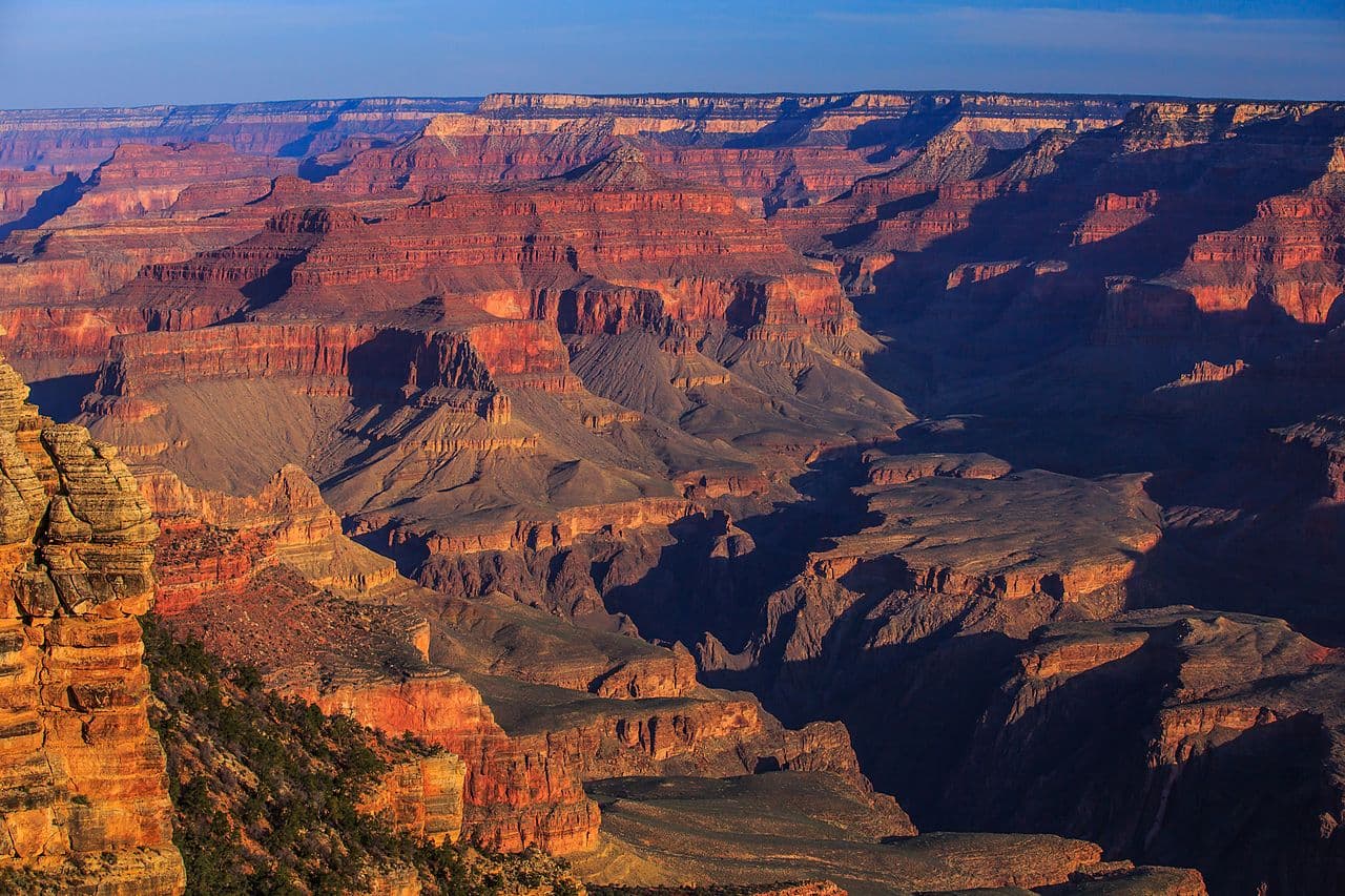
One permit, two rims: 23.5 miles that drop 5,761 feet to the Colorado River and then climb 4,380 feet back out the far side.
This guide covers the Grand Canyon Rim-to-Rim permit.
$10 permit/lottery application + $15 per person per night below the rim ($4 above the rim)
Permit Cost
2-3 days
Duration
23.5 miles
Distance
4,380'
Elevation Gain
strenuous
Difficulty
About Rim-to-Rim
Rim-to-rim is one Grand Canyon backcountry permit covering a crossing of the canyon on the corridor trails. North to south it is 23.5 miles: 14 miles down the North Kaibab from 8,241 feet to Bright Angel Campground at 2,480 feet, then 9.5 miles up the Bright Angel Trail to 6,860 feet on the South Rim. Most people take three days and two nights, camping at Cottonwood and then at Bright Angel. Grand Canyon moved backcountry reservations to Recreation.gov in January 2024. Permits are released through a monthly early access lottery: applications run for two weeks and close at 5 pm MST on the 1st of the month, four months before your start month. The lottery is drawn late on the 2nd, and the top 750 applicants get an assigned date and time to log back in and build an itinerary. Everyone else can reserve leftover space from around the 20th, and the general public gets access on the 1st of the following month. One thing to plan around: the park has said rim-to-rim hiking will not be possible from 11:59 pm on October 15, 2026 through approximately February 2027, while a section of the North Kaibab between Redwall Bridge and Cottonwood Campground is closed for waterline work.
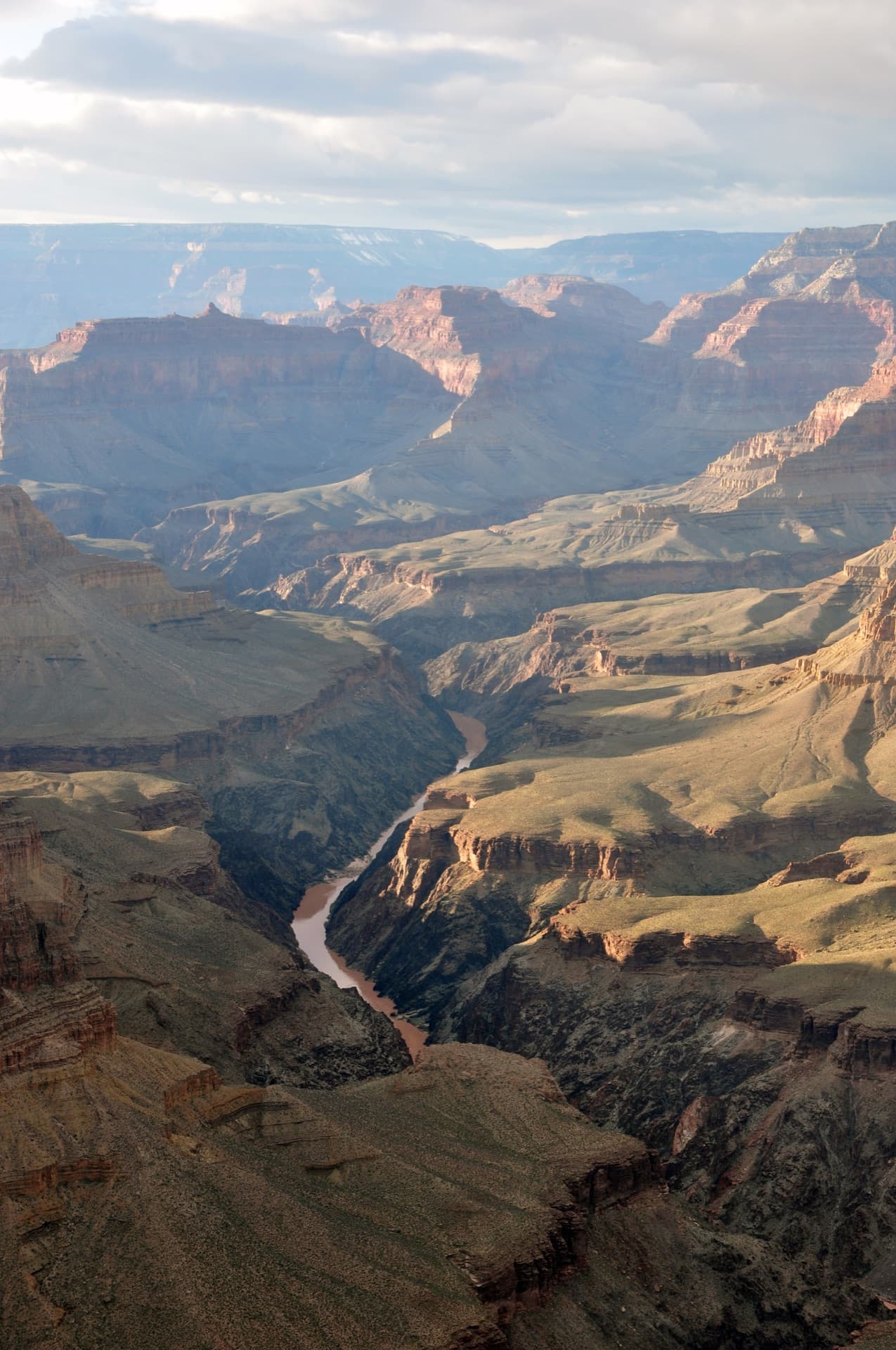
The North Kaibab, South Kaibab and Bright Angel trails meet at the only two footbridges over the Colorado River in the whole Grand Canyon backcountry. The park calls that junction the Trans-Canyon Corridor, and it is literally the way across - there is no other place to get from one rim to the other on foot. Every rim-to-rim itinerary funnels through it, which is why Bright Angel Campground is, in the park's own words, by far the most requested below-rim backpacking destination.
The Rim-to-Rim route
- Distance
- 23.5 miles
- Route type
- point-to-point
- Elevation gain
- 4,380 ft
- High point
- 8,241 ft
- Low point
- 2,480 ft
- Trip length
- 2-3 days
- Difficulty
- strenuous
Entry points: North Kaibab Trailhead, Bright Angel Trailhead, South Kaibab Trailhead
Colorado Plateau. Nearest town: Grand Canyon Village, AZ
Points along the route
- North Kaibab TrailheadMile 0, 8,241 ft
- Supai TunnelMile 1.7, 6,800 ft
- Roaring SpringsMile 4.7, 5,220 ft
- Manzanita Rest AreaMile 5.4, 4,600 ft
- Cottonwood CampgroundMile 6.8, 4,080 ft
- Ribbon FallsMile 8.4, 3,720 ft
- The BoxMile 10, 2,800 ft
- Phantom RanchMile 13.6, 2,546 ft
- Bright Angel CampgroundMile 14, 2,480 ft
- Colorado River CrossingMile 14, 2,425 ft
- Havasupai Gardens CampgroundMile 19, 3,800 ft
- Three-Mile ResthouseMile 20.4, 4,748 ft
- Mile-and-a-Half ResthouseMile 21.9, 5,729 ft
- Bright Angel TrailheadMile 23.5, 6,860 ft
Rim-to-Rim permit detailsandAll Grand Canyon National Park permits
The Experience
You leave the North Rim in ponderosa shade at 8,241 feet and walk downhill for most of a day. Roaring Springs comes out of the cliff face sideways. Below Cottonwood the walls close in and the trail enters The Box, where the rock holds the day's heat long after the sun has gone. Then the bridge, the river noise, and camp under cottonwoods at 2,480 feet. The next morning you start climbing, and you keep climbing for 9.5 miles, and the rim you can see from Havasupai Gardens takes another three hours to reach.
Standard direction is north to south. From the North Kaibab Trailhead at 8,241 feet the trail reaches Supai Tunnel at 1.7 miles (6,800 ft), Roaring Springs at 4.7 miles (5,220 ft), Manzanita Rest Area at 5.4 miles (4,600 ft), and Cottonwood Campground at 6.8 miles (4,080 ft) - the usual first night.
Day two runs Cottonwood to the river. Ribbon Falls is a short detour at 8.4 miles. Below it the trail enters The Box and stays there until Phantom Ranch at 13.6 miles. Bright Angel Campground is at 14 miles and 2,480 feet, half a mile north of the Colorado and right along Bright Angel Creek.
The climb out on the Bright Angel Trail is 9.5 miles. River Resthouse comes at 1.5 miles from camp, Havasupai Gardens at 5 miles (3,800 ft), Three-Mile Resthouse at 6.4 miles (4,748 ft), Mile-and-a-Half Resthouse at 7.9 miles (5,729 ft), and the Bright Angel Trailhead at 6,860 feet. Exiting on the South Kaibab instead makes the climb 7 miles from Bright Angel Campground with no water and no shade - most people take Bright Angel.
What to Expect
23.5 miles north-to-south via the North Kaibab and Bright Angel trails; 21 miles if you exit on the South Kaibab instead
5,761 feet of descent to the river, then 4,380 feet of climbing to reach the South Rim
Two nights, normally Cottonwood then Bright Angel - the corridor rule is a maximum of two nights per campground per hike
The Trans-Canyon Corridor bridges are the only footbridges over the Colorado in the entire Grand Canyon backcountry
Every tap on the Bright Angel Trail runs off the Transcanyon Waterline and can be off on any given day; the South Kaibab has none at all
Mules use the Bright Angel Trail regularly and always have right of way
Summer shade temperatures routinely pass 100°F, and the park tells hikers to avoid 10 am to 4 pm
Get Rim-to-Rim Alerts
Be first to know when cancellations happen.
Permit Requirements
A backcountry permit is required for all overnight camping below the rim and must be carried with you
The trip leader must be 18 or older, and each person may submit only one lottery application per month
Groups larger than eleven people may not camp in the same campground or use area
Two nights maximum per campground per hike; from November 15 to February 28 that rises to four
Wood and charcoal fires are prohibited; fossil-fuel backpacking stoves are fine
Carry out all trash - burning, burying or leaving trash or toilet paper is prohibited
Your permit is void if another group affiliated with yours camps in the same campground on the same night
Pets are not allowed below the rim
Camping within 200 feet of any water source is prohibited except at designated sites
Leaving the trail to shortcut between switchbacks is prohibited
Gear & Preparation
Required Gear
- •Water capacity for the dry stretches - at minimum 3-4 litres per person, more if you are exiting on the South Kaibab
- •Electrolytes. The park specifically warns that water without salt causes hyponatremia, which produces seizures
- •Sun hat, long sleeves and sunscreen; there is no shade on most of the South Kaibab
- •Headlamp, because you want to be walking before sunrise in summer
- •High-calorie food - NPS says doubling your normal exercise calorie intake is realistic for a summer canyon hike
- •Over-the-shoe traction devices for late fall, winter and early spring, when the upper trails ice up
Recommended Gear
- •Trekking poles for 5,761 feet of descent
- •A bandana or sun shirt you can soak - wet clothing is the park's own cooling advice
- •Rain shell for July-September monsoon storms
- •A backup water treatment method in case a pipeline break shuts the resthouse taps
- •Camp shoes; Bright Angel Creek is the reward for the second day
Hazards & Safety
Heat. Shade temperatures routinely pass 100°F in summer and NPS tells hikers to avoid the trail between 10 am and 4 pm
Hyponatremia from drinking without replacing salt - the park names it explicitly alongside dehydration
Monsoon thunderstorms from July to September, which build fast and produce lightning; seek shelter immediately
Ice on the upper Bright Angel Trail in late fall, winter and early spring
The climb out takes about twice as long as the descent; people underestimate it because walking down felt easy
Mule trains on the Bright Angel Trail - step to the inside wall and let them pass
Water outages. Every corridor tap depends on the Transcanyon Waterline and can be off with no notice - NPS publishes the live status per location
Best Time to Visit
Spring and fall. April-May and September-October give you a river camp that is warm rather than lethal and a rim that is not iced over. Summer is the hardest version of this hike: NPS puts shade temperatures over 100°F and tells people to stay off the trail from 10 am to 4 pm, which compresses a 9.5-mile climb into the two ends of the day. Winter closes the North Rim entirely (December 1 - May 15) and puts ice on the upper switchbacks. For 2026 specifically, the North Kaibab closure starting October 15 removes the fall window on the north side.
Pro Tips
Apply on the 16th, not the 1st. Applications open two weeks before they close and the lottery does not reward early submission - but leaving it to the last day is how people miss the 5 pm MST cut-off.
Build the itinerary around Cottonwood, not Bright Angel. Bright Angel Campground is the park's most requested below-rim site; Cottonwood is what actually breaks a two-night crossing into manageable days.
The 30-day refund deadline is the cancellation cliff. A month out from any popular start date, space starts coming back, and cancelled space reappears within 24 hours.
Sort the car shuttle before the permit. The rims are 215 road miles apart and the North Rim is closed December 1 to May 15.
Check the Key Hiking Messages page the morning you start. NPS: these water statuses are current, but can change suddenly due to breaks in the waterline. Every corridor tap is on that page and any of them can read OFF.
Climb out on the Bright Angel, not the South Kaibab. It is 2.5 miles longer but it has shade, two resthouses with emergency phones, and the corridor's only taps - which you should still treat as optional until you have checked their live status.
100+ wilderness permits, extensive backcountry experience
This guide is based on personal experience obtaining wilderness permits and is regularly updated to reflect current policies and strategies.
Frequently Asked Questions
How do I get a Rim-to-Rim permit?
+
Two ways. Cancelled Rim-to-Rim permits return to the booking system through the season, and PermitSnag alerts you the moment one opens. The other way is the lottery, so apply during the application window as well.
When is the best time to visit Rim-to-Rim?
+
Spring and fall. April-May and September-October give you a river camp that is warm rather than lethal and a rim that is not iced over. Summer is the hardest version of this hike: NPS puts shade temperatures over 100°F and tells people to stay off the trail from 10 am to 4 pm, which compresses a 9.5-mile climb into the two ends of the day. Winter closes the North Rim entirely (December 1 - May 15) and puts ice on the upper switchbacks. For 2026 specifically, the North Kaibab closure starting October 15 removes the fall window on the north side.
How long is the Rim-to-Rim route?
+
The route is 23.5 miles, as a point-to-point. Plan on 2-3 days.
How difficult is the Rim-to-Rim route?
+
Hikers who have done multi-day trips with real elevation change and are honest about how they handle heat. The trails are wide and obvious; the difficulty is entirely load, distance and temperature.
Where does the Rim-to-Rim route start?
+
The permit covers 3 entry points: North Kaibab Trailhead, Bright Angel Trailhead, South Kaibab Trailhead.
What if I don't win the Rim-to-Rim lottery?
+
Cancelled permits return to the booking system through the season. PermitSnag watches Rim-to-Rim and alerts you when one opens, so a lost draw is not the end of the trip.
Don't Miss Your Rim-to-Rim Permit
Cancellations happen every day. PermitSnag monitors Rim-to-Rim availability 24/7 and alerts you the moment a spot opens up.
Get Permit Alerts