Lottery8/10
Grand Canyon hiking permits
Required for all overnight camping below the rim....
Grand Canyon National Park · Arizona
The ultimate Grand Canyon experience: 21-24 miles crossing from one rim to the other through two billion years of geologic history.
70% of the openings our scanner caught on Rim-to-Rim were gone within 5 minutes.
Build your full itinerary start to finish
Add your dates and get a day-by-day plan: what needs a permit, what gear to bring, and one link to share with your whole group to coordinate every step.
No permit needed to start
Spring and fall. April-May and September-October give you a river camp that is warm rather than lethal and a rim that is not iced over. Summer is the hardest version of this hike: NPS puts shade temperatures over 100°F and tells people to stay off the trail from 10 am to 4 pm, which compresses a 9.5-mile climb into the two ends of the day. Winter closes the North Rim entirely (December 1 - May 15) and puts ice on the upper switchbacks. For 2026 specifically, the North Kaibab closure starting October 15 removes the fall window on the north side.
Trailhead (2,480 ft)
Backcountry Tips
Today
81°
65°
Mon
79°
62°
Tue
79°
66°
Wed
81°
65°
Thu
75°
64°
Fri
78°
63°
Sat
82°
66°
Sign up at National Park Service if you don't have an account. Verify your email and add payment info ahead of time.
Submit your application between The 16th of each month, four months before your start month and 5 pm MST on the 1st of the following month. Apply for multiple dates to increase your odds.
Results are typically announced Lottery runs late on the 2nd; the top 750 applicants get booking timeslots. Check your email and your National Park Service account.
Permits get cancelled daily. Peak cancellation times are 24-48 hours before the trip date.
Get notified when cancellations happen. Pro and $19 single-permit alerts are checked about every minute, 24/7; free accounts are checked hourly.
Rim temperatures cool, inner canyon warming through May. The North Rim does not open until May 15, so a true rim-to-rim is off the table until then.
Fitness and endurance required
Climbing, scrambling, or specialized skills
Steep dropoffs and fall potential
Route finding and trail clarity
Difficulty of bailing out mid-route
Hikers who have done multi-day trips with real elevation change and are honest about how they handle heat. The trails are wide and obvious; the difficulty is entirely load, distance and temperature.
At least one two-night backpacking trip with 3,000+ feet of climbing, done in warm weather. Train the descent as well as the climb; 5,761 feet down wrecks quads that have only trained uphill.
Anyone who has not trained with a loaded pack on sustained downhill, anyone who struggles in heat, and anyone counting on being rescued quickly - heat illness below the rim is the park's most common rescue.
Rim-to-rim is one Grand Canyon backcountry permit covering a crossing of the canyon on the corridor trails. North to south it is 23.5 miles: 14 miles down the North Kaibab from 8,241 feet to Bright Angel Campground at 2,480 feet, then 9.5 miles up the Bright Angel Trail to 6,860 feet on the South Rim. Most people take three days and two nights, camping at Cottonwood and then at Bright Angel.
Grand Canyon moved backcountry reservations to Recreation.gov in January 2024. Permits are released through a monthly early access lottery: applications run for two weeks and close at 5 pm MST on the 1st of the month, four months before your start month. The lottery is drawn late on the 2nd, and the top 750 applicants get an assigned date and time to log back in and build an itinerary. Everyone else can reserve leftover space from around the 20th, and the general public gets access on the 1st of the following month.
One thing to plan around: the park has said rim-to-rim hiking will not be possible from 11:59 pm on October 15, 2026 through approximately February 2027, while a section of the North Kaibab between Redwall Bridge and Cottonwood Campground is closed for waterline work.
The North Kaibab, South Kaibab and Bright Angel trails meet at the only two footbridges over the Colorado River in the whole Grand Canyon backcountry. The park calls that junction the Trans-Canyon Corridor, and it is literally the way across - there is no other place to get from one rim to the other on foot. Every rim-to-rim itinerary funnels through it, which is why Bright Angel Campground is, in the park's own words, by far the most requested below-rim backpacking destination.
Standard direction is north to south. From the North Kaibab Trailhead at 8,241 feet the trail reaches Supai Tunnel at 1.7 miles (6,800 ft), Roaring Springs at 4.7 miles (5,220 ft), Manzanita Rest Area at 5.4 miles (4,600 ft), and Cottonwood Campground at 6.8 miles (4,080 ft) - the usual first night.
Day two runs Cottonwood to the river. Ribbon Falls is a short detour at 8.4 miles. Below it the trail enters The Box and stays there until Phantom Ranch at 13.6 miles. Bright Angel Campground is at 14 miles and 2,480 feet, half a mile north of the Colorado and right along Bright Angel Creek.
The climb out on the Bright Angel Trail is 9.5 miles. River Resthouse comes at 1.5 miles from camp, Havasupai Gardens at 5 miles (3,800 ft), Three-Mile Resthouse at 6.4 miles (4,748 ft), Mile-and-a-Half Resthouse at 7.9 miles (5,729 ft), and the Bright Angel Trailhead at 6,860 feet. Exiting on the South Kaibab instead makes the climb 7 miles from Bright Angel Campground with no water and no shade - most people take Bright Angel.
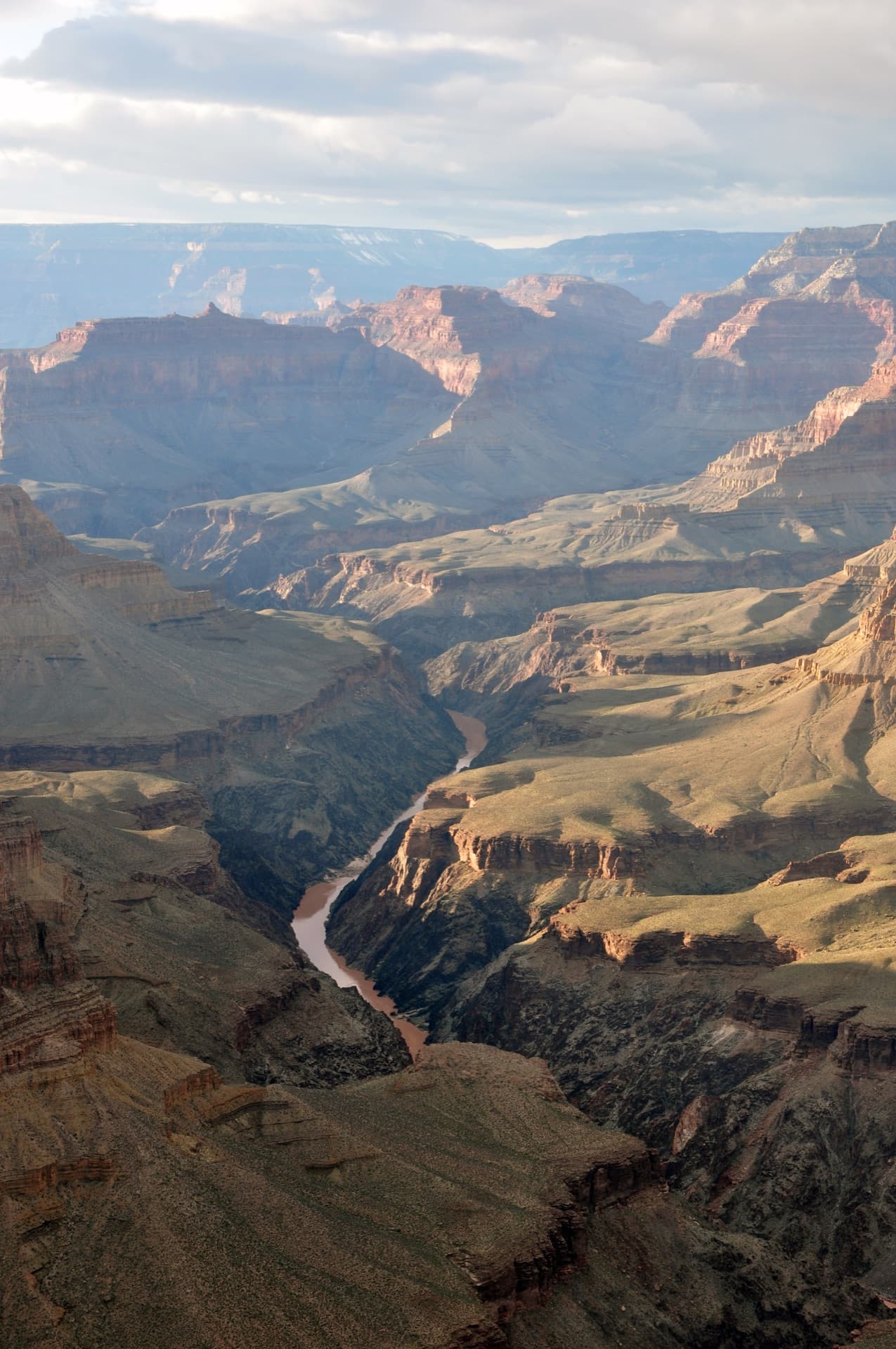
You leave the North Rim in ponderosa shade at 8,241 feet and walk downhill for most of a day. Roaring Springs comes out of the cliff face sideways. Below Cottonwood the walls close in and the trail enters The Box, where the rock holds the day's heat long after the sun has gone. Then the bridge, the river noise, and camp under cottonwoods at 2,480 feet. The next morning you start climbing, and you keep climbing for 9.5 miles, and the rim you can see from Havasupai Gardens takes another three hours to reach.
The standard rim-to-rim start, and the higher of the two rims at 8,241 feet.
North Rim roads and services are closed December 1 - May 15. The North Rim is 30 miles south of Jacob Lake on Highway 67, with the rim itself another 14 miles further south.
North Rim developed area, seasonal only. There is no year-round service on this side.
From 11:59 pm on October 15, 2026 through approximately February 2027 the North Kaibab is closed between Redwall Bridge and the north end of Cottonwood Campground for Transcanyon Waterline work. NPS: "There are no alternative routes or detours available through this section of trail." Rim-to-rim is not possible during that window.
The usual South Rim exit, in Grand Canyon Village. 9.5 miles and 4,380 feet up from Bright Angel Campground.
Fed by the Transcanyon Waterline. NPS publishes a live per-location status on its Key Hiking Messages page because, in the park's words, these statuses are current but can change suddenly due to breaks in the waterline. Check it the morning you start, and carry treatment regardless.
If nothing is open near the trailhead, drive the Village Loop to Parking Lot D by Maswik Lodge and the Backcountry Information Center - about a 0.4 mile walk back to the rim. From the Visitor Center, the Village (Blue) Route shuttle drops you at Hermit Road Interchange.
South Rim is open year-round, 60 miles north of Williams via Route 64 and 80 miles northwest of Flagstaff via Route 180.
Grand Canyon Village - lodging, food, and the Backcountry Information Center, year-round.
Every tap on this trail - both resthouses and Havasupai Gardens - runs off the Transcanyon Waterline, and NPS turns them off without notice when it breaks. Do not plan around any of them until you have read the live status on the park's Key Hiking Messages page, and carry a treatment method regardless.
Shorter and steeper South Rim option at 7,260 feet - 7 miles to Bright Angel Campground. No water anywhere on it.
No private vehicle access. Take the Kaibab Rim (Orange) Route shuttle from the Visitor Center.
Most parties descend South Kaibab and climb out Bright Angel. Climbing out South Kaibab in summer means 7 miles with no water and no shade.
Lottery concierge
Next season’s application dates aren’t published yet.
We check for them every day. Track Rim-to-Rim now and your concierge picks them up the moment they land, then emails you when applications open, before the deadline, and when results post.
Better odds with a crew
Rim-to-Rim is a lottery. Every friend who applies adds another entry, so a crew gets more shots at the same permit than any one of you alone.
One of you runs the pool (Pro or a $19 alert). Everyone else joins free.
Required and recommended gear for Rim-to-Rim
Trailhead transportation options
Browse all shuttlesExperienced wilderness guides
Browse all guidesSome links may be affiliate links. Purchases support PermitSnag at no extra cost to you.
Competitive
estimated success rate
Get detailed lottery statistics and tips. Sign up to track this permit.
Apply with a crew to multiply your combined odds, and let auto win-detection tell you the moment you win — you never have to check National Park Service. Win-detection reads the result email you forward us, so it takes a one-time setup in your inbox (about two minutes, and we walk you through it). Pool and auto win-detection are on Pro or a $19 permit alert.
Through Recreation.gov, on Grand Canyon's monthly backcountry permit lottery. Applications open on the 16th and close at 5 pm MST on the 1st of the month, four months before your start month. The lottery runs late on the 2nd and gives the top 750 applicants a date and time to log back in and build an itinerary. Anything left over opens to the rest of the applicants around the 20th, and to everyone on the 1st of the next month.
$10 for the permit or lottery application, which is non-refundable, plus $15 per person per night for below-rim camping and $4 per person per night above the rim. The nightly charge is refundable until 30 days before your start date as long as the permit has not been printed. Lottery winners and runners-up have the $10 basic charge waived when they reserve through their timeslot.
Yes, for part of it. The closure starts at a specific moment: 11:59 pm on October 15, 2026, running through approximately February 2027, because the North Kaibab Trail closes between Redwall Bridge and the north end of Cottonwood Campground for Transcanyon Waterline work. Recreation.gov states it as from 11:59 p.m. on 10/15/2026; the park's Key Hiking Messages page states the same instant as beginning October 15, 2026 at 11:59 p.m., and separately notes that traditional rim-to-rim hiking will not be possible beginning October 16, 2026. Those are the same cutoff described from either side of midnight. The park states there are no alternative routes or detours through that section.
Not dependably, and you cannot plan the crossing as though there is. Every tap on the corridor - the North Rim, Supai Tunnel, Manzanita, Cottonwood, Bright Angel Campground, Havasupai Gardens and both Bright Angel resthouses - is fed by the Transcanyon Waterline, and the park publishes a live per-location status on its Key Hiking Messages page precisely because, in its own words, these water statuses for the park's Corridor Trails are current, but can change suddenly due to breaks in the waterline. When that page was checked on August 9, 2026 it listed the North Rim as all water OFF, and Manzanita, Cottonwood and Bright Angel Campground as water OFF due to pipeline break, with Havasupai Gardens and both resthouses ON. Read it the morning you start, plan the route on the assumption that any tap on it may be dry, and follow the park's standing instruction that day and overnight hikers should always carry water treatment options.
23.5 miles the standard way. NPS trail distances put Bright Angel Campground 14 miles from the North Kaibab Trailhead and 9.5 miles from the Bright Angel Trailhead on the South Rim. Exiting via the South Kaibab instead makes it 21 miles, but that climb has no water and no shade.
Two. The corridor rule is up to two nights per campground per hike, consecutive or not. The one exception is November 15 to February 28, when it goes up to four nights per campground.
Eleven. The park's Backcountry Management Plan does not allow groups larger than eleven people to camp in the same campground or use area. Non-commercial groups of 12-30 doing a rim-to-rim day hike need a Special Use Permit instead.
Yes, from cancellations. Grand Canyon says cancelled space is randomly made available for new reservations some time within 24 hours, and the refund deadline is 30 days out, which is exactly what pushes people to cancel. Watching the corridor campgrounds for those releases is how most late permits get filled.
No backcountry permit, no. Phantom Ranch Lodge is booked separately through its own lottery and is explicitly excluded from the backcountry permit system. You do need a backcountry permit to camp at Bright Angel Campground next door.
No active conditions reported
Sign in to report trail conditions.
First light on the North Rim before you drop in, and last light from Havasupai Gardens looking back up at the Battleship on your climb-out day.
The inner canyon is a contrast nightmare from 10 am to 4 pm - the same hours the park tells you not to be hiking. Shoot early and late and you solve both problems at once.
The North Kaibab sees a fraction of Bright Angel's traffic. Start north, and be moving by 5 am - you get empty trail and you are through the worst heat before it arrives.
Consider these alternatives if your preferred dates aren't available.
Same campground, same bridges, same river - down the South Kaibab and out the Bright Angel without needing the North Rim at all.
About 16.5 miles instead of 23.5, and you never have to solve the 215-mile car shuttle between rims. You miss Roaring Springs, Ribbon Falls and The Box.
Camp 5 miles down the Bright Angel Trail at 3,800 feet, and day-hike the flat 3-mile round trip out to Plateau Point.
Half the descent and a much shorter climb out, and it is often available when the river campgrounds are not. You do not reach the Colorado.
The same monthly lottery, but for at-large use areas away from the corridor - Hermit, Grandview, the Tonto.
Far less competition and real solitude. No maintained water, no ranger stations, and the park expects prior Grand Canyon experience.
The North Kaibab's mid-canyon campground at 4,080 feet, 6.8 miles below the North Rim.
Useful as its own destination or as the piece of a rim-to-rim itinerary that is hardest to get. NPS publishes its tap as seasonal, mid-May to mid-October, and it is off whenever the waterline breaks.
Nearby campgrounds to complete your Rim-to-Rim trip
A small favor
Google lets you pick the sites it highlights for you. Add PermitSnag and our permit pages get marked as one of yours in AI Overviews and AI Mode.
Takes less than a minute.